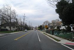
Route 59, at 0.15-mile (0.24 km) long, is the shortest state highway in New Jersey, United States. The route consists entirely of a short block of Lincoln Avenue from Union County Route 610 in Cranford to New Jersey Route 28 along the Cranford–Garwood border. The route functions as an underpass under the Raritan Valley Line of NJ Transit, under which it crosses about halfway down the block, along the municipal border. Route 59 was originally a proposed alignment of Route 22, which was supposed to head from an intersection with current day New Jersey Route 159 in Morris County at the Pine Brook Bridge before heading through several counties, terminating at an intersection with New Jersey Route 27 in Rahway. Most of the route was not constructed, and a portion in Garwood and Cranford was re-designated Route 59 in the 1953 New Jersey state highway renumbering on January 1, 1953.
Route 36 is a state highway in Monmouth County, New Jersey, United States. The 24.40-mile (39.27 km) long route, shaped as a backwards C, begins at an intersection with Garden State Parkway and County Route 51 in Eatontown and runs east to Long Branch. From Long Branch, the route follows the Atlantic Ocean north to Sea Bright and turns west, running to the south of the Raritan Bay. Route 36 ends in Keyport at an interchange with the Garden State Parkway and Route 35. It varies in width from a six-lane divided highway to a two-lane undivided road. The route is signed east–west between Eatontown and Long Branch and north–south between Long Branch and Keyport.

Ewing Township is a township in Mercer County, New Jersey, United States. The township is within the New York metropolitan area as defined by the United States Census Bureau. It also directly borders the Philadelphia metropolitan area and is part of the Federal Communications Commission's Philadelphia Designated Market Area. As of the 2010 United States Census, the township's population was 35,790, reflecting an increase of 83 (+0.2%) from the 35,707 counted in the 2000 Census, which had increased by 1,522 (+4.5%) from the 34,185 counted in the 1990 Census.
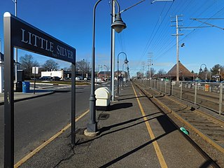
Little Silver is a railway station in Little Silver, Monmouth County, New Jersey, United States. It is served by trains on NJ Transit's North Jersey Coast Line. The station is located in between two grade crossings, and trains can back up traffic when they stop at the station.

Bergenline Avenue is a major commercial district in the North Hudson section of Hudson County, New Jersey, United States. The north-south streets passes through Union City, West New York, Guttenberg, North Bergen. Its southern end is at Union City's Second Street, the north boundary of Washington Park. From there north to 47th Street, the street is one-way southbound; New York Avenue and Kennedy Boulevard serve northbound traffic. Between 48th and 49th Streets, elevators on the west side provide access to the underground Bergenline Avenue station of the Hudson-Bergen Light Rail. After passing through West New York and Guttenberg and into North Bergen, the street meets North Hudson Park, running along its west side from 79th Street to the Bergen County line through the community of Nungesser's and crosses Kennedy Boulevard. The northernmost 0.04 miles (0.064 km) of the route from Kennedy Boulevard to the Bergen County line is designated as County Route 721. North of the county line the street name becomes Anderson Avenue, which is the major commercial district for Fairview, Cliffside Park, and Fort Lee.

Parkway Pines is an unincorporated community located along the border of Howell Township in Monmouth County and Brick Township in Ocean County, in New Jersey, United States. The Howell area of this community is called Ramtown.

New Lisbon is an unincorporated community located within Pemberton Township in Burlington County, New Jersey, United States. It is a settlement along Four Mile Road where it intersects Mount Misery Road. The community is located along the Philadelphia and Long Branch Railway, later a part of the Pennsylvania Railroad, and featured a train station.

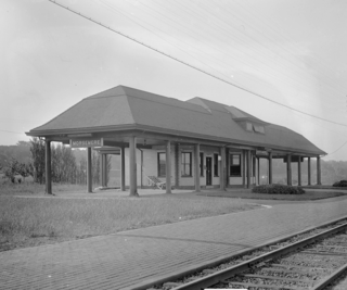
Fairmount Avenue is a former New Jersey Transit rail station on the Pascack Valley Line. The station was one of three rail stations in Hackensack, New Jersey, United States, and was located at Fairmount Avenue and Temple Avenue. The Essex Street and Anderson Street stations are also located in Hackensack. The station house was built in 1870 as part of the extension railroad for the Hackensack and New York Railroad on a track extension from Anderson Street in Hackensack. The line became part of the Erie Railroad in 1896 and New Jersey Transit in 1983.

Main Street is a major north-south street in the borough of Queens in New York City, extending from Queens Boulevard in Briarwood to Northern Boulevard in Flushing. Created in the 17th century as one of Flushing's main roads, Main Street has been lengthened at various points in its existence.

East Long Branch is an unincorporated community and neighborhood located within Long Branch in Monmouth County, New Jersey, United States. It is located in the northern portion of the city along the Atlantic Ocean coastline. Major roads through the area include Joline Avenue and Ocean Boulevard, both of which are parts of New Jersey Route 36. Homes consisting of single-family houses and condominiums are located throughout the area and the county-maintained Seven Presidents Park is located within East Long Branch.

Harneys Corner is an unincorporated community located within Lawrence Township in Mercer County, New Jersey, United States. It is located at the intersection of Lawrence Road and Princeton Pike / Avenue. Located in the southern portion of the township close to the Trenton and Ewing borders, the area consists of small houses on nearby side streets and businesses along the aforementioned arterial roads. The intersection itself is located about 0.3 miles (0.48 km) north of the Brunswick Circle.

Berrien City, also known simply as Berrien, is an unincorporated community located within West Windsor Township in Mercer County, New Jersey, United States. The area is located within the Princeton Junction census designated place centered about the intersection of Alexander Road and Scott Avenue, located within walking distance of the Princeton Junction train station and Princeton-Hightstown Road. It was developed as an upper-middle class development after World War I and features homes constructed about 100 years ago. Most of the homes still exist with some small businesses located along Alexander Road with the West Windsor Arts Center operating its facilities out of the former Princeton Junction Fire Company fire station.

Ewing/Carroll is a neighborhood located within the city of Trenton in Mercer County, New Jersey, United States. It is considered to be an enclave within the larger Coalport/North Clinton neighborhood.

Hanover/Academy is a neighborhood located within the city of Trenton in Mercer County, New Jersey, United States. It is considered to be part of Downtown Trenton.

Branchport is an unincorporated community located within Long Branch in Monmouth County, New Jersey, United States. Centered in the northern part of the city, the area contains mostly single-family homes along grid-like streets though some commercial businesses are located on New Jersey Route 36 which through Branchport is called Joline Avenue. The North Jersey Coast Line passes through the community though the closest stops along the line are the Monmouth Park station in Oceanport and the Long Branch station in the center of the city.

Ewansville or Ewanville is an unincorporated community located in Burlington County, New Jersey, United States. The community is centered on the crossing of U.S. Route 206 (US 206) and the North Branch Rancocas Creek just north of the former Philadelphia and Long Branch Railway. Ewansville was the site of a station on the aforementioned railroad and was the terminus for a short spur track to Vincentown.

Oceanic is an unincorporated community located within Rumson in Monmouth County, New Jersey, United States. Located on the north side of the borough, Oceanic contains most of Rumson's commercial businesses mainly along Bingham Avenue and River Road. Bingham Avenue connects directly to the Oceanic Bridge over the Navesink River to the Middletown Township community of Locust Point.
Stone Church is an unincorporated community located in Middletown Township in Monmouth County, New Jersey, United States, within the census-designated place of Navesink. The settlement is located at the intersection of Valley Road and Locust Avenue, Navesink Avenue, and Monmouth Avenue. In the center of the community, the historic All Saint's Memorial Episcopal Church built in 1864 sits at the main intersection. The remainder of the area consists of single-family houses and forests on the slopes of nearby Mount Mitchill.
Morsemere is an unincorporated community located along the border of Palisades Park and Ridgefield in Bergen County, New Jersey, United States. It is named for Samuel Morse, who bought the property with the intention of building a home there. The Erie Railroad Northern Branch served the neighborhood. U.S. Route 46 passes through the area.