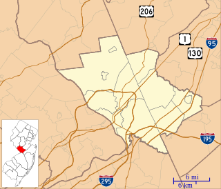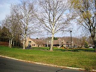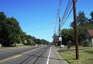
Ewing Township is a township in Mercer County, New Jersey, United States. The township is within the New York metropolitan area as defined by the United States Census Bureau. It also directly borders the Philadelphia metropolitan area and is part of the Federal Communications Commission's Philadelphia Designated Market Area. As of the 2010 United States Census, the township's population was 35,790, reflecting an increase of 83 (+0.2%) from the 35,707 counted in the 2000 Census, which had increased by 1,522 (+4.5%) from the 34,185 counted in the 1990 Census.

Spring Valley is an unincorporated community located within Marlboro Township in Monmouth County, New Jersey, United States. Located in the northern section of the township, the area is mainly forested with some businesses and cemeteries lining the main roads in the area, Spring Valley Road and Texas Road. U.S. Route 9, Route 18 and County Route 3 are major roads nearby Spring Valley.

Chapel Hill is an unincorporated community located within Middletown Township, in Monmouth County, New Jersey, United States. As its name implies, the area is on a high spot within the township between Fairview and Leonardo just south of the Naval Weapons Station Earle Waterfront Section. Unlike other areas of Middletown Township, the Chapel Hill section is not as developed with single-family homes; only a few housing developments are located off the area's main roads, Kings Highway and Chapel Hill Road. The rest of the area outside NWS Earle consists of horse farms and forestland.

Cheesequake is an unincorporated community located within Old Bridge Township in Middlesex County, New Jersey, United States. Cheesequake is located along Route 34, south of Cheesequake State Park.

Collingwood Park is an unincorporated community located along the border of Howell and Wall townships in Monmouth County, New Jersey, United States.

North Crosswicks is an unincorporated community located within Hamilton Township in Mercer County, New Jersey, United States. Residential homes, a cemetery, and farmland make up the area around North Crosswicks. Located across the Crosswicks Creek from the Chesterfield Township settlement of Crosswicks, a covered bridge formerly connected the two localities.

Tumble Falls is an unincorporated community located within Kingwood Township in Hunterdon County, New Jersey, United States. The settlement is located along an unnamed tributary of the Delaware River where a small intermittent waterfall is found in the central part of the township within the Lockatong Formation. The location of the waterfall is at the intersection of Tumble Falls Road and New Jersey Route 29 and is part of the New Jersey Conservation Foundation purchased from private landowners in December 2002.

Charleston Springs is an unincorporated community located within Millstone Township in Monmouth County, New Jersey, United States. Stage Coach Road, also designated County Route 524, is the main road that runs through the settlement, with Ely Harmony Road as the intersecting road defining the locality. The Manalapan Brook runs to the west of the center of Charleston Springs and CR 537 runs to the south of the area. The Monmouth County-owned Charleston Springs Golf Course is located one mile (1.6 km) northeast of the center of Charleston Springs on CR 527.

Cooleys Corner is an unincorporated community located within Upper Freehold Township in Monmouth County, New Jersey, United States. The site of the settlement is within the Assunpink Wildlife Management Area, a New Jersey Department of Environmental Protection Division of Fish and Wildlife-operated preserved area in Monmouth and Mercer counties along the Assunpink Creek. Before the creation of the Assunpink Lake in the 1970s, the area consisted of farmland located at the intersection of Clarksburg Road and Imlaystown-Hightstown Road. Some farmland is still present in the area but is now mostly used by hunters. The main boat ramp to Assunpink Lake is located along the former Imlaystown-Hightstown Road.

Crawford Corners or Crawfords Corner is an unincorporated community located within Holmdel Township in Monmouth County, New Jersey, United States. The settlement is located at the intersection of Holmdel Road and Crawfords Corners Road in the hilly northern portion of the township. The settlement is located about one-half mile (0.80 km) from Crawford Hill, the highest point in Monmouth County. The area also includes the township's town hall, police department, and high school in addition to a New Jersey State Police barracks and the PNC Bank Arts Center off the Garden State Parkway. These buildings and landmarks comprise the eastern section of the settlement, homes and heavily treed lands are located on the west side of Holmdel Road, and Holmdel Park makes up the southern portion of the area.

Ely is an unincorporated community located within Millstone Township in Monmouth County, New Jersey, United States. The settlement is named for the Ely family that owned property in the area and operated the Charleston Springs hotel. Today, the settlement is located along Stage Coach Road, County Route 524, in the eastern portion of the township. Most of the area consists of large single-family homes though some farmland and the township-owned Brandywine Soccer Complex are located in the near the settlement.

Henningers Mills or Henningers Mill is an unincorporated community located along the border of Aberdeen and Marlboro townships in Monmouth County, New Jersey, United States.

Mount Pleasant is an unincorporated community located within Marlboro Township in Monmouth County, New Jersey, United States. It is named for a hill of the same name, one of the highest points in Marlboro Township. The settlement is located at the intersection of Reids Hill Road and Beacon Hill Road.

Navesink Beach is an unincorporated community located within Sea Bright in Monmouth County, New Jersey, United States. It is one of the four main built-up areas of Sea Bright and is the northernmost settled area of the borough. Navesink Beach is a former stop on the New Jersey Southern Railroad. The Sea Bright–Monmouth Beach Seawall passes through the neighborhood and Normandie.

Normandie is an unincorporated community located within Sea Bright in Monmouth County, New Jersey, United States. The community is one of the four main built-up areas of Sea Bright and is a former stop on the New Jersey Southern Railroad. It is located along Route 36 between the CR 520 drawbridge to Rumson and Sandy Hook on a narrow strip of land between the Shrewsbury River and the Atlantic Ocean. The Sea Bright–Monmouth Beach Seawall passes through the neighborhood and Navesink Beach.

Spring Mill is an unincorporated community located within Upper Freehold Township in Monmouth County, New Jersey, United States. The settlement is located along County Route 524 between Hamilton Township and Allentown on a commercialized segment of the road originally built as New Jersey Route 37. A vestige of the state construction remains along the road through a wide right-of-way and a bridge crossing Doctor's Creek stating that it was constructed by the state in 1940 for State Highway Route 37.

Newbolds Corner is an unincorporated community located within Lumberton Township in Burlington County, New Jersey, United States. The site, located at the corner of Eayrestown Road and Newbolds Corner Road, was once home to a Nike missile silo which was fully demolished in late 2015. Today, the west side of Eayrestown Road consists of housing developments, Lumberton Township's town hall, and a school, while the east side of the road features farmland.
Cape May Inlet is an inlet in southeastern Cape May County, New Jersey.


