
Wall Township is a township in Monmouth County, New Jersey, United States. It is located in the New York Metropolitan Area and is a bedroom community of New York. As of the 2010 United States Census, the township's population was 26,164, reflecting an increase of 903 (+3.6%) from the 25,261 counted in the 2000 Census, which had in turn increased by 5,017 (+24.8%) from the 20,244 counted in the 1990 Census.
Marlboro is an unincorporated community located within Marlboro Township in Monmouth County, New Jersey, United States.
Interstate 195 (I-195) is an auxiliary route of the Interstate Highway System located in the U.S. state of New Jersey. Its western end is at I-295 and Route 29 just south of Trenton, New Jersey, in Hamilton Township, Mercer County, while its eastern end is at the Garden State Parkway, Route 34 and Route 138 in Wall Township, Monmouth County. I-195 is 34.17 miles (54.99 km) in length. The route is mostly a four-lane highway that runs through wooded areas in Central Jersey. It has an interchange with the New Jersey Turnpike (I-95) in Robbinsville Township and serves as a main access road to the Six Flags Great Adventure amusement park and the Jersey Shore. I-195 is occasionally referred to as the Central Jersey Expressway. On April 6, 1988, President Ronald Reagan signed H.R. 4263 naming Interstate 195 in New Jersey the James J. Howard Interstate Highway, in honor of the late James J. Howard.

Tennent is an unincorporated community located within Manalapan Township in Monmouth County, New Jersey, United States. Considered to be the historic center of Manalapan Township, Tennent is home to the Old Tennent Church and Old Tennent Cemetery. William Tennent served as pastor at the church for over 40 years. Tennent was also the center of a historic community of African Americans dating back to the early nineteenth century. The location of Tennent is located at the modern intersection of County Route 522 and Tennent Road and is near the limits of Monmouth Battlefield State Park.
Smithburg is an unincorporated community located where the municipal boundaries of Freehold, Manalapan and Millstone townships intersect in Monmouth County, New Jersey, United States. County Route 527 and Monmouth Road pass through the center of the quaint village of Smithburg.

Georgia is an unincorporated community located within Freehold Township in Monmouth County, New Jersey, United States. Exit 22 on Interstate 195 provides access to Georgia via Jackson Mills Road. There is also a road in the area called Georgia Road, leading to Turkey Swamp Park. Georgia sits at the northern reaches of the Pine Barrens and numerous housing developments are located north and east of the settlement.
Etra is an unincorporated community located within East Windsor Township, in Mercer County, New Jersey, United States. It consists mostly of residential homes and farmland. East Windsor's largest park, Etra Lake Park, is located just east of the community.

Cheesequake is an unincorporated community located within Old Bridge Township in Middlesex County, New Jersey, United States. Cheesequake is located along Route 34, south of Cheesequake State Park.
Slackwood is an unincorporated community located within Lawrence Township in Mercer County, New Jersey, United States. The area is named for the owners of the land that was subdivided into the neighborhood today, Joseph Slack and William Wood. The neighborhood was first developed in 1890 as the first suburban development in the reconfigured Lawrence Township. Its location between Princeton Pike and Brunswick Pike allowed for an easy walk to nearby Trenton factories. Today, most of the homes in Slackwood are still small bungalows with some businesses along with Princeton and Brunswick Pikes. The neighborhood is bounded by the two highways on the northwest and southeast, Slackwood Park and forest on the southwest, and Shabakunk Creek and Park on the northeast.

Chewalla Park is an unincorporated community located within Hamilton Township in Mercer County, New Jersey, United States. The neighborhood is roughly bounded by Hamilton Avenue, Klockner Road, Nottingham Way, and the Greenwood Cemetery. Nottingham High School is located in Chewalla Park at the intersection of Hamilton Avenue and Klockner Road.
Voorhees Corner is an unincorporated community located within Raritan Township in Hunterdon County, New Jersey, United States. The settlement is located at the intersection of Old York Road and Voorhees Corner Road in the eastern extents of the township. Most of the area is suburban in nature consisting of single-family houses in developments with a recreational playing field park and some farmland nearby.
Half Acre is an unincorporated community located within Monroe Township in Middlesex County, New Jersey, United States. The settlement is located roughly at the intersection of Prospect Plains Road and Half Acre Road in the center of the township. Some single-family homes and small businesses are located along those two roads and Cranbury-Half Acre Road but most of the area is made up of age-restricted housing developments including Concordia, Clearbrook Park, Greenbriar at Whittingham, and Encore at Monroe.

Union Valley is an unincorporated community located within Monroe Township in Middlesex County, New Jersey, United States. Two large age-restricted communities lie within the settlement today, Clearbrook Park and Concordia. Other than those two communities, the only other buildings in the area are medical offices and facilities and some single-family homes along Union Valley Road.

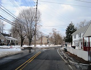
Charleston Springs is an unincorporated community located within Millstone Township in Monmouth County, New Jersey, United States. Stage Coach Road, also designated County Route 524, is the main road that runs through the settlement, with Ely Harmony Road as the intersecting road defining the locality. The Manalapan Brook runs to the west of the center of Charleston Springs and CR 537 runs to the south of the area. The Monmouth County-owned Charleston Springs Golf Course is located one mile (1.6 km) northeast of the center of Charleston Springs on CR 527.
Crawford Corners or Crawfords Corner is an unincorporated community located within Holmdel Township in Monmouth County, New Jersey, United States. The settlement is located at the intersection of Holmdel Road and Crawfords Corners Road in the hilly northern portion of the township. The settlement is located about one-half mile (0.80 km) from Crawford Hill, the highest point in Monmouth County. The area also includes the township's town hall, police department, and high school in addition to a New Jersey State Police barracks and the PNC Bank Arts Center off the Garden State Parkway. These buildings and landmarks comprise the eastern section of the settlement, homes and heavily treed lands are located on the west side of Holmdel Road, and Holmdel Park makes up the southern portion of the area.

Ely is an unincorporated community located within Millstone Township in Monmouth County, New Jersey, United States. The settlement is named for the Ely family that owned property in the area and operated the Charleston Springs hotel. Today, the settlement is located along Stage Coach Road, County Route 524, in the eastern portion of the township. Most of the area consists of large single-family homes though some farmland and the township-owned Brandywine Soccer Complex are located in the near the settlement.

Freewood Acres is an unincorporated community located within Howell Township in Monmouth County, New Jersey, United States. The area is made up of mostly single-story homes arranged along a street grid in the northern reaches of the Pine Barrens. U.S. Route 9 runs through the center of the community just north of its interchange with Interstate 195. The Land O'Pines Elementary School and Manasquan Reservoir County Park exist to the east of the community. It became the center of the Kalmyk American community in the latter part of the 20th century.
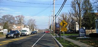
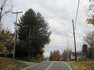
Glendola is an unincorporated community located within Wall Township in Monmouth County, New Jersey, United States. It is the location of the Glendola Reservoir. Most of the area consists of single-family residences along numerous streets throughout the settlement. The main east-west road through Glendola is Belmar Boulevard while access to the nearby Route 18 freeway is provided via Brighton Avenue.

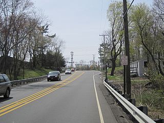
Lower Squankum is an unincorporated community located within Howell Township in Monmouth County, New Jersey, United States. The settlement is located along Lakewood-Farmingdale Road at its intersection with Herbertsville Road and Old Tavern Road in the eastern side of the township. It is also located near the boundary of Allaire State Park and is south of Interstate 195's exit 31. Nearby the community are the remains of the Lower Squankum Mill and the Lower Squankum Friends Burial Site, located within the median of CR 547 at the aforementioned interchange.


