
Neptune City is a borough in Monmouth County, New Jersey, United States. As of the 2010 United States Census, the borough's population was 4,869, reflecting a decline of 349 (-6.7%) from the 5,218 counted in the 2000 Census, which had in turn increased by 221 (+4.4%) from the 4,997 counted in the 1990 Census.

Holmeson is an unincorporated community located within Millstone Township in Monmouth County, New Jersey, United States. As it is located along County Route 537 through which the Monmouth–Ocean county line runs down the center, portions of the community are also located in Jackson Township. Owing to its location near Interstate 195 and Six Flags Great Adventure, the community is mostly made up of gas stations, restaurants, and small businesses though the Jackson Premium Outlets occupies land just south of the community.

Hornerstown is an unincorporated community located within Upper Freehold Township in Monmouth County, New Jersey, United States. Hornerstown is located near Cream Ridge and uses the 08514 ZIP code.

Herberts or Herberts Corner is an unincorporated community located within East Brunswick Township in Middlesex County, New Jersey, United States.

Everett is an unincorporated community located along the border of Holmdel and Middletown townships in Monmouth County, New Jersey, United States. The community is located on Everett Road, along which the township line runs, at its intersection with Stillwell Road and Sunnyside Road. Most of the area in Everett is composed of homes with some farmlands nearby. Holmdel's Bell Labs Complex is located to the west of Everett.

Cooks Mills is an unincorporated community located within Colts Neck Township in Monmouth County, New Jersey, United States. Located on the eastern border of the township near Tinton Falls, it is situated in a rural area of the township surrounded by horse farms and large single-family houses.

Ely is an unincorporated community located within Millstone Township in Monmouth County, New Jersey, United States. The settlement is named for the Ely family that owned property in the area and operated the Charleston Springs hotel. Today, the settlement is located along Stage Coach Road, County Route 524, in the eastern portion of the township. Most of the area consists of large single-family homes though some farmland and the township-owned Brandywine Soccer Complex are located in the near the settlement.

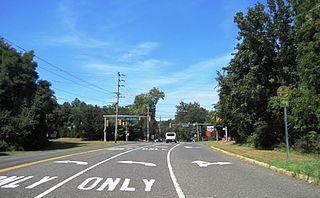
Hendrickson Corners is an unincorporated community located along the border of Holmdel and Middletown townships in Monmouth County, New Jersey, United States. The area primarily consists of commercial businesses along the Route 35 corridor; also nearby are an apartment complex and houses in developments throughout. County Route 516 has a brief concurrency with Route 35 in Hendricksons Corners; the easternmost intersection of the two roads is where the settlement is centered.

Henningers Mills or Henningers Mill is an unincorporated community located along the border of Aberdeen and Marlboro townships in Monmouth County, New Jersey, United States.
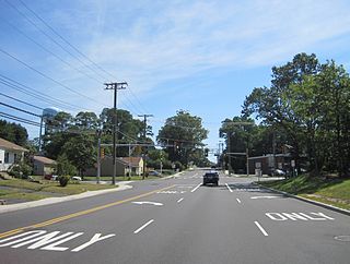
Holland is an unincorporated community located on the border of Holmdel and Middletown townships in Monmouth County, New Jersey, United States. The community is centered on the intersection of County Route 52 and Holland Road. The area making up Holland is hilly and consists of large single-family residences. An AT&T Labs campus is located off Laurel Avenue while Tatum County Park is also located in the area, both of which are on the Middletown side of the border.

Matthews is an unincorporated community located within Howell Township in Monmouth County, New Jersey, United States. The settlement is located on the western border of the township near Jackson Township, Ocean County and Interstate 195. It is located about the intersection of Hulses Corner Road and Fort Plains Road. The Howell side of the North Branch Metedeconk River is mainly rural with only a few houses located along the main surface roads while the Jackson side of the river is more suburbanized.

Monmouth Heights at Marlboro is an unincorporated community located within Marlboro Township in Monmouth County, New Jersey, United States. The housing development was created in the 1960s by Levitt & Sons though some protests occurred by long-time residents of Marlboro Township at the time of its creation. The community is located along New Jersey Route 79 across the highway from Marlboro High School.
Monmouth Hills is an unincorporated community located within Middletown Township in Monmouth County, New Jersey, United States.

Mount Pleasant is an unincorporated community located within Marlboro Township in Monmouth County, New Jersey, United States. It is named for a hill of the same name, one of the highest points in Marlboro Township. The settlement is located at the intersection of Reids Hill Road and Beacon Hill Road.
North Centerville is an unincorporated community located within Hazlet Township in Monmouth County, New Jersey, United States. Like most of Hazlet, North Centerville is largely suburban. The settlement is located at the intersection of Middle Road and Union Avenue in the center of the township.

Orchard Estates is an unincorporated community located within Freehold Township in Monmouth County, New Jersey, United States. The area consists of a single housing development on Duchess Court consisting of one and two-story single family homes. The development is located near the East Freehold intersection of Dutch Lane Road and Kozloski Road.
Osbornes Mills is an unincorporated community located within Wall Township in Monmouth County, New Jersey, United States.
West Grove is an unincorporated community located within Neptune Township in Monmouth County, New Jersey, United States.
Whitesville is an unincorporated community located along the border of Asbury Park and Neptune Township in Monmouth County, New Jersey, United States.


