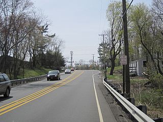
Smithburg is an unincorporated community located where the municipal boundaries of Freehold, Manalapan and Millstone townships intersect in Monmouth County, New Jersey, United States. County Route 527 and Monmouth Road pass through the center of Smithburg.
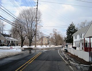
Etra is an unincorporated community located within East Windsor Township, in Mercer County, New Jersey, United States. The surroundings of Etra is mostly residential homes and farmland. East Windsor's largest park, Etra Lake Park, is located just east of the community.

Prospertown is an unincorporated community located within the New Jersey townships of Jackson and Plumsted in Ocean County and Upper Freehold in Monmouth County. The community is home to Prospertown Lake and is adjacent to Six Flags Great Adventure, both located on County Route 537. The center of the community is located at the intersection of CR 537, Hawkin Road, and Emleys Hill Road. Most of the area consists of pine forests but there are some homes along the roads in the area.

Gordons Corner is an unincorporated community located within Manalapan Township in Monmouth County, New Jersey, United States. The community is centered near the interchange with U.S. Route 9 (US 9), Tennent Road and Gordons Corner Road. Numerous strip malls and businesses line US 9 especially south of the interchange. The surrounding area is mostly made up of older housing developments though some farms are located on the north side of the community.

Harts Corner is an unincorporated community located within Hopewell Township in Mercer County, New Jersey, United States. The center of the settlement is located about the intersection of Washington Crossing-Pennington Road and Scotch Road. Three of the four quadrants of the intersection contain farmland and Hopewell Township Municipal Offices, township public works, and recreational facilities occupy the remaining quadrant.

Harneys Corner is an unincorporated community located within Lawrence Township in Mercer County, New Jersey, United States. It is located at the intersection of Lawrence Road and Princeton Pike / Avenue. Located in the southern portion of the township close to the Trenton and Ewing borders, the area consists of small houses on nearby side streets and businesses along the aforementioned arterial roads. The intersection itself is located about 0.3 miles (0.48 km) north of the Brunswick Circle.

Coopers Corner is an unincorporated community located within Hopewell Township in Mercer County, New Jersey, United States. The settlement is centered about the intersection of County Routes 518 and 579.

Ackors Corner is an unincorporated community located within Hopewell Township in Mercer County, New Jersey, United States. The settlement is located at the intersection of Bear Tavern Road / Trenton-Harbourton Road, Pennington-Harbourton Road and Pleasant Valley Road. It is named for the Ackors family which owned land near the current intersection. Small residences and farmland make up the area surrounding Ackors Corner but the area rises in elevation from east to west as one approaches Baldpate Mountain, part of the Sourland Mountain range.

Dunhams Corner is an unincorporated community in East Brunswick Township in Middlesex County, New Jersey, United States. The area is suburban and is mostly made up of single family houses with some churches, temples, and schools located throughout. The settlement is centered on the intersection of Dunhams Corner Road and Ryders Lane.
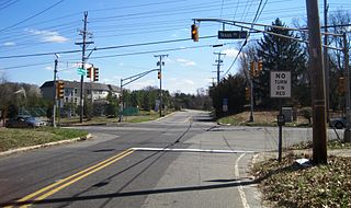
Moerls Corner or Moerle Corner is an unincorporated community located within Old Bridge Township in Middlesex County, New Jersey, United States. The intersection for which the corner is named is at Marlboro Road and Texas Road. The eastern quadrant of the intersection contains condominium units while the other three quadrants are sparsely-populated forest.
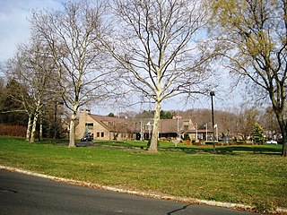
Crawford Corners or Crawfords Corner is an unincorporated community located within Holmdel Township in Monmouth County, New Jersey, United States. The settlement is located at the intersection of Holmdel Road and Crawfords Corners Road in the hilly northern portion of the township. The settlement is located about one-half mile (0.80 km) from Crawford Hill, the highest point in Monmouth County. The area also includes the township's town hall, police department, and high school in addition to a New Jersey State Police barracks and the PNC Bank Arts Center off the Garden State Parkway. These buildings and landmarks comprise the eastern section of the settlement, homes and heavily treed lands are located on the west side of Holmdel Road, and Holmdel Park makes up the southern portion of the area.

Hendrickson Corners is an unincorporated community located along the border of Holmdel and Middletown townships in Monmouth County, New Jersey, United States. The area primarily consists of commercial businesses along the Route 35 corridor; also nearby are an apartment complex and houses in developments throughout. County Route 516 has a brief concurrency with Route 35 in Hendricksons Corners; the easternmost intersection of the two roads is where the settlement is centered.
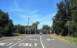
Holland is an unincorporated community located on the border of Holmdel and Middletown townships in Monmouth County, New Jersey, United States. The community is centered on the intersection of County Route 52 and Holland Road. The area making up Holland is hilly and consists of large single-family residences. An AT&T Labs campus is located off Laurel Avenue while Tatum County Park is also located in the area, both of which are on the Middletown side of the border.

Matthews is an unincorporated community located within Howell Township in Monmouth County, New Jersey, United States. The settlement is located on the western border of the township near Jackson Township, Ocean County and Interstate 195. It is located about the intersection of Hulses Corner Road and Fort Plains Road. The Howell side of the North Branch Metedeconk River is mainly rural with only a few houses located along the main surface roads while the Jackson side of the river is more suburbanized.

Morrells Corner or Morrell Corners is an unincorporated community located within Holmdel and Hazlet townships in Monmouth County, New Jersey, United States. The main north-south road through here is Holmdel Road and the main east-west road is Bethany Road. Most of the area is suburban and consists of homes alongside roads with some businesses and the Hazlet NJ Transit station along the main roads.

Shacks Corner is an unincorporated community located within Howell Township in Monmouth County, New Jersey, United States. The settlement is located along New Jersey Route 33 at its intersection with Yellow Brook Road. The area to the north of Route 33 is forested and consists entirely of Naval Weapons Station Earle. On the south side of the highway, there are small clusters of homes along Yellow Brook Road and a few other side roads off Route 33. Some businesses also line the southern side of Route 33 in the area.

Smocks Corner or Smocks Corners is an unincorporated community located within Marlboro Township in Monmouth County, New Jersey, United States. Located at the intersection of Pleasant Valley Road and Conover Road, the area is mostly residences with some open space and farmland. It was called "Smocks Corner" because the Smock Family had houses in that area, both sides of the street back in the 1700s.

Van Marters Corner or Van Mariners Corners is an unincorporated community located along the border of Union Beach Borough and Hazlet Township in Monmouth County, New Jersey, United States.

Comical Corner or Comical Corners is an unincorporated community located within Pemberton Township in Burlington County, New Jersey, United States. The site of the actual corners is at the intersection of Pemberton Road and Arneys Mount Road. The original name may have been "Conical Corner" based on the cone-like shape of the skewed intersection but had turned to "Comical Corner" based on a mishearing. The area, located just to the north of Pemberton Borough, is mostly rural and is surrounded by farmland on the two obtuse sides of the intersection.

Newbolds Corner is an unincorporated community located within Lumberton Township in Burlington County, New Jersey, United States. The site, located at the corner of Eayrestown Road and Newbolds Corner Road, was once home to a Nike missile silo which was fully demolished in late 2015. Today, the west side of Eayrestown Road consists of housing developments, Lumberton Township's town hall, and a school, while the east side of the road features farmland.


