Grove Street is a station on the PATH system. Located at the intersection of Grove Street, Newark Avenue and Railroad Avenue in the Downtown neighborhood of Jersey City, New Jersey, it is served by the Newark–World Trade Center line at all times, the Journal Square–33rd Street line on weekdays, and the Journal Square–33rd Street line on weekends and during late-evening and early-morning weekday hours.

Cedar Grove is an unincorporated community located within Princeton in Mercer County, New Jersey, United States. In the 19th and early 20th centuries it was a village with a church, blacksmith, and schoolhouse. It is located on the brow of a hill along Great Road from Princeton to Blawenburg. The Cedar Grove area was settled by French families of some prominence who were Huguenot refugees, including Louis and Maria Tulane, to whom Paul Tulane, philanthropist and founder of Tulane University, was born in 1801. The suburbanization of Princeton Township in the second half of the 20th century led to a loss of Cedar Grove's place as a distinctive settlement, though some older buildings are still extant. As the main route of Great Road has been relocated to a bypass to the east, the area is much less traveled. Most of the area's land is owned by the Tenacre Foundation, a Christian Science care and nursing facility.

Middlesex Downs is an unincorporated community located within Monroe Township in Middlesex County, New Jersey, United States. The wholly residential settlement contains small homes along Dey Grove Road and Bergen Mills Road with larger homes in developments towards the south. The township-owned James Monroe Memorial Park is also located in this settlement. Much of the area to the north of Dey Grove Road consists of forest land but at one time this was planned to become a large planned community arranged in a street grid. The small property parcels and paper streets remain on township tax maps today.

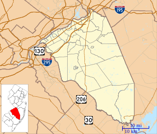
Eayrestown is an unincorporated community located within Lumberton Township in Burlington County, New Jersey, United States. The settlement is named for Richard and Elizabeth Eayres, the first settlers of the site in the 1600s. It was also the first settlement in what is now Lumberton Township. The settlement, located along the South Branch Rancocas Creek, was the site of numerous saw and gristmills early in its history and a picnic grove that attracted people from around the area. Today, numerous farms and housing developments dot the area.

Green Grove is an unincorporated community located where the boundaries of Neptune Township, Ocean Township and Tinton Falls Borough intersect in Monmouth County, New Jersey, United States.

Stonehurst West is an unincorporated community located within Freehold Township in Monmouth County, New Jersey, United States.

Wertheins Corner is an unincorporated community located within Ocean Township in Monmouth County, New Jersey, United States. The settlement is centered on the intersection of New Jersey Route 35 and Deal Road in the center part of the township. Commercial businesses line Route 35 through the area. On the west side of Route 35, there are some apartment and townhouse complexes while single-family houses are located on the east side of the highway.

West Farms is an unincorporated community located within Howell Township in Monmouth County, New Jersey, United States. The settlement is centered on the intersection of West Farms Road and Casino Drive, located to the west of Farmingdale and to the north of the Manasquan Reservoir. The rural area is mostly made up of wooded areas with some houses and churches dotted along the two aforementioned roads. Numerous small farms are also located throughout the area.

West Shrewsbury is an unincorporated community located within Tinton Falls in Monmouth County, New Jersey, United States.

Whitesville is an unincorporated community located along the border of Asbury Park and Neptune Township in Monmouth County, New Jersey, United States.

Wileys Corner or Wileys Corners is an unincorporated community located within Tinton Falls in Monmouth County, New Jersey, United States.

Beaverville is an unincorporated community located within Southampton Township in Burlington County, New Jersey, United States. The area is composed of single-family homes, small businesses and warehouses, forest, and farmland. The community is located along Red Lion Road two miles (3.2 km) south of Vincentown, to the west of U.S. Route 206, and southeast of the Red Lion Airport. Originally, the settlement was the site of a one-room schoolhouse.

Bellview is an unincorporated community located within Cinnaminson Township in Burlington County, New Jersey, United States.

Berlin Heights is an unincorporated community located within Evesham Township in Burlington County, New Jersey, United States.

Birchfield is an unincorporated community located within Mount Laurel Township in Burlington County, New Jersey, United States.

Birchwood Lakes is an unincorporated community located within Medford Township in Burlington County, New Jersey, United States.

Bortons Landing or Borton Landing is an unincorporated community located along the border of Moorestown and Willingboro townships in Burlington County, New Jersey, United States.

Bossert Estates is an unincorporated community located within Bordentown Township in Burlington County, New Jersey, United States.

Clermont is an unincorporated community located within Mount Holly in Burlington County, New Jersey, United States. It is located on the west side of the township along Washington Street and contains numerous small houses and churches arranged in a small street grid.

Ellisdale is an unincorporated community located along the border of North Hanover Township in Burlington County and Upper Freehold Township in Monmouth County, in New Jersey, United States. The community is centered about the intersection of Province Line Road and Hill Road / Ellisdale-Crosswicks Road. The Crosswicks Creek runs to the north of the settlement and the nearby Ellisdale Fossil Site takes its name from Ellisdale.


