
Parkway Pines is an unincorporated community located along the border of Howell Township in Monmouth County and Brick Township in Ocean County, in New Jersey, United States. The Howell area of this community is called Ramtown.
Collingwood Park is an unincorporated community located along the border of Howell and Wall townships in Monmouth County, New Jersey, United States.
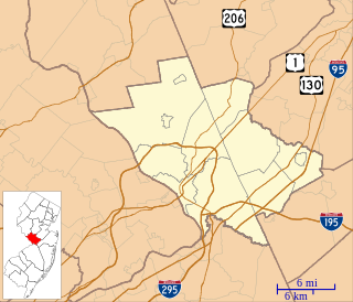
Princeton Estates is an unincorporated community located within West Windsor Township in Mercer County, New Jersey, United States.

Shore Road Estates is an unincorporated community located within Monroe Township in Middlesex County, New Jersey, United States.
Ardena is an unincorporated community located within Howell Township in Monmouth County, New Jersey, United States. The community is located along County Route 524 near Vanderveer Road in the western part of the township. The area consists of about half farmland and half residential developments.

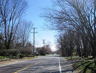
Bergerville is an unincorporated community located within Howell Township in Monmouth County, New Jersey, United States. The settlement is centered on the intersection of U.S. Route 9, Bergerville Road and Casino Drive. Commercial businesses line US 9 through the area and some single-family houses are located along the two main east-west roads and Fort Plains Road. Numerous condominium and town house developments are also located nearby.
Candlewood is an unincorporated community located within Howell Township in Monmouth County, New Jersey, United States. The community is comprised of the largest residential development in Howell Township.

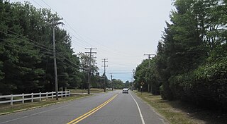
Oak Glen is an unincorporated community located within Howell Township in Monmouth County, New Jersey, United States. The area consists mostly of forest and single-family homes along the four roads that run through the area; Oak Glen Road, Old Tavern Road, Aldrich Road, and Windeler Road. The settlement is located between Interstate 195 and Manasquan Reservoir County Park.

Fairfield is an unincorporated community located within Howell Township in Monmouth County, New Jersey, United States. The community is centered on the intersection of County Route 524 (CR 524) and Ketchum Road, where the Colonial Era Our House Tavern is located. The area includes several small businesses, township offices and schools. There are also small farms and residential developments in the area.

Fort Plains is an unincorporated community located within Howell Township in Monmouth County, New Jersey, United States. The settlement is centered about the intersection of Fort Plains Road and West Farms Road on the western side of the township. Nearby the intersection are numerous housing developments consisting of larger single-family houses. U.S. Route 9 also runs north and south where numerous commercial businesses are found. The remainder of the area consists of forestland.

Freewood Acres is an unincorporated community located within Howell Township in Monmouth County, New Jersey, United States. The area is made up of mostly single-story homes arranged along a street grid in the northern reaches of the Pine Barrens. U.S. Route 9 runs through the center of the community just north of its interchange with Interstate 195. The Land O'Pines Elementary School and Manasquan Reservoir County Park exist to the east of the community.
Lake Club is an unincorporated community located within Howell Township in Monmouth County, New Jersey, United States.

Land of Pines is an unincorporated community located within Howell Township in Monmouth County, New Jersey, United States. The area consists of single-family home developments with some businesses located along U.S. Route 9, a divided highway that runs through the center of the community. It is located in the northernmost extents of the Pine Barrens and is just south of Interstate 195.

Lower Squankum is an unincorporated community located within Howell Township in Monmouth County, New Jersey, United States. The settlement is located along Lakewood-Farmingdale Road at its intersection with Herbertsville Road and Old Tavern Road in the eastern side of the township. It is also located near the boundary of Allaire State Park and is south of Interstate 195's exit 31. Nearby the community are the remains of the Lower Squankum Mill and the Lower Squankum Friends Burial Site, located within the median of CR 547 at the aforementioned interchange.

Matthews is an unincorporated community located within Howell Township in Monmouth County, New Jersey, United States. The settlement is located on the western border of the township near Jackson Township, Ocean County and Interstate 195. It is located about the intersection of Hulses Corner Road and Fort Plains Road. The Howell side of the North Branch Metedeconk River is mainly rural with only a few houses located along the main surface roads while the Jackson side of the river is more suburbanized.

Orchard Estates is an unincorporated community located within Freehold Township in Monmouth County, New Jersey, United States. The area consists of a single housing development on Duchess Court consisting of one and two-story single family homes. The development is located near the East Freehold intersection of Dutch Lane Road and Kozloski Road.
Salem Hill is an unincorporated community located within Howell Township in Monmouth County, New Jersey, United States.

West Farms is an unincorporated community located within Howell Township in Monmouth County, New Jersey, United States. The settlement is centered on the intersection of West Farms Road and Casino Drive, located to the west of Farmingdale and to the north of the Manasquan Reservoir. The rural area is mostly made up of wooded areas with some houses and churches dotted along the two aforementioned roads. Numerous small farms are also located throughout the area.
Wyckoff Mills is an unincorporated community located within Howell Township in Monmouth County, New Jersey, United States. The settlement is centered about the intersection of Wyckoff Mills Road and Strickland Road, just east of U.S. Route 9 in the western sector of the township.
Bossert Estates is an unincorporated community located within Bordentown Township in Burlington County, New Jersey, United States. The area was developed from farmland in the 1950s. The first houses in the neighborhood opened in 1953 and mail delivery began in 1954.


