Oakhurst Manor, New Jersey

Last updated
Oakhurst Manor, New Jersey
Unincorporated community
Location map of Monmouth County, New Jersey.svg
Red pog.svg
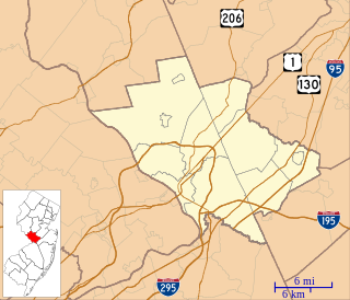
Oakhurst Manor, New Jersey
Location of Oakhurst Manor in Monmouth County Inset: Location of county within the state of New Jersey
USA New Jersey location map.svg
Red pog.svg
Oakhurst Manor, New Jersey
Oakhurst Manor, New Jersey (New Jersey)
Usa edcp location map.svg
Red pog.svg
Oakhurst Manor, New Jersey
Oakhurst Manor, New Jersey (the US)
Coordinates: 40°15′37″N74°00′43″W / 40.26028°N 74.01194°W / 40.26028; -74.01194 Coordinates: 40°15′37″N74°00′43″W / 40.26028°N 74.01194°W / 40.26028; -74.01194
Country Flag of the United States.svg  United States
State Flag of New Jersey.svg  New Jersey
County Monmouth
Township Ocean
Elevation [1] 36 ft (11 m)
GNIS feature ID 882526 [1]

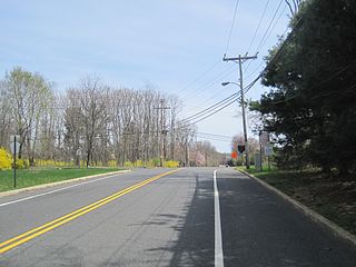
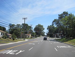
Oakhurst Manor is an unincorporated community located within Ocean Township in Monmouth County, New Jersey, United States. [2]

Ocean Township, Monmouth County, New Jersey Township in New Jersey, United States

Ocean Township is a township located in east central Monmouth County, New Jersey, United States. Ocean Township consists of three main unincorporated communities: Wanamassa, Oakhurst and Wayside. The township is divided into two zip codes, 07755 (Oakhurst) and 07712. Small portions have Allenhurst (07711), Deal (07723) and Long Branch (07740) zip codes.

Monmouth County, New Jersey County in the United States

Monmouth County is a county located in Central New Jersey, in the United States within the New York metropolitan area, and the northernmost county along the Jersey Shore. As of the 2017 Census estimate, the county's population was 626,351, making it the state's fifth-most populous county, representing a decrease of 0.6% from the 2010 Census, when the population was enumerated at 630,380, in turn an increase of 15,079 from 615,301 at the 2000 Census. As of 2010, the county fell to the fifth-most populous county in the state, having been surpassed by Hudson County. Its county seat is Freehold Borough. The most populous place was Middletown Township, with 66,522 residents at the time of the 2010 Census, while Howell Township covered 61.21 square miles (158.5 km2), the largest total area of any municipality.

New Jersey State of the United States of America

New Jersey is a state in the Mid-Atlantic and Northeastern regions of the United States. It is located on a peninsula, bordered on the north and east by the state of New York, particularly along the extent of the length of New York City on its western edge; on the east, southeast, and south by the Atlantic Ocean; on the west by the Delaware River and Pennsylvania; and on the southwest by the Delaware Bay and Delaware. New Jersey is the fourth-smallest state by area but the 11th-most populous, with 9 million residents as of 2017, and the most densely populated of the 50 U.S. states; its biggest city is Newark. New Jersey lies completely within the combined statistical areas of New York City and Philadelphia. New Jersey was the second-wealthiest U.S. state by median household income as of 2017.

Related Research Articles

Montrose, New Jersey Unincorporated community in New Jersey, United States

Montrose is an unincorporated community located near the intersection of Dutch Lane Road and Boundary Road along the border of Colts Neck and Marlboro townships in Monmouth County, New Jersey, United States. The historic one-room Montrose Schoolhouse, built before 1820, is located in the Colts Neck portion of the community.

Briar Manor, New Jersey Unincorporated community in New Jersey, United States

Briar Manor is an unincorporated community located within Hamilton Township in Mercer County, New Jersey, United States.

Ferry Road Manor, New Jersey Unincorporated community in New Jersey, United States

Ferry Road Manor is a neighborhood located within Ewing Township in Mercer County, New Jersey, United States.

Golf View Manor, New Jersey Unincorporated community in New Jersey, United States

Golf View Manor is an unincorporated community located within West Windsor Township in Mercer County, New Jersey, United States.

Heath Manor, New Jersey Unincorporated community in New Jersey, United States

Heath Manor is a neighborhood located within Ewing Township in Mercer County, New Jersey, United States.

Adams, New Jersey Unincorporated community in New Jersey, United States

Adams is an unincorporated community located within North Brunswick Township in Middlesex County, New Jersey, United States. The community is located along Cozzens Lane between Route 27 and U.S. Route 1 and except for commercial businesses lining Routes 1 and 27, is made up of mostly residential homes and apartment complexes.

Lawrence Brook Manor, New Jersey Unincorporated community in New Jersey, United States

Lawrence Brook Manor is an unincorporated community located within East Brunswick Township in Middlesex County, New Jersey, United States.

MacArthur Manor, New Jersey Unincorporated community in New Jersey, United States

MacArthur Manor is a neighborhood in Sayreville in Middlesex County, New Jersey, United States.

Raritan Manor, New Jersey Unincorporated community in New Jersey, United States

Raritan Manor is an unincorporated community located within Edison Township in Middlesex County, New Jersey, United States.

Riverview Manor, New Jersey Unincorporated community in New Jersey, United States

Riverview Manor is an unincorporated community located within Piscataway Township in Middlesex County, New Jersey, United States.

Spotswood Manor, New Jersey Unincorporated community in New Jersey, United States

Spotswood Manor is an unincorporated community located within Monroe Township in Middlesex County, New Jersey, United States. The settlement is located just south of the borough of Spotswood, most of them consist of small homes, though businesses and strip malls line Spotswood-Englishtown Road, the main road through the area.

Monmouth Heights at Marlboro, New Jersey Unincorporated community in New Jersey, United States

Monmouth Heights at Marlboro is an unincorporated community located within Marlboro Township in Monmouth County, New Jersey, United States. The housing development was created in the 1960s by Levitt & Sons though some protests occurred by long-time residents of Marlboro Township at the time of its creation. The community is located along New Jersey Route 79 across the highway from Marlboro High School.

Monmouth Hills, New Jersey Unincorporated community in New Jersey, United States

Monmouth Hills is an unincorporated community located within Middletown Township in Monmouth County, New Jersey, United States.

Mount Pleasant, Monmouth County, New Jersey Unincorporated community in New Jersey, United States

Mount Pleasant is an unincorporated community located within Marlboro Township in Monmouth County, New Jersey, United States. It is named for a hill of the same name, one of the highest points in Marlboro Township. The settlement is located at the intersection of Reids Hill Road and Beacon Hill Road.

Navesink Beach, New Jersey Unincorporated community in New Jersey, United States

Navesink Beach is an unincorporated community located within Sea Bright in Monmouth County, New Jersey, United States. It is one of the four main built-up areas of Sea Bright and is the northernmost settled area of the borough. Navesink Beach is a former stop on the New Jersey Southern Railroad. The Sea Bright–Monmouth Beach Seawall passes through the neighborhood and Normandie.

Normandie, New Jersey Unincorporated community in New Jersey, United States

Normandie is an unincorporated community located within Sea Bright in Monmouth County, New Jersey, United States. The community is one of the four main built-up areas of Sea Bright and is a former stop on the New Jersey Southern Railroad. It is located along Route 36 between the CR 520 drawbridge to Rumson and Sandy Hook on a narrow strip of land between the Shrewsbury River and the Atlantic Ocean. The Sea Bright–Monmouth Beach Seawall passes through the neighborhood and Navesink Beach.

North Centerville, New Jersey Unincorporated community in New Jersey, United States

North Centerville is an unincorporated community located within Hazlet Township in Monmouth County, New Jersey, United States. Like most of Hazlet, North Centerville is largely suburban. The settlement is located at the intersection of Middle Road and Union Avenue in the center of the township.

Orchard Estates, New Jersey Unincorporated community in New Jersey, United States

Orchard Estates is an unincorporated community located within Freehold Township in Monmouth County, New Jersey, United States. The area consists of a single housing development on Duchess Court consisting of one and two-story single family homes. The development is located near the East Freehold intersection of Dutch Lane Road and Kozloski Road.

Osbornes Mills, New Jersey Unincorporated community in New Jersey, United States

Osbornes Mills is an unincorporated community located within Wall Township in Monmouth County, New Jersey, United States.

References