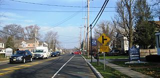
Marlboro is an unincorporated community located within Marlboro Township in Monmouth County, New Jersey, United States.
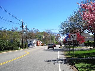
Deans is an unincorporated community located within South Brunswick Township in Middlesex County, New Jersey, United States.

Raven Rock is an unincorporated community and hamlet along the Delaware River approximately three miles (4.8 km) north of Stockton along New Jersey Route 29. The hamlet was known earlier as Saxtonville. It is located within Delaware Township in Hunterdon County, New Jersey, United States. It is the site of Bull's Island Recreation Area. The rock outcrop for which it is named is the southwest corner of the Hunterdon Plateau.

New Lisbon is an unincorporated community located within Pemberton Township in Burlington County, New Jersey, United States. It is a settlement along Four Mile Road where it intersects Mount Misery Road. The community is located along the Philadelphia and Long Branch Railway, later a part of the Pennsylvania Railroad, and featured a train station.

Hornerstown is an unincorporated community located within Upper Freehold Township in Monmouth County, New Jersey, United States. Hornerstown is located near Cream Ridge and uses the 08514 ZIP code.
Lawrence Station is an unincorporated community located within Lawrence Township in Mercer County, New Jersey, United States. The settlement is named for a former railroad station on the Pennsylvania Railroad's New York Division line, now a part of the Northeast Corridor. Today, some wooded areas and buildings from the time of the station remain but more townhouse developments, cultural centers, and industrial facilities are located along the main road through the area, Lawrence Station Road.

Cranbury Station is an unincorporated community located within Cranbury Township in Middlesex County, New Jersey, United States. The area immediately around the site of the former railroad station along the Camden and Amboy Railroad contains agricultural businesses and small homes. Hightstown-Cranbury Station Road is the main road through the settlement paralleling the railroad and Station Road, County Route 615 as a major road heading east and west through the area. Modern warehouses line Station Road and the nearby New Jersey Turnpike west of the station while large housing developments are located east of here in Monroe Township.
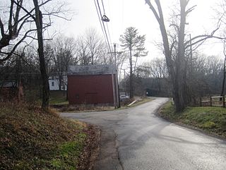
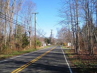
Bowne is an unincorporated community located at the intersection of the boundaries of Delaware, East Amwell and West Amwell townships in Hunterdon County, New Jersey, United States.

Flemington Junction is an unincorporated community located within Raritan Township in Hunterdon County, New Jersey, United States. The area is located approximately one and a half miles (2.4 km) northeast of downtown Flemington and was the site of the junction of the Lehigh Valley Railroad's Flemington Branch and Mainline. The Flemington Junction station was listed as part of the Raritan–Readington South Branch Historic District in 1990. Today, the Flemington Spur tracks have been removed but numerous industries and commercial businesses are located in the vicinity of the crossing. In addition to the Norfolk Southern rail line, County Route 523 passes through the area.

Hoffman is an unincorporated community located within Monroe Township in Middlesex County, New Jersey, United States. The settlement is located at the site of a former railroad station on the Freehold and Jamesburg Agricultural Railroad. Today, most of the area is made up of homes and housing developments along Hoffman Station Road and Gravel Hill-Spotswood Road. Forestland and the Manalapan Brook valley make up the remainder of the area.

Sayreville Junction is a neighborhood located within Sayreville in Middlesex County, New Jersey, United States. It was a stop on the Raritan River Railroad
Tracy is an unincorporated community located within Monroe Township in Middlesex County, New Jersey, United States. The settlement is located at the site of a former station on the Freehold and Jamesburg Agricultural Railroad in the southeastern edge of the township. Most of the area is forestland with some homes and light commercial businesses located along Federal Road and Tracy Station Road.

Freneau is an unincorporated community located within Matawan in Monmouth County, New Jersey, United States. It is named for Philip Freneau (1752–1832), a poet during the American Revolutionary War. The community is located along New Jersey Route 79 in the southern portion of Matawan and was formerly served by the Monmouth County Agricultural Railroad.

Galilee is an unincorporated community located within Monmouth Beach in Monmouth County, New Jersey, United States. The area is named for the Biblical city of Galilee and was founded as a fishing village. Located at the northern extent of Monmouth Beach, it is located along the peninsula where it begins to greatly narrow between the Shrewsbury River and the Atlantic Ocean. Single family homes typically make up the ocean side of the peninsula while condominiums and a marina are located on the river side. The Sea Bright–Monmouth Beach Seawall passes through the community and continues to neighboring Sea Bright.

Navesink Beach is an unincorporated community located within Sea Bright in Monmouth County, New Jersey, United States. It is one of the four main built-up areas of Sea Bright and is the northernmost settled area of the borough. Navesink Beach is a former stop on the New Jersey Southern Railroad. The Sea Bright–Monmouth Beach Seawall passes through the neighborhood and Normandie.

Nelsonville is an unincorporated community located within Upper Freehold Township in Monmouth County, New Jersey, United States. The settlement is located on County Route 526 between Allentown and Imlaystown where it intersects the former Pemberton and Hightstown Railroad. The site was the location of the Newell post office established in 1883. The area was originally known as Imlaystown Station as it was the closest spot to the eponymous town along the railroad. In 1887, the area was renamed to Nelsonville for the local postmaster, Charles Nelson. Other industries in the area at the time included a wagon shop and a cider mill. Today, several agricultural and light industries surround the settlement in addition to some single-family homes. The right-of-way of the former railroad is being reconstructed as the Union Transportation Trail.

Normandie is an unincorporated community located within Sea Bright in Monmouth County, New Jersey, United States. The community is one of the four main built-up areas of Sea Bright and is a former stop on the New Jersey Southern Railroad. It is located along Route 36 between the CR 520 drawbridge to Rumson and Sandy Hook on a narrow strip of land between the Shrewsbury River and the Atlantic Ocean. The Sea Bright–Monmouth Beach Seawall passes through the neighborhood and Navesink Beach.

Ewansville or Ewanville is an unincorporated community located in Burlington County, New Jersey, United States. The community is centered on the crossing of U.S. Route 206 (US 206) and the North Branch Rancocas Creek just north of the former Philadelphia and Long Branch Railway. Ewansville was the site of a station on the aforementioned railroad and was the terminus for a short spur track to Vincentown.

Sharon is an unincorporated community located within Upper Freehold Township in Monmouth County, New Jersey, United States. Located at the intersection of Herbert Road and Sharon Station Road, the settlement is the site of a former stop on the Pemberton and Hightstown Railroad. Except for a few single-family homes in the area, most of the area is farmland. The railroad has since been abandoned and is being converted to the Union Transportation Trail, a rail trail. Sharon is the current northern terminus of the trail.

Browns Mills Junction is an unincorporated community located within Pemberton Township in Burlington County, New Jersey, United States. The site, located about 1.6 miles (2.6 km) southwest of downtown Browns Mills, is located at the crossing of Junction Road and the Philadelphia and Long Branch Railway, later a part of the Pennsylvania Railroad. It was the site of a train station named Browns Mills in-the-Pines where a short branch connected the main line to Browns Mills. The settlement features a few houses along Junction Road and Mount Misery Road but is otherwise very forested as a part of the New Jersey Pine Barrens.


