
Bethel Township is a civil township of Branch County in the U.S. state of Michigan. As of the 2010 census, the township population was 1,434.

Farmingdale is a borough in Monmouth County, New Jersey, United States. As of the 2010 United States Census, the borough's population was 1,329, reflecting a decline of 258 (-16.3%) from the 1,587 counted in the 2000 Census, which had in turn increased by 125 (+8.5%) from the 1,462 counted in the 1990 Census.

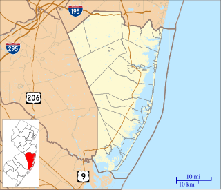
Howell Township is a township in Monmouth County, New Jersey, United States. It is located in the New York metropolitan area and is a bedroom community of New York City. As of the 2010 United States Census, the township's population was 51,075, reflecting an increase of 2,172 (+4.4%) from the 48,903 counted in the 2000 Census, which had in turn increased by 9,916 (+25.4%) from the 38,987 counted in the 1990 Census.

West Freehold is an unincorporated community and census-designated place (CDP) within Freehold Township, in Monmouth County, New Jersey, United States. As of the 2010 United States Census, the CDP's population was 13,613. Due to the community's close proximity to the Battle of Monmouth, West Freehold is home to several important historical structures, which have been preserved in the 'West Freehold Village Historic District'. The historically preserved Monmouth Battlefield, along with the historic villages of Clarksburg, Englishtown, Smithburg and Tennent are a short distance away.

Bethel Township is a township in Armstrong County, Pennsylvania, United States. The population was 1,183 at the 2010 census.

Adelphia is an unincorporated community located within Howell Township in Monmouth County, New Jersey, United States. The area is served as United States Postal Service ZIP code 07710.
County Route 524 is a county highway in the U.S. state of New Jersey. The highway extends 39.90 miles (64.21 km) from the White Horse Circle in Hamilton Township to Route 71 in Spring Lake Heights.

Parkway Pines is an unincorporated community located along the border of Howell Township in Monmouth County and Brick Township in Ocean County, in New Jersey, United States. The Howell area of this community is called Ramtown.
Bonhamtown is a section of Edison Township in Middlesex County, New Jersey, United States.
Squankum is an unincorporated community located within Howell Township in Monmouth County, New Jersey, United States. The name Squankum was used for a town in Gloucester County, which was changed to present day Williamstown, due to postal regulations that prohibited the two towns from having the same name.

Jerseyville is an unincorporated community located within Howell Township in Monmouth County, New Jersey, United States. It is primarily a rural area within the northern part of the township. Route 33 Business travels through Jerseyville, with some development, including a gas station, a convenience store, a church, and several residences.
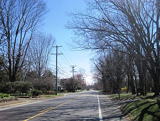
Ardena is an unincorporated community located within Howell Township in Monmouth County, New Jersey, United States. The community is located along County Route 524 near Vanderveer Road in the western part of the township. The area consists of about half farmland and half residential developments.

Bergerville is an unincorporated community located within Howell Township in Monmouth County, New Jersey, United States. The area was originally developed as a resort bungalow community in the first half of the 20th century.

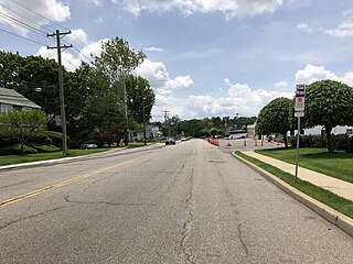
Fairfield is an unincorporated community located within Howell Township in Monmouth County, New Jersey, United States. The community is centered on the intersection of County Route 524 (CR 524) and Ketchum Road, where the Colonial Era Our House Tavern is located. The area includes several small businesses, township offices and schools. There are also small farms and residential developments in the area. Fairfield was a stop on the Freehold and Jamesburg Agricultural Railroad

Freewood Acres is an unincorporated community located within Howell Township in Monmouth County, New Jersey, United States. The area is made up of mostly single-story homes arranged along a street grid in the northern reaches of the Pine Barrens. U.S. Route 9 runs through the center of the community just north of its interchange with Interstate 195. The Land O'Pines Elementary School and Manasquan Reservoir County Park exist to the east of the community. It became the center of the Kalmyk American community in the latter part of the 20th century.

Maxim is an unincorporated community located within Howell Township in Monmouth County, New Jersey, United States. The area, just southwest of the Squankum takes its name from the Maxim Powder Company and its founder, Hudson Maxim, who developed a plant there in 1890.

West Farms is an unincorporated community located within Howell Township in Monmouth County, New Jersey, United States. The settlement is centered on the intersection of West Farms Road and Casino Drive, located to the west of Farmingdale and to the north of the Manasquan Reservoir. It was once home Jewish farmers who settled there in the early 20th century. The rural area is mostly made up of wooded areas with some houses and churches dotted along the two aforementioned roads. Numerous small farms are also located throughout the area.
Pinewald is an unincorporated community located within Berkeley Township in Ocean County, New Jersey, United States. The community is located between U.S. Route 9 and the Garden State Parkway. Pinewald was established in the 1880s and consisted of a post office, land office, two banks, a commissary and a railroad station. The railway station served Pinewald and the Bayville area, on what is now the Barnegat Branch Trail, a 15-mile walking trail. The community was economically unsuccessful and was destroyed by 3 fires.


