Allentown is a borough, located in western Monmouth County, New Jersey, United States, bordering nearby Mercer County. As of the 2010 United States Census, the borough's population was 1,828, reflecting a decline of 54 (-2.9%) from the 1,882 counted in the 2000 Census, which had in turn increased by 54 (+3.0%) from the 1,828 counted in the 1990 Census. The borough is nestled within central New Jersey, and is roughly equidistant between New York City and Philadelphia.

Colts Neck Township is a township in Monmouth County, New Jersey, United States. It is located in the New York Metropolitan Area. As of the 2010 United States Census, the population was 10,142, reflecting a decline of 2,189 (-17.8%) from the 12,331 counted in the 2000 Census, which had in turn increased by 3,772 (+44.1%) from the 8,559 counted in the 1990 Census.

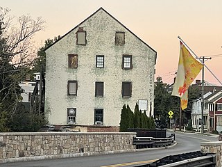
Englishtown is a borough in Monmouth County, New Jersey, United States. The community is nestled within the Raritan Valley region. As of the 2010 United States Census, the borough's population was 1,847, reflecting an increase of 83 (+4.7%) from the 1,764 counted in the 2000 Census, which had in turn increased by 496 (+39.1%) from the 1,268 counted in the 1990 Census.

Freehold is a borough and the county seat of Monmouth County, New Jersey, United States. The borough is located in the Raritan Valley region within the New York Metropolitan Area, located about 35 miles (56 km) from Manhattan and 15 miles (24 km) from Staten Island. The borough has grown to become a commuter town of New York City. As of the 2020 Census, the borough's population was 12,538, reflecting an increase of 486 (+4.0%) from the 10,976 counted in the 2000 Census, which had in turn increased by 234 (+2.2%) from the 10,742 counted in the 1990 Census.

Freehold Township is a township in Monmouth County, New Jersey, United States. The township is located within the Raritan Valley region and is a bedroom suburb for New York City commuters in the much larger New York Metropolitan Area and a regional commercial hub for Central New Jersey. The township is located roughly 35 miles (56 km) away from Manhattan and about 15 miles (24 km) away from Staten Island. As of the 2020 United States Census, the township's population was 35,369, reflecting an decrease of 815 (-2.3%) from the 36,184 counted in the 2010 Census.
Howell Township is a township in Monmouth County, New Jersey, United States. The township is the largest municipality in the county by total area, comprised of about 61.21 square miles (158.5 km2). It is located in the New York metropolitan area and is a steadily growing bedroom community of New York City. As of the 2020 United States Census, the township's population was 53,537, reflecting an increase of 2,462 (+4.8%) from the 51,075 counted in the 2010 Census.
Upper Freehold Township is a township in Monmouth County, New Jersey, United States. As of the 2010 United States Census, the township's population was 6,902, reflecting an increase of 2,620 (+61.2%) from the 4,282 counted in the 2000 Census, which had in turn increased by 1,005 (+30.7%) from the 3,277 counted in the 1990 Census.
Marlboro is an unincorporated community located within Marlboro Township in Monmouth County, New Jersey, United States.
County Route 522 is a county highway in the U.S. state of New Jersey. The highway extends 21 miles (34 km) from Route 27 in South Brunswick Township to Main Street in Freehold Borough.

Perrineville is an unincorporated community located within Millstone Township in Monmouth County, New Jersey, United States. The area is served as United States Postal Service ZIP code 08535.

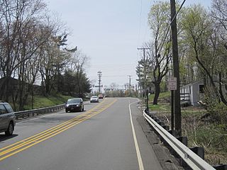
Tennent is an unincorporated community located within Manalapan Township in Monmouth County, New Jersey, United States. Considered to be the historic center of Manalapan Township, Tennent is home to the Old Tennent Church and Old Tennent Cemetery. William Tennent served as pastor at the church for over 40 years. Tennent was also the center of a historic community of African Americans dating back to the early nineteenth century. The location of Tennent is located at the modern intersection of County Route 522 and Tennent Road and is near the limits of Monmouth Battlefield State Park.
Smithburg is an unincorporated community located where the municipal boundaries of Freehold, Manalapan and Millstone townships intersect in Monmouth County, New Jersey, United States. County Route 527 and Monmouth Road pass through the center of the quaint village of Smithburg.

Hornerstown is an unincorporated community located within Upper Freehold Township in Monmouth County, New Jersey, United States. Hornerstown is located near Cream Ridge and uses the 08514 ZIP code.

Prospertown is an unincorporated community located within the New Jersey townships of Jackson and Plumsted in Ocean County and Upper Freehold in Monmouth County. The community is home to Prospertown Lake and is adjacent to Six Flags Great Adventure, both located on County Route 537. The center of the community is located at the intersection of CR 537, Hawkin Road, and Emleys Hill Road. Most of the area consists of pine forests but there are some homes along the roads in the area.

New Canton is an unincorporated community located along the border of Robbinsville Township in Mercer County and Upper Freehold Township in Monmouth County, New Jersey, United States. The area was once known as Cabbagetown and has been settled since the 18th century. The settlement is located at the intersection of Old York Road and New Canton-Stone Tavern Road just north of Interstate 195's interchange 8. The Upper Freehold side of the area contains farmland and new housing developments while the Robbinsville side features new commercial warehouse buildings including an Amazon.com Fulfillment Center opened in July 2014.

New Sharon is an unincorporated community located along the border of Robbinsville Township in Mercer County and Upper Freehold Township in Monmouth County, New Jersey, United States. Old York Road passes through the center of the community.

Hoffman is an unincorporated community located within Monroe Township in Middlesex County, New Jersey, United States. The settlement is located at the site of a former railroad station on the Freehold and Jamesburg Agricultural Railroad. Today, most of the area is made up of homes and housing developments along Hoffman Station Road and Gravel Hill-Spotswood Road. Forestland and the Manalapan Brook valley make up the remainder of the area.

Fairfield is an unincorporated community located within Howell Township in Monmouth County, New Jersey, United States. The community is centered on the intersection of County Route 524 (CR 524) and Ketchum Road, where the Colonial Era Our House Tavern is located. The area includes several small businesses, township offices and schools. There are also small farms and residential developments in the area. Fairfield was a stop on the Freehold and Jamesburg Agricultural Railroad

Kirbys Mills is an unincorporated community located within Upper Freehold Township in Monmouth County, New Jersey, United States. Centered near the intersection of Burlington Path Road and Holmes Mill Road, the area consists of housing developments and small farms.

Ellisdale is an unincorporated community located along the border of North Hanover Township in Burlington County and Upper Freehold Township in Monmouth County, in New Jersey, United States. The community is centered about the intersection of Province Line Road and Hill Road / Ellisdale-Crosswicks Road. The Crosswicks Creek runs to the north of the settlement and the nearby Ellisdale Fossil Site takes its name from Ellisdale.


