
Adelphia is an unincorporated community located within Howell Township in Monmouth County, New Jersey, United States. The area is served as United States Postal Service ZIP code 07710.

Polhemustown is an unincorporated community located within Upper Freehold Township in Monmouth County, New Jersey, United States. The community is mostly made up of farmland with a few homes and businesses scattered around the area. Polhemustown is centered about the intersection of County Route 539, Polhemustown Road, and Holmes Mill Road.

Millhurst is an unincorporated community located within Manalapan Township in Monmouth County, New Jersey, United States. Route 33 and County Route 527 pass through the center of Millhurst. Much of the area consists of businesses along the aforementioned arterial roads with the Millhurst Mill at the CR 527 crossing of Manalapan Brook. The mill is a former grist mill built in the 1700s, rebuilt in the 1800s as a more efficient mill, and turned into a family business by Bernard Hochberg in 1925.

Phalanx is an unincorporated community located within Colts Neck Township in Monmouth County, New Jersey, United States. It is located near the Swimming River Reservoir and is across from Brookdale Community College in Lincroft. The community is named for the North American Phalanx, a communal agricultural community that existed in the 19th century. The community disbanded in 1854 following a fire but the main residence stood until November 14, 1972 when another fire destroyed it. Homes began to replace the former farmland beginning in the late 1970s and is now the primary composition of the area.
Montrose is an unincorporated community located near the intersection of Dutch Lane Road and Boundary Road along the border of Colts Neck and Marlboro townships in Monmouth County, New Jersey, United States. The historic one-room Montrose Schoolhouse, built before 1820, is located in the Colts Neck portion of the community.
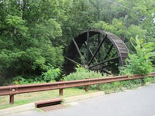
Bucks Mill is an unincorporated community located within Colts Neck Township, in Monmouth County, New Jersey, United States. Bucks Mill Road is the main road that passes north and south through the area; County Route 537 travels to the south of Bucks Mill, near the Hominy Hill Golf Course. Homes, equestrian facility and horse farms, and the township-owned Bucks Mill Recreational Area are located in the area. The settlement is named for Bucks Mill, a gristmill that derived its power from a watermill on the Yellow Brook. Originally built in 1854 and owned for many years by William Buck, Alfred Buck, and Garrett Buck, it was destroyed by a fire on October 30, 1967. The watermill is the only remaining artifact of the original complex and stands today on the side of Bucks Mill Road.

Bergen Mills is an unincorporated community located within Millstone Township in Monmouth County, New Jersey, United States. Centered on Bergen Mills Road, Millstone Road, and Route 33, the area is made up of mostly farmland with some residential homes scattered about, small business along Route 33, and a rock quarry on Old Bergen Mills Road.

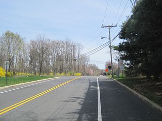
Burlington Heights is an unincorporated community located within Freehold Township in Monmouth County, New Jersey, United States. The community was created in the early 1960s and originally consisted of 112 homes of mixed styles designed by Peter Petillo and Associates of Freehold. It is located along Colts Neck Road on the east side of the township, near New Jersey Route 18 and the Colts Neck municipal line.

Henningers Mills or Henningers Mill is an unincorporated community located along the border of Aberdeen and Marlboro townships in Monmouth County, New Jersey, United States.
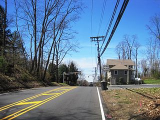
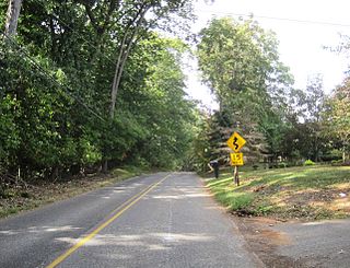
Hillsdale is an unincorporated community located within Colts Neck and Marlboro townships in Monmouth County, New Jersey, United States. The community is located at the intersection of County Route 520 which runs east and west, Conover Road which heads north, and Boundary Road which heads south. The southeastern quadrant of this intersection is a part of Colts Neck while the other three are in Marlboro. The community is located atop a small hill and is largely rural. The Colts Neck quadrant is made up of a housing development while the Marlboro side is mostly forests, parkland, and the remains of the Marlboro Psychiatric Hospital.
Homes Mills or Holmes Mills is an unincorporated community located within Upper Freehold Township in Monmouth County, New Jersey, United States. The settlement is located along Holmes Mill Road [sic] where it crosses the Miry Run. The land around the Miry Run is hilly and forested but on the north side of the stream there are horse farms and housing developments on the south side.

Kirbys Mills is an unincorporated community located within Upper Freehold Township in Monmouth County, New Jersey, United States. Centered near the intersection of Burlington Path Road and Holmes Mill Road, the area consists of housing developments and small farms.

Lower Squankum is an unincorporated community located within Howell Township in Monmouth County, New Jersey, United States. The settlement is located along Lakewood-Farmingdale Road at its intersection with Herbertsville Road and Old Tavern Road in the eastern side of the township. It is also located near the boundary of Allaire State Park and is south of Interstate 195's exit 31. Nearby the community are the remains of the Lower Squankum Mill and the Lower Squankum Friends Burial Site, located within the median of CR 547 at the aforementioned interchange.

Mount Pleasant is an unincorporated community located within Marlboro Township in Monmouth County, New Jersey, United States. It is named for a hill of the same name, one of the highest points in Marlboro Township. The settlement is located at the intersection of Reids Hill Road and Beacon Hill Road.
Oakland Mills is an unincorporated community located within Manalapan Township in Monmouth County, New Jersey, United States. The area is named for Oakland Mill, a mill along the Manalapan Brook operated by the Boo family. Some areas within the Manalapan Brook valley and surround forestland are preserved while the remainder of the area surrounding Oakland Mills has since been developed into housing developments.
Osbornes Mills is an unincorporated community located within Wall Township in Monmouth County, New Jersey, United States.

Philips Mills or Philip Mills is an unincorporated community located along the border of Holmdel and Middletown townships in Monmouth County, New Jersey, United States. It is located about the intersection of Palmer Avenue and Middle Road and Main Street. Around the area, some small businesses are located along the main arterial roads; single-family houses dot the area mostly towards the east side of the community. Throughout most of the west side, wooded areas lining the Waackaack Creek are found.

Spring Mill is an unincorporated community located within Upper Freehold Township in Monmouth County, New Jersey, United States. The settlement is located along County Route 524 between Hamilton Township and Allentown on a commercialized segment of the road originally built as New Jersey Route 37. A vestige of the state construction remains along the road through a wide right-of-way and a bridge crossing Doctor's Creek stating that it was constructed by the state in 1940 for State Highway Route 37.
Wyckoff Mills is an unincorporated community located within Howell Township in Monmouth County, New Jersey, United States. The settlement is centered about the intersection of Wyckoff Mills Road and Strickland Road, just east of U.S. Route 9 in the western sector of the township.


