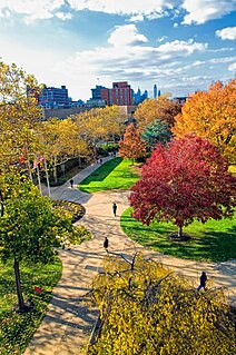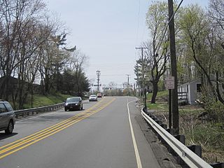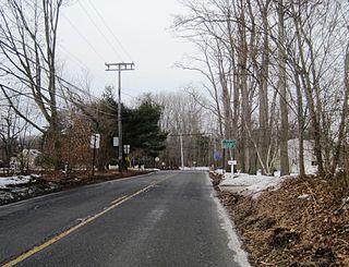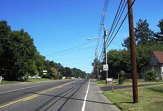
Route 27 is a state highway in New Jersey, United States. It runs 38.53 mi (62.01 km) from U.S. Route 206 in Princeton, Mercer County northeast to an interchange with Route 21 and Broad Street in Newark, Essex County. The route passes through many communities along the way, including New Brunswick, Metuchen, Rahway, and Elizabeth. Route 27 is a two- to four-lane undivided highway for most of its length, passing through a variety of urban and suburban environments. It intersects many roads along the way, including Route 18 in New Brunswick, Interstate 287 in Edison, the Garden State Parkway in Woodbridge Township, Route 35 in Rahway, Route 28 in Elizabeth, and U.S. Route 22 in Newark. Route 27 crosses the Raritan River on the Albany Street Bridge, which connects Highland Park on the east with New Brunswick on the west.

Camden County is a county located in the U.S. state of New Jersey. Its county seat is Camden. As of the 2017 Census estimate, the county's population was 510,719, making it the state's 8th-largest county, representing a 0.7% decrease from the 513,657 enumerated at the 2010 Census, in turn having increased by 4,725 from the 508,932 counted in the 2000 Census. The most populous place was Camden, with 77,344 residents at the time of the 2010 Census, while Winslow Township covered 58.19 square miles (150.7 km2), the largest total area of any municipality.

The Delaware Valley is the valley through which the Delaware River flows. By extension, this toponym is commonly used to refer to Greater Philadelphia or Philadelphia metropolitan area, which straddles the Lower Delaware River just north of its estuary. The Delaware Valley Metropolitan Area is located at the southern part of the Northeast megalopolis and as such, the Delaware Valley can be described as either a metropolitan statistical area (MSA), or as a broader combined statistical area (CSA). The Delaware Valley Metropolitan Area is composed of several counties in southeastern Pennsylvania and southwestern New Jersey, one county in northern Delaware, and one county in northeastern Maryland. The MSA has a population of over 6 million, while the CSA has a population of over 7.1 million. Philadelphia, being the region's major commercial, cultural, and industrial center, wields a rather large sphere of influence that affects the counties that immediately surround it.

Smithburg is an unincorporated community located where the municipal boundaries of Freehold, Manalapan and Millstone townships intersect in Monmouth County, New Jersey, United States. County Route 527 and Monmouth Road pass through the center of Smithburg.

Elys Corner is an unincorporated community within Millstone Township, in Monmouth County, New Jersey, United States. It is located north of Roosevelt, southeast of Hightstown, and west of Perrineville. The roads that form the community are Perrineville Road, Windsor Road, and CR 571.

Spring Valley is an unincorporated community located within Marlboro Township in Monmouth County, New Jersey, United States. Located in the northern section of the township, the area is mainly forested with some businesses and cemeteries lining the main roads in the area, Spring Valley Road and Texas Road. U.S. Route 9, Route 18 and County Route 3 are major roads nearby Spring Valley.

Texas is an unincorporated community located along the border of Monroe and Old Bridge townships in Middlesex County, New Jersey, United States. The two townships, split by the Matchaponix Brook, consist of similar land uses. Both have a mix of housing developments and forest land in the vicinity of the community. The main road that runs east and west through the community is Texas Road; it connects to County Route 520 towards the east and CR 612 on the west via Matchaponix Avenue. Other nearby roads in the vicinity include CR 527, CR 613, U.S. Route 9, and Route 18.
Van der Burg is a Dutch toponymic surname meaning "from the fortress / stronghold". Variations are Van de Burg, Van den Brug, Van den Burgh and Van der Burgh. Anglicized versions of these names show a variety of agglutinations and capitalizations. Notable people with the surname include:

Coffins Corner is an unincorporated community located within Cherry Hill Township, in Camden County, New Jersey, United States. Located near the border of Voorhees, Coffins Corner is at the crossroads of County Route 561, County Route 544, and County Route 678.

Bakersville, also known as Bakers Basin, is an unincorporated community located within Lawrence Township in Mercer County, New Jersey, United States. The center of the community is located at the intersection of U.S. Route 1, Franklin Corner Road, and Bakers Basin Road.

Chewalla Park is an unincorporated community located within Hamilton Township in Mercer County, New Jersey, United States. The neighborhood is roughly bounded by Hamilton Avenue, Klockner Road, Nottingham Way, and the Greenwood Cemetery. Nottingham High School is located in Chewalla Park at the intersection of Hamilton Avenue and Klockner Road.

New Sharon is an unincorporated community located along the border of Robbinsville Township in Mercer County and Upper Freehold Township in Monmouth County, New Jersey, United States. Old York Road passes through the center of the community and its center line the county border.

East Spotswood, also known as the settlement of Old Bridge, is an unincorporated community located within East Brunswick, New Jersey and Old Bridge townships in Middlesex County, New Jersey, United States. The area is made up of homes, businesses, and wetlands for the South River. The area is located at the junction of New Jersey Route 18, County Route 527, the western end of CR 516, and the Bordentown and South Amboy Turnpike. The still-active Jamesburg Branch of the former Camden & Amboy Railroad also runs through the community.

Bergen Mills is an unincorporated community located within Millstone Township in Monmouth County, New Jersey, United States. Centered on Bergen Mills Road, Millstone Road, and Route 33, the area is made up of mostly farmland with some residential homes scattered about, small business along Route 33, and a rock quarry on Old Bergen Mills Road.

Hendrickson Corners is an unincorporated community located along the border of Holmdel and Middletown townships in Monmouth County, New Jersey, United States. The area primarily consists of commercial businesses along the Route 35 corridor; also nearby are an apartment complex and houses in developments throughout. County Route 516 has a brief concurrency with Route 35 in Hendricksons Corners; the easternmost intersection of the two roads is where the settlement is centered.

Herberts Corner is an unincorporated community located within Marlboro Township in Monmouth County, New Jersey, United States. The center of the community is located at the intersection of Wyncrest Road and Newman Springs Road.

Macedonia is an unincorporated community located within Tinton Falls in Monmouth County, New Jersey, United States. The settlement, found in the center of Tinton Falls, is located near the interchange complex between the Garden State Parkway, New Jersey Route 18, New Jersey Route 36, and Wayside Road. The main residential section of the community is located just north of Route 18 and consists of smaller single-family houses, churches, a fire department, and a park. On the south side of Route 18, an asphalt production plant and Naval Weapons Station Earle make up the landscape.

Shacks Corner is an unincorporated community located within Howell Township in Monmouth County, New Jersey, United States. The settlement is located along New Jersey Route 33 at its intersection with Yellow Brook Road. The area to the north of Route 33 is forested and consists entirely of Naval Weapons Station Earle. On the south side of the highway, there are small clusters of homes along Yellow Brook Road and a few other side roads off Route 33. Some businesses also line the southern side of Route 33 in the area.

Spring Mill is an unincorporated community located within Upper Freehold Township in Monmouth County, New Jersey, United States. The settlement is located along County Route 524 between Hamilton Township and Allentown on a commercialized segment of the road originally built as New Jersey Route 37. A vestige of the state construction remains along the road through a wide right-of-way and a bridge crossing Doctor's Creek stating that it was constructed by the state in 1940 for State Highway Route 37.


