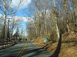
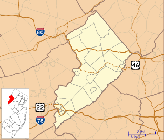
Harmony Township is a township located in the far eastern region of the Lehigh Valley in Warren County, New Jersey, United States. As of the 2010 United States Census, the township's population was 2,667, reflecting a decline of 62 (-2.3%) from the 2,729 counted in the 2000 Census, which had in turn increased by 76 (+2.9%) from the 2,653 counted in the 1990 Census.

Harmony is an unincorporated community located within Jackson Township, in Ocean County, New Jersey, United States.
Columbia is an unincorporated community and census-designated place (CDP) located within Knowlton Township in Warren County, New Jersey, United States, that was created as part of the 2010 United States Census. As of the 2010 Census, the CDP's population was 229. The area is served as United States Postal Service ZIP Code 07832.

Buttzville is an unincorporated community and census-designated place (CDP) located within White Township in Warren County, New Jersey, United States, that was created as part of the 2010 United States Census. As of the 2010 Census, the CDP's population was 146.

Asbury is an unincorporated community and census-designated place (CDP) located within Franklin Township in Warren County, New Jersey, United States, that was created as part of the 2010 United States Census. As of the 2010 Census, the CDP's population was 273.
The Harmony Township School District is a comprehensive community public school district that serves students in pre-kindergarten through eighth grade from Harmony Township, in Warren County, New Jersey, United States.

Harmony Hill Methodist Church is a Methodist Episcopal house of worship affiliated with the United Methodist Church and located about one mile north of the village of Stillwater in Stillwater Township, in the Sussex County, New Jersey, United States.

Siloam is an unincorporated community located within Freehold Township in Monmouth County, New Jersey, United States. Siloam was once the site of a school serving a district in the township until 1936. County Route 527 passes through the center of Siloam. Exit 21 on Interstate 195 provides access to Siloam from the south. Except around the center of the settlement at the junction of CR 527 and Ely Harmony Road, the area consists of forests comprising the northernmost reaches of the Pine Barrens. The homes in the area are smaller in size and are found only along the aforementioned roads.
Marksboro is an unincorporated community and census-designated place (CDP) located within Frelinghuysen Township in Warren County, New Jersey, United States, that was created as part of the 2010 United States Census, though settlement and naming of the community date back to before 1760. As of the 2010 Census, the CDP's population was 82.
Brainards is an unincorporated community and census-designated place (CDP) located within Harmony Township, in Warren County, New Jersey, United States, that was created as part of the 2010 United States Census. As of the 2010 United States Census, the CDP's population was 202. It was formerly known as Martin's Creek.
Broadway is an unincorporated community and census-designated place (CDP) located within Franklin Township, in Warren County, New Jersey, United States, that was created as part of the 2010 United States Census. As of the 2010 Census, the CDP's population was 244.

Fifth Harmony is an American girl group based in Miami, composed of Ally Brooke, Normani Kordei, Dinah Jane, Lauren Jauregui, and previously Camila Cabello until her departure from the group in December 2016. The group signed a joint record deal with Simon Cowell's label Syco Records and L.A. Reid's label Epic Records after forming and finishing third in the second season of the American singing competition series The X Factor in 2012. Rising to prominence by social media, the group's debut extended play and their three studio albums all charted within the top ten of the Billboard 200 in the United States.
New Village is an unincorporated community and census-designated place (CDP) located within Franklin Township in Warren County, New Jersey, United States, that was created as part of the 2010 United States Census. As of the 2010 Census, the CDP's population was 421.
Harmony is an unincorporated community and census-designated place (CDP) located within Harmony Township in Warren County, New Jersey, United States, that was defined as part of the 2010 United States Census. As of the 2010 Census, the CDP's population was 441.
Hutchinson is an unincorporated community and census-designated place (CDP) located within Harmony Township in Warren County, New Jersey, United States, that was defined as part of the 2010 United States Census. As of the 2010 Census, the CDP's population was 135.
Marble Mountain is a mountain in Warren County, New Jersey. The summit rises to 771 feet (235 m), and is located in Harmony and Lopatcong Townships, overlooking the Delaware River; along with Chestnut Hill on the Pennsylvania side, Marble Mountain forms Weygadt Gap or the Little Water Gap.
Scotts Mountain is a mountain in Warren County, New Jersey. The mountain covers portions of Harmony, Lopatcong, Franklin and Washington Townships; the main summit rises to 1,086 feet (331 m), and is located in Harmony. It is part of the New York–New Jersey Highlands of the Appalachian Mountains, although somewhat isolated to the west of the main body of the Highlands.

Harmony is an unincorporated community located within Quinton Township in Salem County, New Jersey, United States.

Charleston Springs is an unincorporated community located within Millstone Township in Monmouth County, New Jersey, United States. Stage Coach Road, also designated County Route 524, is the main road that runs through the settlement, with Ely Harmony Road as the intersecting road defining the locality. The Manalapan Brook runs to the west of the center of Charleston Springs and CR 537 runs to the south of the area. The Monmouth County-owned Charleston Springs Golf Course is located one mile (1.6 km) northeast of the center of Charleston Springs on CR 527.
Montana is an unincorporated community located in Harmony Township, in Warren County, New Jersey, United States.


