
Gordons Corner is an unincorporated community located within Manalapan Township in Monmouth County, New Jersey, United States. The community is centered near the interchange with U.S. Route 9 (US 9), Tennent Road and Gordons Corner Road. Numerous strip malls and businesses line US 9 especially south of the interchange. The surrounding area is mostly made up of older housing developments though some farms are located on the north side of the community.

Coopers Corner is an unincorporated community located within Hopewell Township in Mercer County, New Jersey, United States. The settlement is centered about the intersection of County Routes 518 and 579.

Ackors Corner is an unincorporated community located within Hopewell Township in Mercer County, New Jersey, United States. The settlement is located at the intersection of Bear Tavern Road / Trenton-Harbourton Road, Pennington-Harbourton Road and Pleasant Valley Road. It is named for the Ackors family which owned land near the current intersection. Small residences and farmland make up the area surrounding Ackors Corner but the area rises in elevation from east to west as one approaches Baldpate Mountain, part of the Sourland Mountain range.
Voorhees Corner is an unincorporated community located within Raritan Township in Hunterdon County, New Jersey, United States. The settlement is located at the intersection of Old York Road and Voorhees Corner Road in the eastern extents of the township. Most of the area is suburban in nature consisting of single-family houses in developments with a recreational playing field park and some farmland nearby.

Dunhams Corner is an unincorporated community in East Brunswick Township in Middlesex County, New Jersey, United States. The area is suburban and is mostly made up of single family houses with some churches, temples, and schools located throughout. The settlement is centered on the intersection of Dunhams Corner Road and Ryders Lane.

Herberts or Herberts Corner is an unincorporated community located within East Brunswick Township in Middlesex County, New Jersey, United States.
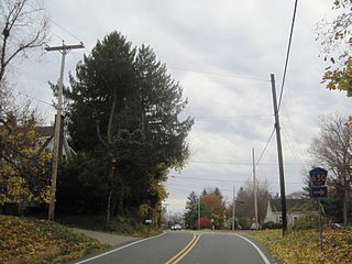
Moerls Corner or Moerle Corner is an unincorporated community located within Old Bridge Township in Middlesex County, New Jersey, United States. The intersection for which the corner is named is at Marlboro Road and Texas Road. The eastern quadrant of the intersection contains condominium units while the other three quadrants are sparsely-populated forest.
Patricks Corner or Patricks Corners is an unincorporated community located along the border of East Brunswick and North Brunswick townships in Middlesex County, New Jersey, United States. Adjacent to Farrington Lake, the East Brunswick side is about half residential homes and half forestland. The North Brunswick side is much denser with more homes in the area.

Paulas Corner or Paulas Corners is an unincorporated community located within East Brunswick Township in Middlesex County, New Jersey, United States. It is located at the intersection of Church Lane and Fresh Ponds Road in the southwestern portion of the township and consists of homes, some small farms, and forest land. The county-owned Tamarack Golf Course is located just northeast of the intersection.

Claytons Corner is an unincorporated community located within Marlboro Township in Monmouth County, New Jersey, United States. The community is located along Gordons Corner Road near its intersections with Church Road and Robertsville Road and is completely suburban in nature as the area is part of houses in planned communities. The last remaining farm in Clayton's Corner belonged to the Yoncak family.
Crawford Corners or Crawfords Corner is an unincorporated community located within Holmdel Township in Monmouth County, New Jersey, United States. The settlement is located at the intersection of Holmdel Road and Crawfords Corners Road in the hilly northern portion of the township. The settlement is located about one-half mile (0.80 km) from Crawford Hill, the highest point in Monmouth County. The area also includes the township's town hall, police department, and high school in addition to a New Jersey State Police barracks and the PNC Bank Arts Center off the Garden State Parkway. These buildings and landmarks comprise the eastern section of the settlement, homes and heavily treed lands are located on the west side of Holmdel Road, and Holmdel Park makes up the southern portion of the area.

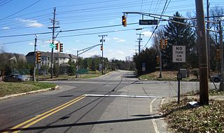
Hendrickson Corners is an unincorporated community located along the border of Holmdel and Middletown townships in Monmouth County, New Jersey, United States. The area primarily consists of commercial businesses along the Route 35 corridor; also nearby are an apartment complex and houses in developments throughout. County Route 516 has a brief concurrency with Route 35 in Hendricksons Corners; the easternmost intersection of the two roads is where the settlement is centered.

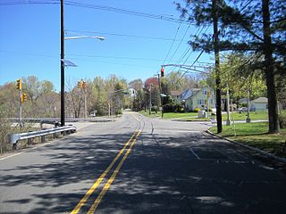
Morrells Corner or Morrell Corners is an unincorporated community located within Holmdel and Hazlet townships in Monmouth County, New Jersey, United States. The main north-south road through here is Holmdel Road and the main east-west road is Bethany Road. Most of the area is suburban and consists of homes alongside roads with some businesses and the Hazlet NJ Transit station along the main roads.

Sands Point is an unincorporated community located within Oceanport in Monmouth County, New Jersey, United States. The community is located on a peninsula surrounded by Blackberry Bay on the west and Branchport Creek on the east. Except for a park and some yachting clubs, the community consists of single-family houses arranged on a street grid in the northeast corner of the borough.

Buttonwood Corners is an unincorporated community located within East Amwell Township in Hunterdon County, New Jersey, United States. Located along the ridge line of the Sourland Mountains, it consists of forested lands with homes dotted along the narrow roads that pass through the area.

Scotts Corner or Scotts Corners is an unincorporated community located within Plainsboro Township in Middlesex County, New Jersey, United States. The corner itself is located at the intersection of Scotts Corner Road and Dey Road in the eastern portion of the township. The area contains residential neighborhoods on all four quadrants of the intersection; an apartment complex comprises the southwestern corner of it while single-family housing developments are located in the other three corners.
Tiltons Corner or Tiltons Corners is an unincorporated community located where the municipal boundaries of Keansburg Borough, Hazlet Township and Middletown Township intersect in Monmouth County, New Jersey, United States.
Van Marters Corner or Van Mariners Corners is an unincorporated community located along the border of Union Beach Borough and Hazlet Township in Monmouth County, New Jersey, United States.
Wileys Corner or Wileys Corners is an unincorporated community located within Tinton Falls in Monmouth County, New Jersey, United States.

Newbolds Corner is an unincorporated community located within Lumberton Township in Burlington County, New Jersey, United States. The site, located at the corner of Eayrestown Road and Newbolds Corner Road, was once home to a Nike missile silo which was fully demolished in late 2015. Today, the west side of Eayrestown Road consists of housing developments, Lumberton Township's town hall, and a school, while the east side of the road features farmland.


