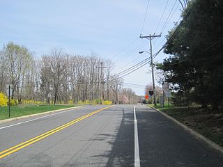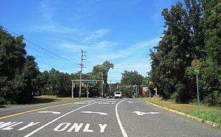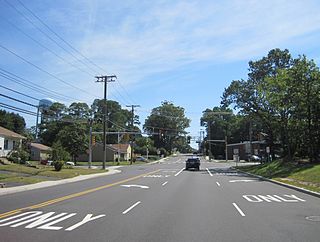
Route 36 is a state highway in Monmouth County, New Jersey, United States. The 24.40-mile (39.27 km) long route, shaped as a backwards C, begins at an intersection with Garden State Parkway and County Route 51 in Eatontown and runs east to Long Branch. From Long Branch, the route follows the Atlantic Ocean north to Sea Bright and turns west, running to the south of the Raritan Bay. Route 36 ends in Keyport at an interchange with the Garden State Parkway and Route 35. It varies in width from a six-lane divided highway to a two-lane undivided road. The route is signed east–west between Eatontown and Long Branch and north–south between Long Branch and Keyport.

Montrose is an unincorporated community located near the intersection of Dutch Lane Road and Boundary Road along the border of Colts Neck and Marlboro townships in Monmouth County, New Jersey, United States. The historic one-room Montrose Schoolhouse, built before 1820, is located in the Colts Neck portion of the community.

Centerville is an unincorporated community located along the border of Hazlet and Holmdel townships in Monmouth County, New Jersey, United States.

Everett is an unincorporated community located along the border of Holmdel and Middletown townships in Monmouth County, New Jersey, United States. The community is located on Everett Road, along which the township line runs, at its intersection with Stillwell Road and Sunnyside Road. Most of the area in Everett is composed of homes with some farmlands nearby. Holmdel's Bell Labs Complex is located to the west of Everett.

Cooks Mills is an unincorporated community located within Colts Neck Township in Monmouth County, New Jersey, United States. Located on the eastern border of the township near Tinton Falls, it is situated in a rural area of the township surrounded by horse farms and large single-family houses.

Green Grove is an unincorporated community located where the boundaries of Neptune Township, Ocean Township and Tinton Falls Borough intersect in Monmouth County, New Jersey, United States.

Holland is an unincorporated community located on the border of Holmdel and Middletown townships in Monmouth County, New Jersey, United States. The community is centered on the intersection of County Route 52 and Holland Road. The area making up Holland is hilly and consists of large single-family residences. An AT&T Labs campus is located off Laurel Avenue while Tatum County Park is also located in the area, both of which are on the Middletown side of the border.

Matthews is an unincorporated community located within Howell Township in Monmouth County, New Jersey, United States. The settlement is located on the western border of the township near Jackson Township, Ocean County and Interstate 195. It is located about the intersection of Hulses Corner Road and Fort Plains Road. The Howell side of the North Branch Metedeconk River is mainly rural with only a few houses located along the main surface roads while the Jackson side of the river is more suburbanized.

Mechanicsville is an unincorporated community located within Hazlet Township in Monmouth County, New Jersey, United States.

Monmouth Heights at Marlboro is an unincorporated community located within Marlboro Township in Monmouth County, New Jersey, United States. The housing development was created in the 1960s by Levitt & Sons though some protests occurred by long-time residents of Marlboro Township at the time of its creation. The community is located along New Jersey Route 79 across the highway from Marlboro High School.

Monmouth Hills is an unincorporated community located within Middletown Township in Monmouth County, New Jersey, United States.

Morrells Corner or Morrell Corners is an unincorporated community located within Holmdel and Hazlet townships in Monmouth County, New Jersey, United States. The main north-south road through here is Holmdel Road and the main east-west road is Bethany Road. Most of the area is suburban and consists of homes alongside roads with some businesses and the Hazlet NJ Transit station along the main roads.

Mount Pleasant is an unincorporated community located within Marlboro Township in Monmouth County, New Jersey, United States. It is named for a hill of the same name, one of the highest points in Marlboro Township. The settlement is located at the intersection of Reids Hill Road and Beacon Hill Road.

Oakhurst Manor is an unincorporated community located within Ocean Township in Monmouth County, New Jersey, United States.

Oceanic is an unincorporated community located within Rumson in Monmouth County, New Jersey, United States. Located on the north side of the borough, Oceanic contains most of Rumson's commercial businesses mainly along Bingham Avenue and River Street. Bingham Avenue connects directly to the Oceanic Bridge over the Navesink River to the Middletown Township community of Locust Point.

Orchard Estates is an unincorporated community located within Freehold Township in Monmouth County, New Jersey, United States. The area consists of a single housing development on Duchess Court consisting of one and two-story single family homes. The development is located near the East Freehold intersection of Dutch Lane Road and Kozloski Road.

Osbornes Mills is an unincorporated community located within Wall Township in Monmouth County, New Jersey, United States.

Tiltons Corner or Tiltons Corners is an unincorporated community located where the municipal boundaries of Keansburg Borough, Hazlet Township and Middletown Township intersect in Monmouth County, New Jersey, United States.

Van Marters Corner or Van Mariners Corners is an unincorporated community located along the border of Union Beach Borough and Hazlet Township in Monmouth County, New Jersey, United States.


