
Locust is an unincorporated community located within Middletown Township in Monmouth County, New Jersey, United States. It is situated along the north banks of the Navesink River and Claypit Creek. The area consists of mostly medium-to-large sized houses throughout the hilly terrain of this part of the township. The Oceanic Bridge connects Locust with Rumson to the south.

Polhemustown is an unincorporated community located within Upper Freehold Township in Monmouth County, New Jersey, United States. The community is mostly made up of farmland with a few homes and businesses scattered around the area. Polhemustown is centered about the intersection of County Route 539, Polhemustown Road, and Holmes Mill Road.

Pleasant Valley Crossroads is an unincorporated community located within Holmdel Township in Monmouth County, New Jersey, United States. Route 34 and County Route 520 are major roads in this area.
Montrose is an unincorporated community located near the intersection of Dutch Lane Road and Boundary Road along the border of Colts Neck and Marlboro townships in Monmouth County, New Jersey, United States. The historic one-room Montrose Schoolhouse, built before 1820, is located in the Colts Neck portion of the community.
Ardmore Estates is an unincorporated community located within Howell Township in Monmouth County, New Jersey, United States. The community is located along County Route 524 in the western part of the township. With construction dating back to the 1950s, the neighborhood is one of the oldest residential developments in Howell. The community sits adjacent to the Manasquan River and Howell Memorial and Adelphia Schools.
Candlewood is an unincorporated community located within Howell Township in Monmouth County, New Jersey, United States. The community is comprised of the largest residential development in Howell Township.
Crawford Corners or Crawfords Corner is an unincorporated community located within Holmdel Township in Monmouth County, New Jersey, United States. The settlement is located at the intersection of Holmdel Road and Crawfords Corners Road in the hilly northern portion of the township. The settlement is located about one-half mile (0.80 km) from Crawford Hill, the highest point in Monmouth County. The area also includes the township's town hall, police department, and high school in addition to a New Jersey State Police barracks and the PNC Bank Arts Center off the Garden State Parkway. These buildings and landmarks comprise the eastern section of the settlement, homes and heavily treed lands are located on the west side of Holmdel Road, and Holmdel Park makes up the southern portion of the area.

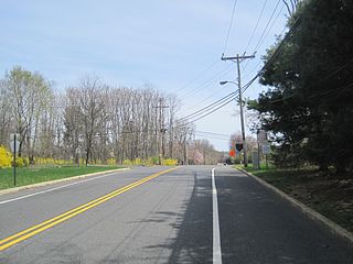
Ely is an unincorporated community located within Millstone Township in Monmouth County, New Jersey, United States. The settlement is named for the Ely family that owned property in the area and operated the Charleston Springs hotel. Today, the settlement is located along Stage Coach Road, County Route 524, in the eastern portion of the township. Most of the area consists of large single-family homes though some farmland and the township-owned Brandywine Soccer Complex are located in the near the settlement.

Land of Pines is an unincorporated community located within Howell Township in Monmouth County, New Jersey, United States. The area consists of single-family home developments with some businesses located along U.S. Route 9, a divided highway that runs through the center of the community. It is located in the northernmost extents of the Pine Barrens and is just south of Interstate 195.
Little Silver Point is an unincorporated community located within Little Silver in Monmouth County, New Jersey, United States.

Normandie is an unincorporated community located within Sea Bright in Monmouth County, New Jersey, United States. The community is one of the four main built-up areas of Sea Bright and is a former stop on the New Jersey Southern Railroad. It is located along Route 36 between the CR 520 drawbridge to Rumson and Sandy Hook on a narrow strip of land between the Shrewsbury River and the Atlantic Ocean. The Sea Bright–Monmouth Beach Seawall passes through the neighborhood and Navesink Beach.

Oceanic is an unincorporated community located within Rumson in Monmouth County, New Jersey, United States. Located on the north side of the borough, Oceanic contains most of Rumson's commercial businesses mainly along Bingham Avenue and River Street. Bingham Avenue connects directly to the Oceanic Bridge over the Navesink River to the Middletown Township community of Locust Point.
Pine Brook is an unincorporated community located within Tinton Falls in Monmouth County, New Jersey, United States.

Pullentown is an unincorporated community located within Upper Freehold Township in Monmouth County, New Jersey, United States. The settlement is located along County Route 526 east of Allentown and just west of its intersection with Sharon Station Road. The area contains mostly farmland with some homes and small businesses located along the road.
Red Hill is an unincorporated community located within Middletown Township in Monmouth County, New Jersey, United States.

Red Valley is an unincorporated community located within Upper Freehold Township in Monmouth County, New Jersey, United States. The settlement is located at the intersection of County Route 526 and Red Valley Road (south) and Yellow Meetinghouse Road (north) near the township's eastern border with Millstone Township. Except for some single-family houses located along the roads in the area, the area is primarily made up of farmland.
Reevytown is an unincorporated community located within Tinton Falls in Monmouth County, New Jersey, United States.

Robinsville is an unincorporated community located within Upper Freehold Township in Monmouth County, New Jersey, United States. Located in the northeastern corner of the township near Millstone Township and Roosevelt, the area is located wholly in the Assunpink Wildlife Management Area, the area consists of forest and some farmland that was in existence prior to the creation of the WMA in the 1970s.
Salem Hill is an unincorporated community located within Howell Township in Monmouth County, New Jersey, United States.

Buttonwood Corners is an unincorporated community located within East Amwell Township in Hunterdon County, New Jersey, United States. Located along the ridge line of the Sourland Mountains, it consists of forested lands with homes dotted along the narrow roads that pass through the area.


