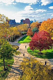
Essex County is a county in the northeastern part of the U.S. state of New Jersey. As of the 2017 Census estimate, the county's population was 808,285, making it the state's third-most populous county, an increase of 3.1% from the 2010 United States Census, when its population was enumerated at 783,969, in turn a decrease of 1.2% from the 793,633 enumerated in the 2000 Census. In 2010, the county dropped down to third-largest, behind Middlesex County, and was one of only two counties in the state to see a decline between 2000 and 2010. Its county seat is Newark, the most populous city in the state. It is part of the New York Metropolitan Area.

Camden County is a county located in the U.S. state of New Jersey. Its county seat is Camden. As of the 2017 Census estimate, the county's population was 510,719, making it the state's 8th-largest county, representing a 0.7% decrease from the 513,657 enumerated at the 2010 Census, in turn having increased by 4,725 from the 508,932 counted in the 2000 Census. The most populous place was Camden, with 77,344 residents at the time of the 2010 Census, while Winslow Township covered 58.19 square miles (150.7 km2), the largest total area of any municipality.

Bergen County is the most populous county in the U.S. state of New Jersey. As of the 2017 Census estimate, the county's population was 948,406, an increase of 4.8% from the 2010 United States Census, which in turn represented an increase of 20,998 (2.4%) from the 884,118 counted in the 2000 Census. Located in the northeastern corner of New Jersey and its Gateway Region, Bergen County is part of the New York City Metropolitan Area and is directly across the Hudson River from Manhattan, to which it is connected by the George Washington Bridge.

Jersey City is the second most populous city in the U.S. state of New Jersey, after Newark. It is the seat of Hudson County as well as the county's largest city. As of 2017, the Census Bureau's Population Estimates Program calculated that Jersey City's population was 270,753, with the largest population increase of any municipality in New Jersey since 2010, an increase of about 9.4% from the 2010 United States Census, when the city's population was at 247,597. ranking the city the 75th-most-populous in the nation.

Freehold Township is a township in Monmouth County, New Jersey, United States. As of the 2010 United States Census, the township's population was 36,184, reflecting an increase of 4,647 (+14.7%) from the 31,537 counted in the 2000 Census, which had in turn increased by 6,827 (+27.6%) from the 24,710 counted in the 1990 Census.

Stockholm is an unincorporated community, located in the southeastern part of Hardyston Township in Sussex County, New Jersey, United States. Its ZIP Code is 07460. Like many neighboring towns, Stockholm is home to a number of lakes including Deer Trail Lakes, Lake Stockholm, Lake Gerard, Beaver Lake, Lake Tamarack and Summit Lake.

The Millstone River is a 38.6-mile-long (62.1 km) tributary of the Raritan River in central New Jersey in the United States.

Norton is an unincorporated community located within Union Township, in Hunterdon County, New Jersey, United States.

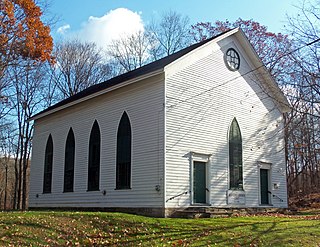
First Presbyterian Church of Wantage is a historic church in Wantage Township, Sussex County, New Jersey, United States. Church records point to a Dutch Reformed congregation founded in 1788, which merged with First Presbyterian Church of Wantage, founded in 1818. The building is situated on a hill, due south of Clove Brook, a creek from which it derives its common name. It was built in 1829 and added to the National Register in 1982. The structure is no longer used as a church, but the Friends of Old Clove Church continue an inter-denominational service once annually.

Millhurst is an unincorporated community located within Manalapan Township in Monmouth County, New Jersey, United States. Route 33 and County Route 527 pass through the center of Millhurst. Much of the area consists of businesses along the aforementioned arterial roads with the Millhurst Mill at the CR 527 crossing of Manalapan Brook. The mill is a former grist mill built in the 1700s, rebuilt in the 1800s as a more efficient mill, and turned into a family business by Bernard Hochberg in 1925.

Prospertown is an unincorporated community located within the New Jersey townships of Jackson and Plumsted in Ocean County and Upper Freehold in Monmouth County. The community is home to Prospertown Lake and is adjacent to Six Flags Great Adventure, both located on County Route 537. The center of the community is located at the intersection of CR 537, Hawkin Road, and Emleys Hill Road. Most of the area consists of pine forests but there are some homes along the roads in the area.

Baptistown is an unincorporated community located within Kingwood Township, in Hunterdon County, New Jersey, United States. Baptistown is located on New Jersey Route 12, approximately three miles (4.8 km) east of Frenchtown. The township's municipal offices are located in Baptistown just north of the center of the community.
Kenneth Jay Sweetman is an organist currently based in the United States. He was born in Paterson, New Jersey, and graduated from Calvin College and the University of Michigan.

Morristown is an unincorporated community located within Old Bridge Township in Middlesex County, New Jersey, United States. Located on the eastern side of the township near its border with Aberdeen and Matawan, it is centered on the intersection of Cliffwood Road and Matawan Road. Many commercial offices and businesses line the two major county roads in the area while single-family houses make up the rest of the area. The settlement is located to the south of Cheesequake State Park and the Garden State Parkway.

Herberts Corner is an unincorporated community located within Marlboro Township in Monmouth County, New Jersey, United States. The center of the community is located at the intersection of Wyncrest Road and Newman Springs Road.

Macedonia is an unincorporated community located within Tinton Falls in Monmouth County, New Jersey, United States. The settlement, found in the center of Tinton Falls, is located near the interchange complex between the Garden State Parkway, New Jersey Route 18, New Jersey Route 36, and Wayside Road. The main residential section of the community is located just north of Route 18 and consists of smaller single-family houses, churches, a fire department, and a park. On the south side of Route 18, an asphalt production plant and Naval Weapons Station Earle make up the landscape.

Matthews is an unincorporated community located within Howell Township in Monmouth County, New Jersey, United States. The settlement is located on the western border of the township near Jackson Township, Ocean County and Interstate 195. It is located about the intersection of Hulses Corner Road and Fort Plains Road. The Howell side of the North Branch Metedeconk River is mainly rural with only a few houses located along the main surface roads while the Jackson side of the river is more suburbanized.

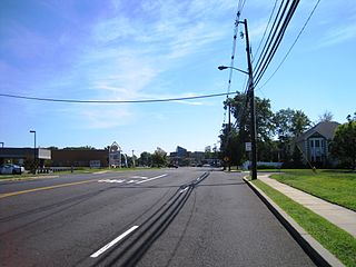
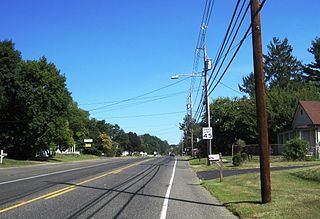
Spring Mill is an unincorporated community located within Upper Freehold Township in Monmouth County, New Jersey, United States. The settlement is located along County Route 524 between Hamilton Township and Allentown on a commercialized segment of the road originally built as New Jersey Route 37. A vestige of the state construction remains along the road through a wide right-of-way and a bridge crossing Doctor's Creek stating that it was constructed by the state in 1940 for State Highway Route 37.


