Chouteau County, Montana

Last updated

Chouteau County
Choteau County Courthouse.JPG
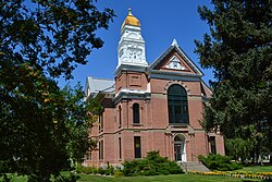
Chouteau County Courthouse in Fort Benton
Map of Montana highlighting Chouteau County.svg
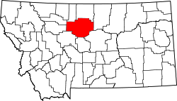
Location within the U.S. state of Montana
Montana in United States.svg
Montana's location within the U.S.
Coordinates: 47°53′N110°26′W / 47.88°N 110.44°W / 47.88; -110.44
CountryFlag of the United States.svg United States
StateFlag of Montana.svg Montana
Founded1865
Named after Pierre Chouteau Jr.
Seat Fort Benton
Largest cityFort Benton
Area
  Total
3,997 sq mi (10,350 km2)
  Land3,972 sq mi (10,290 km2)
  Water24 sq mi (60 km2)  0.6%
Population
 (2020)
  Total
5,895
  Estimate 
(2024)
5,880 Decrease2.svg
  Density1.5/sq mi (0.57/km2)
Time zone UTC−7 (Mountain)
  Summer (DST) UTC−6 (MDT)
Congressional district 2nd
Website co.chouteau.mt.us
  • Montana county number 19

Chouteau County is a county located in the North-Central region of the U.S. state of Montana. As of the 2020 census, the population was 5,895. [1] Its county seat is Fort Benton. [2] The county was established in 1865 as one of the original nine counties of Montana, and named in 1882 after Pierre Chouteau Jr., a fur trader who established a trading post that became Fort Benton, which was once an important port on the Missouri River.

Contents

Chouteau County is home to the Chippewa-Cree tribe on the Rocky Boy Indian Reservation. It contains part of the Lewis and Clark National Forest.

Geography

According to the United States Census Bureau, the county has a total area of 3,997 square miles (10,350 km2), of which 3,972 square miles (10,290 km2) is land and 24 square miles (62 km2) (0.6%) is water. [3]

Chouteau County was once the largest county in the Montana Territory and the second largest in the United States, with an area of 15,439 square miles (39,990 km2) in the early 20th century. However, some parts of the county were over 250 miles (400 km) from Fort Benton, and in 1893, the first of several divisions began with the creation of Teton County, the western portion of Chouteau County. Chouteau County lost half of its population from 1910 to 1930.

The land is mostly rolling prairie, hence the high density of wheat farming. However, there is notable topography, namely some of Montana's forested island ranges. The Bear Paw Mountains rise in the northeast and the Little Rockies and the Highwood Ranges are in the southeast. Major rivers include the Teton River, Marias River, Missouri River and Arrow Creek.

Adjacent counties

Major highway

National protected areas

Politics

Choteau County is heavily Republican, like many other rural Montana counties. The entirety of the county votes majority Republican except for the portion of the Rocky Boy's Reservation in the northeast, which is strongly Democratic. In no election since 1964 has a Democratic presidential candidate carried the county. [4]

United States presidential election results for Chouteau County, Montana [5]
Year Republican Democratic Third party(ies)
No.%No.%No.%
1904 1,51770.62%56826.44%632.93%
1908 1,22054.73%89340.06%1165.20%
1912 56141.43%40229.69%39128.88%
1916 1,48633.62%2,73861.95%1964.43%
1920 2,64660.86%1,43633.03%2666.12%
1924 1,34746.15%70624.19%86629.67%
1928 1,83759.14%1,23239.67%371.19%
1932 1,23235.43%2,09360.20%1524.37%
1936 87824.01%2,73474.76%451.23%
1940 1,23535.54%2,21363.68%270.78%
1944 1,22038.69%1,90660.45%270.86%
1948 1,18137.64%1,83258.38%1253.98%
1952 2,09859.35%1,42340.25%140.40%
1956 1,72148.96%1,79451.04%00.00%
1960 1,67249.34%1,70850.40%90.27%
1964 1,44444.08%1,82755.77%50.15%
1968 1,69553.66%1,21638.49%2487.85%
1972 2,02759.64%1,14933.80%2236.56%
1976 1,81452.35%1,56845.25%832.40%
1980 2,44868.32%85323.81%2827.87%
1984 2,42572.17%89626.67%391.16%
1988 1,98061.51%1,16636.22%732.27%
1992 1,38042.65%95929.64%89727.72%
1996 1,66052.58%1,03932.91%45814.51%
2000 2,03970.68%68623.78%1605.55%
2004 1,91365.49%94632.39%622.12%
2008 1,63457.11%1,12239.22%1053.67%
2012 1,75862.32%97834.67%853.01%
2016 1,67964.50%73228.12%1927.38%
2020 1,89163.78%99133.42%832.80%
2024 1,88564.25%94032.04%1093.72%

Demographics

Historical population
CensusPop.Note
1870 517
1880 3,068493.4%
1890 4,74154.5%
1900 10,966131.3%
1910 17,19156.8%
1920 11,051−35.7%
1930 8,635−21.9%
1940 7,316−15.3%
1950 6,974−4.7%
1960 7,3485.4%
1970 6,473−11.9%
1980 6,092−5.9%
1990 5,452−10.5%
2000 5,9709.5%
2010 5,813−2.6%
2020 5,8951.4%
2024 (est.)5,880 [6] −0.3%
U.S. Decennial Census [7]
1790–1960 [8] 1900–1990 [9]
1990–2000 [10] 2010–2020 [1]

Census-designated places

The United States Census Bureau, for population data analyses of unorganized rural areas, the following Census-designated places, or CDPs, in addition to the organized communities listed elsewhere in this article.

2020 census

As of the 2020 census, there were 5,895 people living in the county.[ citation needed ]

2010 census

As of the 2010 census, there were 5,813 people, 2,294 households, and 1,560 families living in the county. The population density was 1.5 inhabitants per square mile (0.58/km2). There were 2,879 housing units at an average density of 0.7 units per square mile (0.27 units/km2). The racial makeup of the county was 75.8% white, 21.8% American Indian, 0.4% Asian, 0.1% Pacific islander, 0.1% black or African American, 0.3% from other races, and 1.6% from two or more races. Those of Hispanic or Latino origin made up 1.6% of the population. In terms of ancestry, 27.6% were German, 13.0% were Irish, 11.2% were English, 9.8% were Norwegian, and 2.0% were American.

Of the 2,294 households, 31.2% had children under the age of 18 living with them, 52.3% were married couples living together, 10.1% had a female householder with no husband present, 32.0% were non-families, and 29.1% of all households were made up of individuals. The average household size was 2.48 and the average family size was 3.04. The median age was 41.5 years.

The median income for a household in the county was $41,064 and the median income for a family was $50,201. Males had a median income of $33,866 versus $25,077 for females. The per capita income for the county was $20,202. About 14.8% of families and 21.0% of the population were below the poverty line, including 33.6% of those under age 18 and 6.2% of those age 65 or over.

Economy

Chouteau County is the state's largest winter wheat producer. [11] It is located in the heart of the "Golden Triangle", which produces about 45% of Montana's annual wheat crop. [12]

Communities

Square Butte SQUARE BUTTE NATIONAL NATURAL LANDMARK; CHOUTEAU COUNTY, MONTANA.jpg
Square Butte

City

Towns

Census-designated places

Unincorporated communities

See also

References

  1. 1 2 "State & County QuickFacts". United States Census Bureau. Retrieved May 9, 2023.
  2. "Find a County". National Association of Counties. Archived from the original on May 3, 2015. Retrieved June 7, 2011.
  3. "2010 Census Gazetteer Files". United States Census Bureau. August 22, 2012. Archived from the original on December 5, 2014. Retrieved November 27, 2014.
  4. Datar, Saurabh; Marcus, Ilana; Murray, Eli; Singer, Ethan; Lemonides, Alex; Zhang, Christine; Smith, Jonah (January 15, 2025). "An Extremely Detailed Map of the 2024 Election". The New York Times.
  5. Leip, David. "Atlas of US Presidential Elections". uselectionatlas.org. Retrieved April 2, 2018.
  6. "County Population Totals and Components of Change: 2020-2024". United States Census Bureau. Retrieved June 3, 2025.
  7. "U.S. Decennial Census". United States Census Bureau. Retrieved November 27, 2014.
  8. "Historical Census Browser". University of Virginia Library. Archived from the original on August 11, 2012. Retrieved November 27, 2014.
  9. "Population of Counties by Decennial Census: 1900 to 1990". United States Census Bureau. Retrieved November 27, 2014.
  10. "Census 2000 PHC-T-4. Ranking Tables for Counties: 1990 and 2000" (PDF). United States Census Bureau. Archived (PDF) from the original on March 27, 2010. Retrieved November 27, 2014.
  11. Merrill, Andrea; Judy Jacobson (1997). Montana almanac. Helena MT: Falcon Publishing. ISBN   1-56044-493-2.
  12. Wheat and Barley Committee. "The basics of wheat – and more!". Archived from the original on July 21, 2011. Retrieved July 23, 2011.
  13. Big Sag, Chouteau County MT Google Maps (accessed January 1, 2019)
  14. Coal Banks Landing, Chouteau County MT Google Maps (accessed January 1, 2019)
  15. Lippard, Chouteau County MT Google Maps (accessed January 1, 2019)
  16. Google Maps, also an extensive history found with a search engine.
  17. Shepherd Crossing, Chouteau County MT Google Maps (accessed January 1, 2019)
  18. Shonkin, Chouteau County MT Google Maps (accessed January 1, 2019)
  19. Stranahan, Chouteau County MT Google Maps (accessed January 1, 2019)
  20. Virgelle, Chouteau County MT Google Maps (accessed January 1, 2019)
  21. Warrick, Chouteau County MT Google Maps (accessed January 1, 2019)
  22. Woods Crossing, Chouteau County MT Google Maps (accessed January 1, 2019)

47°53′N110°26′W / 47.88°N 110.44°W / 47.88; -110.44