Viking 1 was the first of two spacecraft, along with Viking 2, each consisting of an orbiter and a lander, sent to Mars as part of NASA's Viking program. The lander touched down on Mars on July 20, 1976, the first successful Mars lander in history. Viking 1 operated on Mars for 2,307 days or 2245 Martian solar days, the longest Mars surface mission until the record was broken by the Opportunity rover on May 19, 2010.
The Viking 2 mission was part of the American Viking program to Mars, and consisted of an orbiter and a lander essentially identical to that of the Viking 1 mission. Viking 2 was operational on Mars for 1281 sols. The Viking 2 lander operated on the surface for 1,316 days, or 1281 sols, and was turned off on April 12, 1980, when its batteries failed. The orbiter worked until July 25, 1978, returning almost 16,000 images in 706 orbits around Mars.

Mars Global Surveyor (MGS) was an American robotic space probe developed by NASA's Jet Propulsion Laboratory and launched November 1996. MGS was a global mapping mission that examined the entire planet, from the ionosphere down through the atmosphere to the surface. As part of the larger Mars Exploration Program, Mars Global Surveyor performed atmospheric monitoring for sister orbiters during aerobraking, and helped Mars rovers and lander missions by identifying potential landing sites and relaying surface telemetry.

Utopia Planitia is a large plain within Utopia, the largest recognized impact basin on Mars and in the Solar System with an estimated diameter of 3,300 km (2,100 mi). It is the Martian region where the Viking 2 lander touched down and began exploring on September 3, 1976, and the Zhurong rover touched down on May 14, 2021, as a part of the Tianwen-1 mission. It is located at the antipode of Argyre Planitia, centered at 46.7°N 117.5°E. It is also in the Casius quadrangle, Amenthes quadrangle, and the Cebrenia quadrangle of Mars.

Hellas Planitia is a plain located within the huge, roughly circular impact basin Hellas located in the southern hemisphere of the planet Mars. Hellas is the third- or fourth-largest known impact crater in the Solar System. The basin floor is about 7,152 m (23,465 ft) deep, 3,000 m (9,800 ft) deeper than the Moon's South Pole-Aitken basin, and extends about 2,300 km (1,400 mi) east to west. It is centered at 42.4°S 70.5°E. Hellas Planitia spans the boundary between the Hellas quadrangle and the Noachis quadrangle.

Chryse Planitia is a smooth circular plain in the northern equatorial region of Mars close to the Tharsis region to the west, centered at 28.4°N 319.7°E. Chryse Planitia lies partially in the Lunae Palus quadrangle, partially in the Oxia Palus quadrangle, partially in the Mare Acidalium quadrangle. It is 1600 km or 994 mi in diameter and with a floor 2.5 km below the average planetary surface altitude, and has been suggested to be an ancient buried impact basin, though this is contested. It has several features in common with lunar maria, such as wrinkle ridges. The density of impact craters in the 100 to 2,000 metres range is close to half the average for lunar maria.

Ares Vallis is an outflow channel on Mars, named after the Greek name for Mars: Ares, the god of war; it appears to have been carved by fluids, perhaps water. The valley 'flows' northwest out of the hilly Margaritifer Terra, where the Iani Chaos depression 180 km (110 mi) long and 200 km (120 mi) wide) is connected to the beginning of Ares Vallis by a 100 km (62 mi) wide transition zone centered on 342.5° East and 3° North. It then continues through the ancient Xanthe Terra highlands, and ends in a delta-like region of Chryse Planitia. Ares Vallis was the landing site of NASA's Mars Pathfinder spacecraft, which studied a region of the valley near the border with Chryse in 1997.

The Memnonia quadrangle is one of a series of 30 quadrangle maps of Mars used by the United States Geological Survey (USGS) Astrogeology Research Program. The Memnonia quadrangle is also referred to as MC-16.

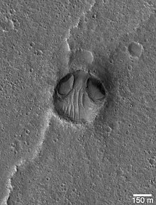
Cydonia is a region on the planet Mars that has attracted both scientific and popular interest. The name originally referred to the albedo feature that was visible from earthbound telescopes. The area borders the plains of Acidalia Planitia and the highlands of Arabia Terra. The region includes the named features Cydonia Mensae, an area of flat-topped mesa-like features; Cydonia Colles, a region of small hills or knobs; and Cydonia Labyrinthus, a complex of intersecting valleys. As with other albedo features on Mars, the name Cydonia was drawn from classical antiquity, in this case from Kydonia, a historic polis on the island of Crete. Cydonia contains the "Face on Mars", located about halfway between the craters Arandas and Bamberg.

Isidis Planitia is a plain located within a giant impact basin on Mars, located partly in the Syrtis Major quadrangle and partly in the Amenthes quadrangle. At approximately 1,900 km (1,200 mi) in diameter, it is the third-largest confirmed impact structure on the planet, after the Hellas and Utopia basins. Isidis was likely the last major basin to be formed on Mars, having formed approximately 3.9 billion years ago during the Noachian period. Due to dust coverage, it typically appears bright in telescopic views, and was mapped as a classical albedo feature, Isidis Regio, visible by telescope in the pre-spacecraft era.

The Noachis quadrangle is one of a series of 30 quadrangle maps of Mars used by the United States Geological Survey (USGS) Astrogeology Research Program. The Noachis quadrangle is also referred to as MC-27.

The Casius quadrangle is one of a series of 30 quadrangle maps of Mars used by the United States Geological Survey (USGS) Astrogeology Research Program. The quadrangle is located in the north-central portion of Mars' eastern hemisphere and covers 60° to 120° east longitude and 30° to 65° north latitude. The quadrangle uses a Lambert conformal conic projection at a nominal scale of 1:5,000,000 (1:5M). The Casius quadrangle is also referred to as MC-6. Casius quadrangle contains part of Utopia Planitia and a small part of Terra Sabaea. The southern and northern borders of the Casius quadrangle are approximately 3,065 km and 1,500 km wide, respectively. The north to south distance is about 2,050 km. The quadrangle covers an approximate area of 4.9 million square km, or a little over 3% of Mars' surface area.

The Cebrenia quadrangle is one of a series of 30 quadrangle maps of Mars used by the United States Geological Survey (USGS) Astrogeology Research Program. The quadrangle is located in the northeastern portion of Mars' eastern hemisphere and covers 120° to 180° east longitude and 30° to 65° north latitude. The quadrangle uses a Lambert conformal conic projection at a nominal scale of 1:5,000,000 (1:5M). The Cebrenia quadrangle is also referred to as MC-7. It includes part of Utopia Planitia and Arcadia Planitia. The southern and northern borders of the Cebrenia quadrangle are approximately 3,065 km (1,905 mi) and 1,500 km (930 mi) wide, respectively. The north to south distance is about 2,050 km (1,270 mi). The quadrangle covers an approximate area of 4.9 million square km, or a little over 3% of Mars' surface area.

The Diacria quadrangle is one of a series of 30 quadrangle maps of Mars used by the United States Geological Survey (USGS) Astrogeology Research Program. The quadrangle is located in the northwestern portion of Mars' western hemisphere and covers 180° to 240° east longitude and 30° to 65° north latitude. The quadrangle uses a Lambert conformal conic projection at a nominal scale of 1:5,000,000 (1:5M). The Diacria quadrangle is also referred to as MC-2. The Diacria quadrangle covers parts of Arcadia Planitia and Amazonis Planitia.

The Mare Acidalium quadrangle is one of a series of 30 quadrangle maps of Mars used by the United States Geological Survey (USGS) Astrogeology Research Program. The quadrangle is located in the northeastern portion of Mars' western hemisphere and covers 300° to 360° east longitude and 30° to 65° north latitude. The quadrangle uses a Lambert conformal conic projection at a nominal scale of 1:5,000,000 (1:5M). The Mare Acidalium quadrangle is also referred to as MC-4.

The Amazonis quadrangle is one of a series of 30 quadrangle maps of Mars used by the United States Geological Survey (USGS) Astrogeology Research Program. The Amazonis quadrangle is also referred to as MC-8.

The Lunae Palus quadrangle is one of a series of 30 quadrangle maps of Mars used by the United States Geological Survey (USGS) Astrogeology Research Program. The quadrangle is also referred to as MC-10. Lunae Planum and parts of Xanthe Terra and Chryse Planitia are found in the Lunae Palus quadrangle. The Lunae Palus quadrangle contains many ancient river valleys.

The Argyre quadrangle is one of a series of 30 quadrangle maps of Mars used by the United States Geological Survey (USGS) Astrogeology Research Program. The Argyre quadrangle is also referred to as MC-26. It contains Argyre Planitia and part of Noachis Terra.

The Mare Australe quadrangle is one of a series of 30 quadrangle maps of Mars used by the United States Geological Survey (USGS) Astrogeology Research Program. The Mare Australe quadrangle is also referred to as MC-30. The quadrangle covers all the area of Mars south of 65°, including the South polar ice cap, and its surrounding area. The quadrangle's name derives from an older name for a feature that is now called Planum Australe, a large plain surrounding the polar cap. The Mars polar lander crash landed in this region.

Dark slope streaks are narrow, avalanche-like features common on dust-covered slopes in the equatorial regions of Mars. They form in relatively steep terrain, such as along escarpments and crater walls. Although first recognized in Viking Orbiter images from the late 1970s, dark slope streaks were not studied in detail until higher-resolution images from the Mars Global Surveyor (MGS) and Mars Reconnaissance Orbiter (MRO) spacecraft became available in the late 1990s and 2000s.