
Herschel is a 304 kilometer impact crater in the Martian southern hemisphere, at 14.5°S, 130°E, located in the Mare Tyrrhenum region of Mars. The crater is jointly named after the seventeenth/eighteenth century father and son astronomers William Herschel and John Herschel.
Stokes is an impact crater on Mars, located on the Martian Northern plains at 55.9°N latitude and 188.8°W longitude. It measures approximately 62.74 kilometres (38.98 mi) in diameter and was named after Irish-born physicist George Gabriel Stokes (1819–1903). The crater's name was officially adopted by IAU's Working Group for Planetary System Nomenclature in 1973.

Olympia Undae is a vast dune field in the north polar region of the planet Mars. It consists of a broad "sand sea" or erg that partly rings the north polar plateau from about 120° to 240°E longitude and 78° to 83°N latitude. Stretching about 1,100 km (680 mi) across and covering an area of 470,000 km2, Olympia Undae is the largest continuous dune field on Mars. It is similar in size to the Rub' Al Khali in the Arabian Peninsula, the largest active erg on Earth.

Gale is a crater, and probable dry lake, at 5.4°S 137.8°E in the northwestern part of the Aeolis quadrangle on Mars. It is 154 km (96 mi) in diameter and estimated to be about 3.5-3.8 billion years old. The crater was named after Walter Frederick Gale, an amateur astronomer from Sydney, Australia, who observed Mars in the late 19th century. Aeolis Mons is a mountain in the center of Gale and rises 5.5 km (18,000 ft) high. Aeolis Palus is the plain between the northern wall of Gale and the northern foothills of Aeolis Mons. Peace Vallis, a nearby outflow channel, 'flows' down from the hills to the Aeolis Palus below and seems to have been carved by flowing water. Several lines of evidence suggest that a lake existed inside Gale shortly after the formation of the crater.

Trouvelot is a crater on Mars, located in the Oxia Palus quadrangle at 16.2° north latitude and 13.1° west longitude near the crustal dichotomy in the circum-Chryse region. It is roughly located along the dichotomy between Arabia Terra to the northeast and the southernmost of the circum-Chryse outflow channels to the southwest. Trouvelot crater measures approximately 148.77 kilometres (92.44 mi) in diameter and was named after Étienne Léopold Trouvelot, a French astronomer (1827–1895). The name was adopted by IAU's Working Group for Planetary System Nomenclature in 1973.

Wirtz is a crater on Mars, located in Argyre quadrangle at 48.6° south latitude and 26° west longitude. It measures approximately 120.26 kilometres (74.73 mi) in diameter and was named after Carl Wilhelm Wirtz, a German astronomer (1886–1956). The name was adopted by IAU's Working Group for Planetary System Nomenclature in 1973. Wirtz lies on the eastern edge of the large impact crater Argyre Planitia.

Russell is a crater on Mars, located in the Noachis quadrangle at 54.9° south latitude and 347.6° west longitude. It measures approximately 135 kilometers in diameter and was named after American astronomer Henry Norris Russell (1877–1957).

Proctor is a large crater in the Noachis quadrangle of Mars. It measures 168.2 kilometres in diameter and was named after Richard A. Proctor, a British astronomer (1837–1888).

Pasteur Crater is a crater in the Arabia quadrangle of Mars, located at 19.4° north latitude and 335.5° west longitude. It is approximately 116 kilometres (72 mi) in diameter and was named after renowned French chemist and microbiologist Louis Pasteur.

Kaiser is a crater in the Noachis quadrangle of Mars, located at 46.6° S and 340.9° W. It is 207 km wide and was named after Frederik Kaiser, a Dutch astronomer (1808–1872). Debris flows have been observed on some of the dunes in this crater. Some researchers believe that they may be caused by liquid water. Liquid water could be stable for short periods of time in the summer in the southern hemisphere of Mars. These gully-like debris flows may be denivation features caused by small amounts of ice melting.

Liu Hsin Crater is a crater in the Phaethontis quadrangle of Mars, located at 53.6°S latitude and 171.6°W longitude. It is 137.0 km in diameter and was named after Liu Xin. Liu Hsin was a Chinese astronomer, historian, and editor during the Western Han Dynasty and the Xin Dynasty. The name was approved in 1973 by the International Astronomical Union (IAU) Working Group for Planetary System Nomenclature (WGPSN).

Von Kármán is an impact crater in the Argyre quadrangle of Mars, located at 64.6°S latitude and 58.5°W longitude. It is 90 km (56 mi) in diameter. It was named after Hungarian-American aeronautical engineer Theodore von Kármán.
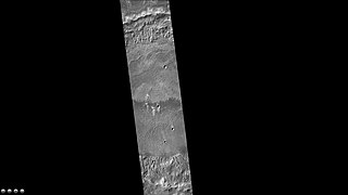
Briault is an impact crater in the Mare Tyrrhenum quadrangle of Mars, located at 10.2°S latitude and 270.4°W longitude. It is 96.6 kilometers in diameter and was named after P. Briault, and the name was approved in 1973 by the International Astronomical Union (IAU) Working Group for Planetary System Nomenclature (WGPSN). The dark areas seen in the images are dunes; the curved dunes are called barchans.

Nili Patera is a dune field on Mars. It is located on top of a lava bed, at the site of an ancient volcano, the Nili Patera caldera of Syrtis Major, near the Martian equator, and it is one of the most active dune fields of Mars. Its location coordinates on Mars are 8.7° N latitude, 67.3° E longitude. It is being actively studied by the HiRISE camera, on board the Mars Reconnaissance Orbiter, at the rate of one image every six weeks. The study of the movement of the dunes provides information regarding wind variation as a function of time and furthers the study of surface erosion characteristics of the Martian landscape. This information can then be used for the development and design of future Mars expeditions. The dunes of the Patera field are of the barchan type and their study by HiRISE was the first one to establish dune and ripple movement of a minimum of 1 metre on Mars. The Patera dune field, was also the first to be investigated using the COSI-Corr software, which was originally developed to analyse the movement of earthbound dunes. The research results from the evidence provided by the monitoring of the Nili Patera field, indicate sand fluxes of the order of several cubic metres per metre per year, similar to the flux observed at the sand dunes of Victoria Valley in Antarctica.

Abalos Undae is a dune field on Mars in the periphery of Planum Boreum, the Martian North pole. It is one of the officially named northern circumpolar dune fields, along with Olympia, Hyperboreae, and Siton Undae, and also one of the densest of the region. Its northernmost boundary is located in the southwest channel that separates the Abalos Colles formation from the main polar ice cap, and from there the dune field extends southwest all the way to the lowlands of Vastitas Borealis.

Hyperboreae Undae is one of the largest and densest dune fields of Planum Boreum, the Martian North Pole. It is named after one of the classical albedo features on Mars. Its name was officially approved by IAU in 1988. It extends from latitude 77.12°N to 82.8°N and from longitude 302.92°E to 316.02°E. Its centre is at latitude 79.96°N, longitude 49.49°W, and has a diameter of 463.65 kilometres (288.10 mi).
Siton Undae is one of the largest and densest dune fields in the vicinity of Planum Boreum, the Martian northern polar ice-cap. It is named after one of the classical albedo features on Mars. Its name was officially approved by IAU on 20 March 2007. It extends from latitude 73.79°N to 77.5°N and from longitude 291.38°E to 301.4°E. Its centre is located at latitude 75.55°N, longitude 297.28E (62.72°W), and has a diameter of 222.97 kilometres (138.55 mi).

Aspledon Undae is one of the named northern circumpolar dune fields in the vicinity of Planum Boreum, the Martian North pole. It is named after one of the classical albedo features on Mars. Its name was officially approved by the International Astronomical Union (IAU) on 20 March 2007. Its name is Greek, and derives from the name of a town in Boeotia, Ancient Greece, which, in turn, took its name from Aspledon, son of Poseidon, the ancient Greek god of the sea. The dunes of Aspledon Undae extend from latitude 71.47°N to 75.14°N and from longitude 305.83°E to 315.04°E. Its centre is located at latitude 73.06°N, longitude 309.65°E (50.35°W), and has a diameter of 215.2 km.

Abalos Mensa is a wedge-shaped mound, or mensa and one of the named features in the vicinity of Planum Boreum, the Martian North pole. It is named after one of the classical albedo features on Mars. Its name was officially approved by IAU in 2006. It extends from latitude 80.21°N to 82.4°N and from longitude 279.34°E to 290.52°E. Its centre is located at latitude 81.17°N, longitude 284.4°E (75.6°W), and has a diameter of 129.18 km.
