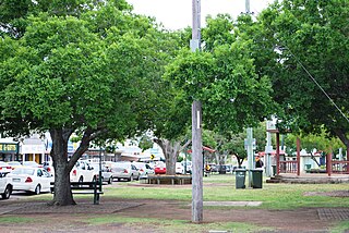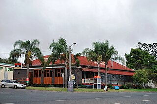
Kingaroy is a rural town and locality in the South Burnett Region, Queensland, Australia. The town is situated on the junction of the D'Aguilar and the Bunya Highways, 218 kilometres (135 mi) north-west of the state capital Brisbane and 141 kilometres (88 mi) south west of Gympie. In the 2021 census, the locality of Kingaroy had a population of 10,266 people.

Murgon is a rural town and locality in the South Burnett Region, Queensland, Australia. In the 2016 census, the locality of Murgon had a population of 2,378 people.

Wondai is a rural town and locality in the South Burnett Region, Queensland, Australia. In the 2021 census, Wondai had a population of 1,975 people.

Goomeri is a rural town and locality in the Gympie Region, Queensland, Australia. In the 2016 census, the locality of Goomeri had a population of 664 people.

Tingoora is a rural town and a locality in the South Burnett Region, Queensland, Australia.

Wooroolin is a rural town and a locality in the South Burnett Region, Queensland, Australia.

Kumbia is a rural town and locality in the South Burnett Region, Queensland, Australia. In the 2021 census, the locality of Kumbia had a population of 301 people.

Memerambi is a rural town and locality in the South Burnett Region, Queensland, Australia. In the 2021 census, the locality of Memerambi had a population of 338 people.

Durong is a rural locality in the South Burnett Region, Queensland, Australia.
Gordonbrook is a rural locality in the South Burnett Region, Queensland, Australia. In the 2016 census Gordonbrook had a population of 175 people.
Coolabunia is a rural locality in the South Burnett Region, Queensland, Australia.

Crawford is a locality in the South Burnett Region, Queensland, Australia.

Cinnabar is a rural locality in the Gympie Region, Queensland, Australia. In the 2016 census, Cinnabar had a population of 72 people.
Cushnie is a rural locality in the South Burnett Region, Queensland, Australia.
Inverlaw is a rural locality in the South Burnett Region, Queensland, Australia.

Kinbombi is a rural town and locality in the Gympie Region, Queensland, Australia. In the 2016 census, the locality of Kinbombi had a population of 37 people.
Leafdale is a rural locality in the South Burnett Region, Queensland, Australia. In the 2016 census, Leafdale had a population of 28 people.

Mondure is a rural town and locality in the South Burnett Region, Queensland, Australia. In the 2016 census, Mondure had a population of 100 people.
Stalworth is a rural locality in the South Burnett Region, Queensland, Australia. In the 2021 census, Stalworth had a population of 37 people.
Charlestown is a locality in the South Burnett Region, Queensland, Australia. In the 2021 census, Charlestown had a population of 79 people.


