District Council of Brown's Well

Last updated
Former Brown's Well Council Chambers Brown's Well Council Chambers South Australia near Loxton. (7524922856).jpg
Former Brown's Well Council Chambers

The District Council of Brown's Well was a local government area in South Australia from 1916 to 1997. The name stemmed from the Brown's Well pastoral station, which was located near the council seat of Paruna. [1] [2] Meetings were also held on a regular basis in the institute at Alawoona, which was the district's major centre. [3]

It was proclaimed on 16 November 1916, and held its first meeting on 16 December. [4] The area had formerly been part of the District Council of Loxton. [5] The first council chamber was a ten by ten shed and it was reported that there were "no roads and very few grubbed tracks" and "the population of the entire district [was] very small." [4]

A permanent council chambers building was opened in May 1929. [6] In 1935, the council had a total population of 1,100, with 85 miles of main roads and 409 miles of district roads. [4] In 1936, it comprised the cadastral hundreds of Allen, Kekwick and McGorrery, with a total land area of 340,800 acres, having increased since the initial proclamation. The main towns were Paruna, Alawoona, Cobera (now incorporated into Alawoona), Malpas, Meribah and Veitch. It was divided into six wards: North-East, South-East, North, South, South-West and North-West. [1] [4]

Much of the area was isolated Mallee country that was still being opened up in the 1930s. [1] In 1932, it was reported that the council's road-building works were sufficiently large that there was "not a single man in the whole of the area who was unemployed." [7]

The council ceased to exist on 3 May 1997, when it amalgamated with the District Council of Loxton and the District Council of Waikerie to form the District Council of Loxton Waikerie. [2]

The Brown's Well council's former honour board was re-unveiled in the Loxton council offices in March 2016, following calls for its reinstatement from a former Brown's Well councillor. [8] [9]

Chairmen of the District Council of Brown's Well

Related Research Articles

Riverland Region in South Australia

The Riverland is a region of South Australia. It covers an area of 9,386 square kilometres (3,624 sq mi) along the Murray River from where it flows into South Australia from New South Wales and Victoria downstream to Blanchetown. The major town centres are Renmark, Berri, Loxton, Waikerie, Barmera and Monash, along with many minor townships; the population is approximately 35,000 people.

Loxton, South Australia Town in South Australia

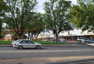
Loxton is a town on the south bank of the River Murray in the Riverland region of South Australia. At the 2016 census, Loxton had a population of 4,568. It is a service town for the surrounding districts. The area near Loxton is a significant citrus fruit and summer fruit growing area. Loxton is also the main town for the northern part of the Murray Mallee which is a dryland farming and grain cropping area.

District Council of Loxton Waikerie Local government area in South Australia

The District Council of Loxton Waikerie is a local government area in the Murray Mallee region of South Australia. The council seat lies at Loxton, while it maintains a branch office at Waikerie.

Waikerie, South Australia Town in South Australia

Waikerie is a rural town in the Riverland region of South Australia on the south bank of the Murray River. At the 2016 census, Waikerie had a population of 2,684. The Sturt Highway passes to the south of the town at the top of the cliffs. There is a cable ferry crossing the river to provide vehicle access from the north side of the river. Waikerie is known for citrus growing, along with stone fruit and grapes.

Mindarie, South Australia Town in South Australia

Mindarie is a small town in the Murray Mallee of South Australia between Karoonda and Loxton. The town was gazetted in 1912. The name Mindarie is believed to originate from the Dieri Aboriginal language, and possibly means "festival to invoke peace".

The District Council of Waikerie was a local government area in South Australia from 1914 to 1997, centring on the town of Waikerie.

The District Council of Loxton was a local government area in South Australia from 1910 to 1997, centring on the town of Loxton.

Galga, South Australia Town in South Australia

Galga is a settlement in the northern Murray Mallee region of South Australia. The town of Galga was surveyed in 1915 after the Waikerie railway line from Karoonda to Waikerie was opened in 1914. The line was shortened to Galga in 1990, and closed completely in 1994. There is a small bulk grain silo at Galga, but it is no longer regularly used. Galga has an active Country Fire Service brigade with one fire truck.

Paruna, South Australia Town in South Australia

Paruna is a town in eastern South Australia. The town is located on the Browns Well Highway, where it crosses the former Barmera railway line, 237 kilometres (147 mi) east of the state capital, Adelaide.

The Karoonda Highway is a 172-kilometre-long (107 mi) state-controlled highway in South Australia linking the Murray River towns of Murray Bridge and Loxton. It was created after local councils called for the renaming of the B55 road route.

Albert was an electoral district of the House of Assembly in South Australia, spanning its time as both a colony and a state. It was created in 1875, taking much territory from adjacent Victoria, merged with Victoria in 1902 as Victoria and Albert, separated again in 1915, and abolished in 1970.

Loxton railway line

The Loxton railway line is a closed railway line in the northern Murray Mallee region of South Australia. It ran north-east from Tailem Bend to grain silos near Loxton.

The Barmera railway line was the second railway built to develop the Murray Mallee region of South Australia, in 1913. It followed the success of the Pinnaroo railway line in 1906. Both lines branched east from Tailem Bend to the north of the main Melbourne–Adelaide railway. The Brown's Well line was the more northerly, and extended into country which had not been developed much before the railway, partly due to the absence of any viable transport route for produce. The original terminus of the Brown's Well railway was at Meribah, not far from the Victorian border.

Cameron Highway

The Cameron Highway is an arterial road in South Australia, connecting Alawoona on the Karoonda Highway to Paruna on the Browns Well Highway. It follows part of the former Barmera railway line.

Mantung, South Australia Town in South Australia

Mantung is a town and a locality in the Australian state of South Australia located in the state's south-east about 140 kilometres (87 mi) east of the state capital of Adelaide, and about 58 kilometres (36 mi) north-east and about 48 kilometres (30 mi) south-west respectively of the municipal seats of Karoonda and Loxton.

County of Albert Cadastral in South Australia

The County of Albert is one of the 49 cadastral counties of South Australia on the east banks of the River Murray. It was proclaimed by Governor Richard MacDonnell in 1860 and named for Albert, Prince Consort of Queen Victoria.

The Loxton News is a weekly newspaper published in Loxton, South Australia, and published continuously since April 1960. It is now owned by the Taylor Group of Newspapers.

The River News is a weekly newspaper published in Waikerie, South Australia, and published continuously since July 1956. It is now owned by the Taylor Group of Newspapers.

County of Alfred Cadastral in South Australia

The County of Alfred is one of the 49 cadastral counties of South Australia on the south banks of the River Murray. It was proclaimed by Governor James Fergusson in 1868 and named for Prince Alfred, second son of Queen Victoria, who visited the state in 1867.

References

  1. 1 2 3 Hosking, P. (1936). The Official civic record of South Australia : centenary year, 1936. Adelaide: Universal Publicity Company. p. 492.
  2. 1 2 "Introduction". District Council of Loxton Waikerie. Retrieved 31 March 2016.
  3. "BROWN'S WELL DISTRICT COUNCIL". Murray Pioneer and Australian River Record . 31 (35). South Australia. 31 August 1923. p. 17. Retrieved 28 May 2016 via National Library of Australia.
  4. 1 2 3 4 5 "Brown's Welts Story of Achievement". Murray Pioneer and Australian River Record . 40 (51). South Australia. 19 December 1935. p. 11. Retrieved 28 May 2016 via National Library of Australia.
  5. "LOXTON COUNCIL CHAMBER". Murray Pioneer and Australian River Record . 44 (5[?]). South Australia. 16 December 1937. p. 28. Retrieved 28 May 2016 via National Library of Australia.
  6. "BROWN'S WELL DISTRICT D.C." Murray Pioneer and Australian River Record . 38 (19). South Australia. 10 May 1929. p. 4. Retrieved 28 May 2016 via National Library of Australia.
  7. "THE BROWN'S WELL DISTRICT COUNCIL". Murray Pioneer and Australian River Record . 41 (21). South Australia. 26 May 1932. p. 4. Retrieved 28 May 2016 via National Library of Australia.
  8. "Council meeting agenda Friday 18 March 2016 Council Chamber, Loxton" (PDF). District Council of Loxton Waikerie. Retrieved 28 May 2016.
  9. "Call for council honour boards". Australian Broadcasting Corporation. 8 December 2003. Retrieved 28 May 2016.
  10. "ROUND THE FARM — AND ALL THAT". The Chronicle . LXXV (3, 946). Adelaide. 21 July 1932. p. 5. Retrieved 28 May 2016 via National Library of Australia.
  11. "DISTRICT COUNCIL OF BROWN'S WELL". Murray Pioneer and Australian River Record . 23 (29). South Australia. 27 July 1917. p. 6. Retrieved 28 May 2016 via National Library of Australia.
  12. "BROWN'S WELL DISTRICT COUNCIL". Murray Pioneer and Australian River Record . 24 (32). South Australia. 9 August 1918. p. 6. Retrieved 28 May 2016 via National Library of Australia.
  13. "BROWN'S WELL DISTRICT COUNCIL". Murray Pioneer and Australian River Record . 25 (10). South Australia. 7 March 1919. p. 6. Retrieved 28 May 2016 via National Library of Australia.
  14. "Meeting of the Murray and Mallee Local Government Association – 6 June 2008" (PDF). Local Government Association of South Australia. Retrieved 28 May 2016.
  15. 1 2 3 4 5 6 7 8 9 10 11 12 13 Matthews, Penny (1986), South Australia, the civic record, 1836-1986, Wakefield Press, ISBN   978-0-949268-82-2

Coordinates: 34°44′12″S140°30′23″E / 34.7368°S 140.5064°E / -34.7368; 140.5064