
Light Regional Council is a local government area north of Adelaide in South Australia. It is based in the town of Kapunda, and includes the towns of Freeling, Greenock, Hansborough, Hewett, Roseworthy and Wasleys.

The Town of Gawler is a local government area located north of Adelaide city centre in South Australia containing Gawler and its suburbs. The corporate town was established in 1857 due to the township's residents' dissatisfaction at being governed by three different district councils.

Hansborough is a locality along the former Morgan railway line adjacent to the Thiele Highway, in South Australia's Mid North region. It is situated 9 kilometres south-west of Eudunda and 18 kilometres north-east of Kapunda. The Light River runs through the locality.

The District Council of Yatala was a local government area of South Australia established in 1853 and abolished in 1868.
The Hundred of Belvidere is a cadastral unit of hundred located in the north Barossa Valley of South Australia in the County of Light.

Ebenezer is a locality in the northern Barossa Valley of South Australia. It includes the historic Ebenezer settlement settled by 72 Wendish Lutherans who had migrated from Silesia in January 1852. It also includes the nearby Neukirch settlement founded in 1854 by another group of Lutheran immigrants.

Katarapko is a locality in the Australian state of South Australia located in the Riverland about 188 kilometres north-east of the state capital of Adelaide and about 6.6 kilometres (4.1 mi) north of Loxton.
The District Council of Light was a local government area in South Australia from 1977 to 1996, seated at Freeling.

The County of Light is one of the 49 cadastral counties of South Australia. It was proclaimed by Governor George Grey in 1842 and named for the River Light, the river being named after Colonel William Light, the first Surveyor-General of South Australia. It covers the modern region of the Barossa Valley and a portion of the northern Mt Lofty Ranges. It is bounded by the upper Wakefield River in the north, the approximate path of Horrocks Highway in the west, and the North Para River in the south, and is bisected east to west by the River Light.
The District Council of Neales was a local government area in South Australia from 1878 to 1932. The main town and council seat was Eudunda.
The Hundred of Gilbert is a cadastral unit of hundred in the northern Mount Lofty Ranges including the town of Riverton. It is one of the nine hundreds of the County of Light. It was proclaimed in 1851 by Governor Henry Young and named after the Gilbert River, which flows from north to south through the hundred. The river, in turn, was named in honour of South Australian pioneer Thomas Gilbert.

The Hundred of Goyder is the cadastral unit of hundred on the northern Adelaide Plains centred on the locality of Goyder. It is one of the 16 hundreds of the County of Stanley. It was named in 1862 by Governor Dominick Daly after George Goyder, famed South Australian surveyor. In addition to the localities of Goyder and Beaufort, most of Nantawarra lies within the Hundred of Goyder. The portions of Port Wakefield and Bowmans north of the Wakefield River are also inside the hundred, and small parts of the localities of South Hummocks and Mount Templeton cross the western and eastern of boundaries of the hundred, respectively.
The District Council of Port Wakefield was a local government area seated at Port Wakefield in South Australia from 1878 to 1983.
The District Council of Hindmarsh was a local government area in South Australia from 1853 to 1875, seated at the inner north west Adelaide suburb of Hindmarsh.
The District Council of Stockport was a local government area in South Australia seated at Stockport from 1865 to 1932.
The Hundred of Alma is a cadastral unit of hundred located on the northern Adelaide Plains of South Australia spanning the township of Alma and the Alma Plains. The hundred was proclaimed in 1856 in the County of Gawler and named by Governor Richard Graves MacDonnell for the River Alma on the Crimean Peninsula, the location of the Battle of the Alma, the first Allied victory in the Crimean War. The hundred is bounded on the north by the Wakefield River and on the south by the Light River

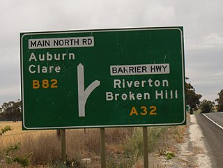
The Corporation and District Council of Clare were twin local government areas in South Australia centred on the town of Clare. The district council existed from 1853 until 1997, while the town corporation existed from 1868 until 1969.

The Hundred of Nuriootpa is a cadastral unit of hundred in the County of Light, South Australia split between in the eastern Adelaide Plains and western Barossa Valley. Named in 1847 for an indigenous term officially thought to mean "bartering place" and traditionally used as neutral ground for trading between various indigenous tribes, it is bounded on the south and east by the North Para River.
The District Council of Strathalbyn was a local government area in South Australia centred on the town of Strathalbyn from 1854 until 1997. From 1868 the township itself was locally governed by the Corporation of Strathalbyn but that entity was amalgamated back into the district council in 1976.
The District Council of Kapunda was a local government area in South Australia from 1866 to 1996. The Kapunda town corporation was formed a year earlier in 1865 and ultimately amalgamated into the district council.
