
Gawler is the oldest country town on the Australian mainland in the state of South Australia. It was named after the second Governor of the colony of South Australia, George Gawler. It is about 40–44 km (25–27 mi) north of the centre of the state capital, Adelaide, and is close to the major wine producing district of the Barossa Valley. Topographically, Gawler lies at the confluence of two tributaries of the Gawler River, the North and South Para rivers, where they emerge from a range of low hills.

Light Regional Council is a local government area north of Adelaide in South Australia. It is based in the town of Kapunda, and includes the towns of Freeling, Greenock, Hansborough, Hewett, Roseworthy and Wasleys.

Roseworthy is a small town in South Australia, about 10 km north of Gawler on the Horrocks Highway. At the 2016 census, Roseworthy had a population of 994.

Freeling is a small town in South Australia, about 60 km north of Adelaide. It neighbours the Barossa Valley wine region. At the 2016 census, Freeling had a population of 2,214.

The Barossa Light & Gawler Football Association, more commonly referred to as the BL&GFA, is an Australian rules football competition based in the Barossa Valley, Gawler Region and Light Region of South Australia, Australia. Just 42 kilometres north of the state capital of Adelaide, the BL&GFA is an affiliated member of the South Australian National Football League. In 2018, the Nuriootpa Football Club secured the premiership cup for an equal 7th time alongside the Tanunda Football Club. The current president of the League currently is Mick Brien and the major sponsor of the league is the Grant Burge Winery.

The Adelaide Plains Council is a local government area in South Australia. It consists of a largely rural region along the Gulf St Vincent, covering a total area of approximately 926 km2. The council seat lies at Mallala, but it also maintains a service centre at Two Wells.

Kapunda Football Club, nicknamed The Bombers, is an Australian rules football club, based in Kapunda, South Australia, that competes in the Barossa Light & Gawler Football Association.

The Morgan railway line or North-West Bend railway was a railway line on the South Australian Railways network.

The Thiele Highway is a road in South Australia connecting the outskirts of Adelaide to the North west bend of the Murray River at Morgan, South Australia. It is named after author Colin Thiele who lived most of his life in towns along the route, and set some of his stories in the area.

Barossa zone is a wine zone located in central South Australia west of the Murray River and which occupies the Barossa Valley, the Eden Valley and some adjoining land. The zone which is enclosed by the Mount Lofty Ranges zone on three sides and by the Lower Murray zone to its east, contains two wine regions which have received appellation as Australian Geographical Indications (AGI). These are the Barossa Valley and Eden Valley regions. The Barossa zone also includes a broader area around these two defined regions. The zone received AGI in 1996.

The County of Light is one of the 49 cadastral counties of South Australia. It was proclaimed by Governor George Grey in 1842 and named for the River Light, the river being named after Colonel William Light, the first Surveyor-General of South Australia. It covers the modern region of the Barossa Valley and a portion of the northern Mt Lofty Ranges. It is bounded by the upper Wakefield River in the north, the approximate path of Horrocks Highway in the west, and the North Para River in the south, and is bisected east to west by the River Light.
The District Council of Port Gawler was a local government area in South Australia from 1856 to 1935. It was proclaimed on 11 September 1856 after being severed from the District Council of Mudla Wirra.
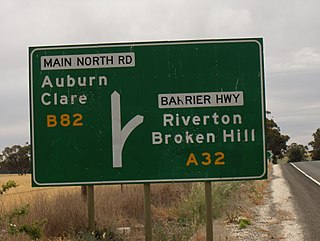
The Hundred of Gilbert is a cadastral unit of hundred in the northern Mount Lofty Ranges including the town of Riverton. It is one of the nine hundreds of the County of Light. It was proclaimed in 1851 by Governor Henry Young and named after the Gilbert River, which flows from north to south through the hundred. The river, in turn, was named in honour of South Australian pioneer Thomas Gilbert.
The District Council of Light was a local government area in South Australia from 1867 to 1892.

The District Council of Dublin was a local government area in South Australia from 1873 to 1935, seated at Dublin.
The District Council of Grace was a local government area in South Australia from 1874 to 1935, seated at Mallala.

The Hundred of Mudla Wirra is a cadastral unit of hundred located on the northern Adelaide Plains of South Australia. The hundred was proclaimed in 1847 in the County of Gawler and named by Governor Frederick Robe. The hundred is bounded on the north by the Light River and on the south by the Gawler River.

The Hundred of Nuriootpa is a cadastral unit of hundred in the County of Light, South Australia split between in the eastern Adelaide Plains and western Barossa Valley. Named in 1847 for an indigenous term officially thought to mean "bartering place" and traditionally used as neutral ground for trading between various indigenous tribes, it is bounded on the south and east by the North Para River.
The District Council of Kapunda was a local government area in South Australia from 1866 to 1996. The Kapunda town corporation was formed a year earlier in 1865 and ultimately amalgamated into the district council.

The Barossa District Football Club is an Australian rules football club based in the Barossa Valley region of South Australia. The club is nicknamed the Bulldogs and represents the towns of Lyndoch and Williamstown.
