
The Hastings Micropolitan Statistical Area, as defined by the United States Census Bureau, is an area consisting of two counties in Nebraska, anchored by the city of Hastings.
The Tullahoma–Manchester Micropolitan Statistical Area, as defined by the United States Census Bureau, is an area consisting of two counties in central Tennessee, anchored by the cities of Tullahoma and Manchester.

The Roanoke Rapids, NC Micropolitan Statistical Area (μSA) as defined by the United States Census Bureau, is an area consisting of two counties in North Carolina, anchored by the city of Roanoke Rapids.

The Cape Girardeau–Jackson Metropolitan Statistical Area, as defined by the United States Census Bureau, is an area consisting of two counties in southeastern Missouri and one in southern Illinois with its core in both states. Its largest cities are the cities of Cape Girardeau and Jackson. It was upgraded from a Micropolitan Statistical Area (μSA) to a Metropolitan Statistical Area (MSA) by the Office of Management and Budget on November 20, 2008.

The Charleston–Mattoon, IL Micropolitan Statistical Area, as defined by the United States Census Bureau, is an area consisting of Coles County in central Illinois, anchored by the cities of Charleston and Mattoon.
The Paducah, KY–IL Metropolitan Statistical Area, as defined by the United States Census Bureau, is an area consisting of five counties – three in the Jackson Purchase region of Kentucky, a fourth Kentucky county bordering the Purchase, and one in Southern Illinois – anchored by the city of Paducah, Kentucky. The Paducah KY-IL Micropolitan Statistical Area was upgraded to Metropolitan Statistical Area (MSA) status on July 21, 2023, by the Office of Management and Budget.. Carlisle County, Kentucky, was added to the area following the 2020 Census of the Population. The total MSA population from the 2020 United States Census was 103,486.
The Frankfort Micropolitan Statistical Area, as defined by the United States Census Bureau, is an area consisting of two counties in central Kentucky, anchored by the city of Frankfort. As of the 2000 census, the Micropolitan Statistical Area (μSA) had a population of 66,798.
The Richmond-Berea Micropolitan Statistical Area, as defined by the United States Census Bureau, is an area consisting of two counties in Kentucky, anchored by the cities of Richmond and Berea. As of the 2000 census, the μSA had a population of 87,454.

The Burlington, IA−IL Micropolitan Statistical Area, as defined by the United States Census Bureau, is an area consisting of two counties−one in southeast Iowa and the other in West Central Illinois, anchored by the city of Burlington, Iowa.

The Mount Vernon, IL Micropolitan Statistical Area, as defined by the United States Census Bureau, is an area consisting of one county in southern Illinois, anchored by the city of Mount Vernon.

The Jacksonville, IL Micropolitan Statistical Area, as defined by the United States Census Bureau, is an area consisting of two counties in west central Illinois, anchored by the city of Jacksonville.

The Mason City Micropolitan Statistical Area, as defined by the United States Census Bureau, is an area consisting of two counties in north central Iowa, anchored by the city of Mason City.

The Muscatine Micropolitan Statistical Area, as defined by the United States Census Bureau, is an area consisting solely of Muscatine County and anchored by the city of Muscatine. The Muscatine Micropolitan Statistical Area is also a part of the Quad Cities Iowa–Illinois Combined Statistical Area (CSA), which has a population of 474,226, making it the 90th-largest CSA in the nation.
The Danville Micropolitan Statistical Area, as defined by the United States Census Bureau, is an area consisting of Boyle and Lincoln counties in Kentucky, anchored by the city of Danville. As of the 2000 census, the μSA had a population of 51,058. A July 1, 2009 estimate placed the population at 54,435.

The Hannibal Micropolitan Statistical Area, as defined by the United States Census Bureau, is an area consisting of two counties in northeast Missouri, anchored by the city of Hannibal.

The Hope Micropolitan Statistical Area, as defined by the United States Census Bureau, is an area consisting of two counties in the U.S. state of Arkansas, anchored by the city of Hope.
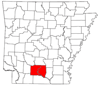
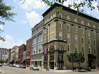
The Camden Micropolitan Statistical Area, as defined by the United States Census Bureau, is an area consisting of two counties in the U.S. state of Arkansas, anchored by the city of Camden.

The Bloomsburg–Berwick Metropolitan Statistical Area (MSA), as defined by the United States Census Bureau, is an area consisting of two counties in Pennsylvania, anchored by the town of Bloomsburg and the borough of Berwick. As of the 2010 census, the MSA had a population of 85,562.

The Martinsville Micropolitan Statistical Area is a United States Micropolitan Statistical Area (USA) in Virginia, as defined by the Office of Management and Budget (OMB) as of June, 2003. As of the 2000 census, the μSA had a population of 73,346.

The Dublin Micropolitan Statistical Area, as defined by the United States Census Bureau, is an area consisting of two counties in Georgia, anchored by the city of Dublin.

