Hodges Peak | |
---|---|
Highest point | |
Elevation | 11,180 ft (3,408 m) [1] [2] |
Prominence | 760 ft (232 m) [1] |
Parent peak | Doubletop Peak (11,740 ft) [1] |
Isolation | 2.29 mi (3.69 km) [1] |
Coordinates | 43°19′06″N110°15′54″W / 43.3183447°N 110.2648819°W [3] |
Geography | |
Country | United States |
State | Wyoming |
County | Sublette |
Protected area | Gros Ventre Wilderness |
Parent range | Rocky Mountains Gros Ventre Range [2] |
Topo map | USGS Doubletop Peak |
Geology | |
Age of rock | Carboniferous |
Type of rock | Sandstone, Amsden Formation [4] |
Climbing | |
Easiest route | class 2 hiking [1] |
Hodges Peak is an 11,180-foot-elevation (3,408-meter) mountain summit in Sublette County, Wyoming, United States. [3]
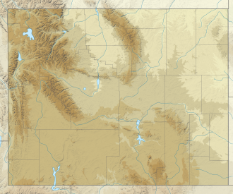
Hodges Peak is located on the crest of the Gros Ventre Range which is a subrange of the Rocky Mountains. Hodges Peak ranks as the ninth-highest peak in the range and is 2.27 miles (3.65 km) south-southeast of Doubletop Peak, the highest peak in the range. [2] It is set 28 miles (45 km) west of the Continental Divide within the Gros Ventre Wilderness, on land managed by Bridger-Teton National Forest. The nearest town is Jackson, 27 miles (43 km) to the west-northwest. Precipitation runoff from the mountain's west slope drains to the Hoback River via Dell Creek, whereas the east slope drains to the Green River via Tosi Creek. Topographic relief is significant as the summit rises approximately 2,800 feet (850 meters) above Dell Creek in one mile (1.6 km). The mountain's toponym has been officially adopted by the United States Board on Geographic Names, [3] and has been recorded in publications since at least 1914. [5]
According to the Köppen climate classification system, Hodges Peak is located in an alpine subarctic climate zone with long, cold, snowy winters, and cool to warm summers. [6] Due to its altitude, it receives precipitation all year, as snow in winter and as thunderstorms in summer.
Sharkstooth Peak is a 12,468-foot-elevation (3,800-meter) mountain summit in Montezuma County, Colorado.
The Gros Ventre Range is part of the Central Rocky Mountains and is located west of the Continental Divide in U.S. state of Wyoming. The name "Gros Ventre" is French for "big belly." The highest summit in the range is Doubletop Peak at 11,720 feet (3,570 m). The Gros Ventre Range is mostly within the Gros Ventre Wilderness of Bridger–Teton National Forest. To the northwest of the range lies the valley known as Jackson Hole. Snow King ski resort is in the range adjacent to the town of Jackson, Wyoming. Also in the Gros Ventre Range is the Gros Ventre landslide, which in 1925 slid down the north slope of Sheep Mountain.
Cirque Peak is a 12,900-foot-elevation (3,900-meter) mountain summit located on the crest of the Sierra Nevada mountain range in California. It is situated on the common border of Tulare County with Inyo County, as well as the shared boundary of Golden Trout Wilderness and John Muir Wilderness, on land managed by Inyo National Forest. It is 14 miles (23 km) southwest of the community of Lone Pine, 7.7 miles (12.4 km) south-southeast of Mount Whitney, and 3.2 miles (5.1 km) south of Mount Langley, the nearest higher neighbor. Cirque Peak is the highest point of the Golden Trout Wilderness, and ranks as the 175th highest peak in California. Topographic relief is significant as it rises 1,800 feet above Cirque Lake in approximately one mile. The Pacific Crest Trail traverses the southwest slope of this mountain, providing an approach option. The mountain was apparently named in 1890 by Joseph Nisbet LeConte and companions who noted the remarkable cirque on the north aspect.
Sawmill Point is a 9,429-foot-elevation (2,874 meter) mountain summit located in Inyo County, California. It is situated 2.6 miles east of the crest of the Sierra Nevada mountain range, in the John Muir Wilderness, on land managed by Inyo National Forest. It is also 10.5 miles (16.9 km) northwest of the community of Independence, and 2.6 miles (4.2 km) east of proximate parent Colosseum Mountain. Topographic relief is significant as the summit rises 4,770 feet above Owens Valley in two miles. The Sawmill Pass Trail traverses the east and south slopes of the peak, providing an approach option, and access to the John Muir Trail.
Wheeler Mountain is a 13,690-foot (4,173 m) summit in Summit County, Colorado, United States.
Carson Peak is a 13,662-foot-elevation (4,164-meter) summit in Hinsdale County, Colorado, United States.
Paiute Peak is a 13,088-foot (3,989 m) mountain summit on the boundary shared by Boulder County and Grand County, in Colorado, United States.
Sayres Benchmark is a 13,746-foot-elevation (4,190-meter) mountain summit in Chaffee County, Colorado, United States.
Henrys Fork Peak is a 13,260-foot elevation (4,042 m) mountain summit located on the common border that Duchesne County shares with Summit County in the U.S. state of Utah.
Darwin Peak is an 11,647-foot-elevation (3,550-meter) mountain summit in Teton County, Wyoming, United States.
Two Ocean Mountain is a 10,724-foot-elevation (3,269-meter) summit in Teton County, Wyoming, United States.
Sacajawea Peak is an 11,936-foot elevation (3,638 m) mountain summit in Custer County, Idaho, United States.
Tohobit Peak is a 10,046-foot elevation (3,062 m) mountain summit located in Boise County, Idaho, United States.
Grandjean Peak is a 9,180-foot-elevation (2,798-meter) mountain summit in Boise County, Idaho, United States.
Fools Peak is a 12,954-foot-elevation (3,948-meter) summit in Eagle County, Colorado, United States.
Virginia Peak is a 10,141-foot-elevation (3,091-meter) mountain summit in Lincoln County, Wyoming, United States.
Man Peak is a 10,326-foot-elevation (3,147-meter) mountain summit in Lincoln County, Wyoming, United States.
Sugarloaf Mountain is an 11,051-foot-elevation (3,368-meter) summit on the boundary that Salt Lake County shares with Utah County, in Utah, United States.
Sunset Peak is a 10,648-foot-elevation (3,246-meter) summit in Utah, United States.
Loaf Mountain is a 11,722-foot-elevation (3,573-meter) summit in Johnson County, Wyoming, United States.