Kargil district is a district in Ladakh, a region administered by India as a union territory. It spans the entire length of Ladakh in the north–south direction, with Jammu and Kashmir to the west, the Leh district to the east, the Pakistan-administered region of Gilgit–Baltistan to the north and Himachal Pradesh to the south. Encompassing two historical regions known as Purig and Zanskar, the district lies to the northwest of the Great Himalayan range and encompasses the majority of the Zanskar Range. Its population inhabits the river valleys of the Dras, Suru, Kartse, Wakha, and Zanskar rivers.

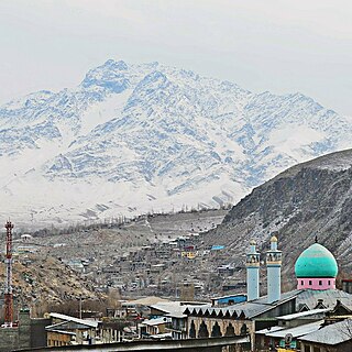
Kargil is a town in Kargil district and the joint capital of the union territory of Ladakh. Kargil is the second largest town in Ladakh after Leh. It is located 204 km to the east of Srinagar and 234 km west of Leh to the east. Kargil is the centre of the Suru River valley, historically known as Purig.

Zangla is a village in Zanskar tehsil of Kargil district, in the Indian union territory of Ladakh. It is located 32 km from Padum, the capital of Zanskar and presently the headquarter of Zanskar. The town is the nodal point on the popular Padum-Strongdey-Zangla-Karsha-Padum round trip. An old monastery, Known as Zangla Monastery is located on a hilltop right side to the village at a distance of one km belief of 11th century.

Batalik is a town in Ladakh, India, located on the upper reaches of the Indus river. It has been a focal point in the Kargil War because of its strategic location between Kargil, Leh and Baltistan. In 1999 Kargil war was fought in this region. Batalik is 56 km from Kargil and is known for its four Brokpa villages: Dah, Hanu, Garkon, Chulichan, Sharchay and Darchak. The Brokpa tribe is believed to be directly descended from the soldiers of Alexander the Great. Most of the valley is made up of nominally Buddhist Brokpas, but a few communities have converted to Shia Islam and intermarried with other Muslim ethnic groups as a result.
Poyen is a village vicinity of Kargil town in Kargil district, Ladakh, in India. It is on the bank of the river Suru. The village is one of the most ancient settlements in the region.
Fotoksar is a village in the Leh district of Ladakh, India. It is located in the Khalsi tehsil.
Hunderman or Hundarmaan or Hundurmaan is one of the northernmost villages in India and is situated in the Kargil district of Ladakh. It is located 10 km from Kargil, the district headquarters, and is on the banks of the Drass River. It was under Pakistan's control until 1971. Geographically, Hunderman lies in the Baltistan Region. There are two parts of Hunderman: Lower Hunderman and Upper Hunderman.

Wavoora is a village in Kupwara district of the Indian union territory of Jammu and Kashmir. The town is located 13 km (8.1 mi) from district headquarters Kupwara.
Kalarooch, also known as Kalaroos, is a Town in Kupwara district of Jammu and Kashmir. The village is located 5 km (3.1 mi) from district headquarters Kupwara.
Azmatabad is a village in Thanamandi tehsil in Rajouri district of the Indian union territory of Jammu and Kashmir.
Hardas is a village in Kargil district of the Indian union territory of Ladakh. The village is located 10 kilometres from the district and tehsil headquarters Kargil.
Jusgund is a village in Drass tehsil in Kargil district of the Indian union territory of Ladakh. The village is located 30 kilometres from the district headquarters Kargil.
Itchoo is a village in Sankoo tehsil in Kargil district of the Indian union territory of Ladakh. The village is located 75 kilometres from the district headquarters Kargil.
Namsuru is a village in Kargil district of the Indian union territory of Ladakh. The village is located 88 kilometres from district headquarters Kargil.
Shargole is a medium-sized village and tehsil in Kargil district of the Indian union territory of Ladakh. The village is located 30 kilometres from district headquarters Kargil.
Trespone is a village in Sankoo tehsil in Kargil district of the Indian union territory of Ladakh. The village is located 10 kilometres from the district and tehsil headquarters Kargil.
Thasgam is a village in Drass tehsil in Kargil district of the Indian union territory of Ladakh. The village is located 36 kilometres from the district and tehsil headquarters Kargil.
Goshan is a village in Drass tehsil in Kargil district of the Indian union territory of Ladakh. The village is located 77 kilometres from the district headquarters Kargil.
Mankote is a village and tehsil in Poonch district of the Indian union territory of Jammu and Kashmir. The village is located 91 kilometres from the district headquarters in Poonch.
Matayen is a village in Drass tehsil in Kargil district of the Indian union territory of Ladakh. The village is located 81 kilometres from the district headquarters Kargil.Its only village in ladakh where Kashmiri is spoken and Kashmiri peoples are being lived.

