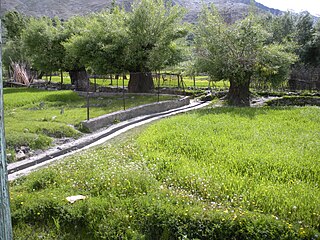
Kargil or Kargyil is a city and a joint capital of the union territory of Ladakh, India. It is also the headquarters of the Kargil district. It is the second-largest city in Ladakh after Leh. Kargil is located 204 kilometres (127 mi) east of Srinagar in Jammu and Kashmir, and 234 kilometres (145 mi) to the west of Leh. It is on the bank of the Suru River near its confluence with the Wakha Rong river, the latter providing the most accessible route to Leh.

Zangla is a village in Zanskar tehsil of Kargil district, in the Indian union territory of Ladakh. It is located 262 km from Kargil city, the district headquarter, 32 km from Padum, the capital of Zanskar, and presently is the headquarters of Zanskar. An ancient ruined fort, known as Zangla Fort is located on a hilltop one km outside the village, believed to be 11th-century.

Sankoo is a charming town nestled in a picturesque valley within the Kargil district of the Union Territory of Ladakh, India. This delightful township is located approximately 42 kilometers south of Kargil city and is renowned for its breathtaking beauty. The valley is shaped like a bowl and is fed by several large tributary streams of the Suru River, as well as the Nakpochu river.
Batalik is a village and military base in Ladakh, India, located in a narrow section of the Indus river valley, close to the Line of Control with Pakistan-administered Baltistan. It was a focal point of the Kargil War because of its strategic location between Kargil, Leh and Baltistan. In 1999, the Kargil war was fought in this region.
Poyen is a village in the Kargil district, Ladakh, in India, close to the Kargil town. It is on the right bank of Wakha Rong river near its confluence with the Suru River. The village jurisdiction includes the hamlets of Hunderman acquired from Pakistan during the Indo-Pakistan War of 1971.
Fotoksar or Photoksar is a village in the Leh district of Ladakh, India. It is located in the Khalsi tehsil.
Hunderman or Hundarmaan or Hundurmaan is one of the northernmost hamlets in India and is situated in the Kargil district of Ladakh. Located on the banks of the Suru River 10 km from Kargil, it is a hamlet under Shilikchey village of Kargil district.] It was under Pakistan's control until 1971. Geographically, Hunderman lies in the Baltistan Region. There are two parts of Hunderman: Lower Hunderman Mal and Hunderman Broq.
Kralpora is a Tehsil and a village in Kupwara district of the Indian administered union territory of Jammu and Kashmir. The village is located just 15 kilometres from district headquarters Kupwara town.
Gundna is a village in Doda district of the Indian union territory of Jammu and Kashmir. The village is located just 40 kilometres from the district headquarters Doda.
Dudu is a village and municipality in Udhampur district of the Indian union territory of Jammu and Kashmir. The town is located 100 kilometres from the district headquarters Udhampur.
Hardas is a village in Kargil district of the Indian union territory of Ladakh, close to the India–Pakistan border (LOC). The village is located 10 kilometres north of Kargil, the district headquarters, on the left of the Dras River.
Jusgund is a village in Drass tehsil in Kargil district of the Indian union territory of Ladakh. The village is located 30 kilometres from the district headquarters Kargil.
Namsuru is a village in Kargil district of the Indian union territory of Ladakh. The village is located 88 kilometres from district headquarters Kargil.
Shargole is a medium-sized village and tehsil in Kargil district of the Indian union territory of Ladakh. The village is located 30 kilometres from district headquarters Kargil.

Trespone is a scenic village in the TSG block of Sankoo tehsil in the Kargil district of the Indian union territory of Ladakh. Trespone is a historically, culturally, and architecturally rich village in the Suru Valley, located on the bank of the Suru River, and is around 20 km from Kargil town. It is often called little Kashmir, and is the gateway to Suru Valley. It is surrounded by five other villages, namely Saliskote, G.M.Pore, Tambis, Kanoor and Sarchey.
Thasgam is a village in Drass tehsil in Kargil district of the Indian union territory of Ladakh. The village is located 36 kilometres from the district and tehsil headquarters Kargil.
Kharbu is a village in Drass tehsil in Kargil district of the Indian union territory of Ladakh. The village is located 26 kilometres from the district and tehsil headquarters Kargil.
Goshan is a village in Drass tehsil in Kargil district of the Indian union territory of Ladakh. The village is located 77 kilometres from the district headquarters Kargil.
Matayen is a village in Drass tehsil in Kargil district of the Indian union territory of Ladakh. The village is located around 21 kilometer's from drass and around 81 kilometres from the district headquarters Kargil.Its only village in ladakh where Kashmiri is spoken and Kashmiri peoples are being lived.


