King Street, Dundas, Ontario

Last updated
Carnegie Gallery Carnegie Gallery.JPG
Carnegie Gallery
King Street West, Dundas King West Dundas.JPG
King Street West, Dundas
Collins Brewhouse,
Originally Collins Hotel Collins Hotel.JPG
Collins Brewhouse,
Originally Collins Hotel
Thirsty Cactus/ Masonic Hall Thirsty Cactus.JPG
Thirsty Cactus/ Masonic Hall
Memorial Square Memorial Square.JPG
Memorial Square
Canadian Armed Forces Jet,
Hamilton Air Force Association Canadian Airforce Assoc.JPG
Canadian Armed Forces Jet,
Hamilton Air Force Association
Desjardins Canal Desjardins Canal.JPG
Desjardins Canal
25-Pounder Gun/ Howitzer 25 Pounder Gun.JPG
25-Pounder Gun/ Howitzer
25-Pounder Gun/ Howitzer Dundas 146.JPG
25-Pounder Gun/ Howitzer
Central Hotel building Central Hotel.JPG
Central Hotel building

King Street starts off as a collector road in the east-end of town in Dundas, Hamilton, Ontario, Canada beside Cootes Paradise and the Desjardins Canal at Olympic Drive and switches to an arterial road at York Street and cuts through the town of Dundas where it ends in the west-end by the CN railway tracks at the base of the Niagara Escarpment. It is a two-way street throughout.

Contents

Note: West of the CN railway tracks this road changes its name to Brock Road.

History

On January 1, 2001 the present City of Hamilton was formed from the amalgamation of the Regional Municipality of Hamilton-Wentworth (the metropolitan area of Hamilton and its five surrounding municipalities: Ancaster, Dundas, Flamborough, Glanbrook, and Stoney Creek). Before amalgamation, the City of Hamilton had 331,121 Hamiltonians divided into 100 neighbourhoods. The amalgamated city has 490,268 people in over 200 neighbourhoods and communities. [1] This resulted in several duplicate street names; and there are two separate King Streets found in the present City of Hamilton. One in Dundas and the other in Lower City Hamilton.

The Dundas Valley was formed by retreating glaciers more than 25,000 years ago. Dundas originally was known as Cootes Paradise, named after Captain Cootes of the Kings Royal 8th Regiment and was incorporated as a town in 1847. [2]

The Carnegie Library was the first library to open in Dundas. It opened in 1910 and was funded by a donation from American industrialist, Andrew Carnegie, and the citizens of Dundas. Today it plays a central role in the historic character of the Valley Town as Carnegie Gallery. In 1980 it became the home of the Dundas Art & Craft Association, a non-profit organization. [3]

Dundas was also proclaimed the cactus capital of Canada in 1976. A summertime festival called The Cactus Festival is held in Dundas annually. When it was discovered that Dundas was already internationally recognized for the Cacti produced by the local Ben Veldhuis Cactus Greenhouses, the citizens of Dundas came up with the name, "Cactus Festival" for a summertime festival. [4]

The Desjardins Canal in pioneer days provided the essential means of transportation. Dundas, located at the head of navigation of Lake Ontario and the eastern terminus of the Governor's Road, was thus in a favoured position. However, in 1823 the government authorized the construction of a canal for larger vessels through Burlington sand-bar. Since its completion would make the shallow approach through Coote's Paradise marsh inadequate, Pierre Desjardins, an enterprising settler from France, formed a company in 1826 to build a canal there. Opened on August 16, 1837, it contributed greatly to the development of this region until the completion of the Great Western Railway in 1853, when the Desjardins Canal gradually fell into disuse. By the time the first train entered Dundas in 1895 commercial traffic on the canal had come to an end. [5]

The canal continued to be a popular recreational spot; boats could be rented for fishing, excursions and picnics to La Salle Park, Oaklands and Burlington Beach. In 1966 Dundas Town Council granted permission for the canal basin to be filled in. On July 1, 1967 as part of Canada's Centennial Celebration Dundas' Centennial Park was officially dedicated.

Hollywood North: The West Wing and others

The De Luxe Restaurant is a nostalgic 1950s-style diner used primarily today for film shoots. A number of feature films and television productions have been shot here in Dundas at the De Luxe Restaurant. [6] In 2006 the NBC television serial drama, The West Wing , directed by Christopher Misiano and starring Jimmy Smits and Bradley Whitford was shot here at this location. [7]

Also in 2006, Man of the Year, a political thriller/comedy movie directed by Barry Levinson and featuring Robin Williams and Christopher Walken was shot here. [8] As well, Molly: An American Girl on the Home Front , the third movie in the American Girl film series, tagged as a Disney Channel Original Movie was shot here. It was directed by Joyce Chopra and stars Molly Ringwald. [9]

In 2007, parts of Closing the Ring , a film directed by Richard Attenborough and starring Shirley MacLaine, Christopher Plummer and Neve Campbell was shot in Dundas and at the De Luxe Restaurant. [10] Also in 2007, CIBC Bank used the restaurant for a TV commercial shoot.

Landmarks

Note: Listing of landmarks from west to east.

Communities

Note: Listing of neighbourhoods from West to East. [11]

Images

Related Research Articles

<span class="mw-page-title-main">Dundas, Ontario</span> Town in Canada

Dundas is a community and town in Hamilton, Ontario, Canada. It is nicknamed the Valley Town because of its topographical location at the bottom of the Niagara Escarpment on the western edge of Lake Ontario. The population has been stable for decades at about 20,000, largely because it has not annexed rural land from the protected Dundas Valley Conservation Area.

Royal Botanical Gardens (RBG) is headquartered in Burlington owning extensive environmental protection areas, historic sites and culturally relevant gardens in Hamilton, Ontario, Canada. It is one of the major tourist attractions between Niagara Falls and Toronto, as well as a significant local and regional horticultural, education, conservation, and scientific resource. The mandate is derived by a Provincial Act of 1941 centred on human interaction with the natural world and protection of environmentally significant lands that form the western tip of Lake Ontario. Royal Botanical Gardens spans an area of about 10 km by 4 km, dominated by two coastal wetlands, and glacial-carved landscapes that extend from the lake up to the Niagara Escarpment plateau. The various gardens and natural areas are accessed through nine public entrance locations. It is one of several Prescribed Public Bodies listed under the Ontario Heritage Act.

Hamilton West was a federal electoral district in Ontario, Canada, that was represented in the House of Commons of Canada from 1904 to 2004.

<span class="mw-page-title-main">Desjardins Canal</span> Canal in Ontario, Canada

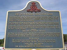
The Desjardins Canal, named after its promoter Pierre Desjardins, was a canal in Ontario, Canada. It was built to give the town of Dundas easier access to Lake Ontario and the Great Lakes system of North America. Although a technological achievement and a short term commercial success, the canal was soon eclipsed by the railway, and Dundas by neighbouring Hamilton.

<span class="mw-page-title-main">Hamilton Harbour</span> Bay in western Lake Ontario, Ontario, Canada

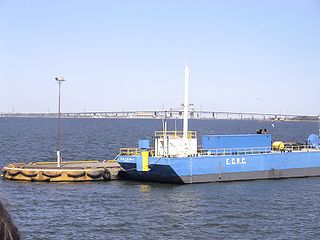
Hamilton Harbour lies on the western tip of Lake Ontario, bounded on the northwest by the City of Burlington, on the south by the City of Hamilton, and on the east by Hamilton Beach and Burlington Beach. It is joined to Cootes Paradise by a narrow channel formerly excavated for the Desjardins Canal. Within Hamilton itself, it is referred to as "Hamilton Harbour", "The Harbour" and "The Bay". The bay is naturally separated from Lake Ontario by a sand bar. The opening in the north end was filled in and channel cut in the middle for ships to pass. The Port of Hamilton is on the Hamilton side of the harbour.
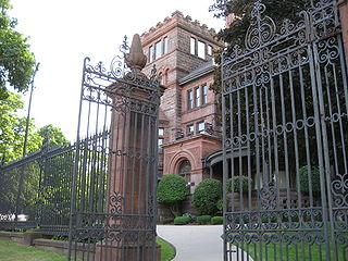
<span class="mw-page-title-main">Thomas McQuesten</span> Canadian politician

Thomas Baker McQuesten was a politician in Ontario, Canada. He was a Liberal member of the Legislative Assembly of Ontario from 1934 to 1943 who represented the riding of Hamilton—Wentworth. He served as a cabinet minister in the governments of Mitchell Hepburn and Gordon Conant.

<span class="mw-page-title-main">Westdale, Hamilton</span>

Westdale is a residential neighbourhood in Hamilton, Ontario, Canada. It is centred in the Westdale Village shopping district and located near McMaster University. It is bordered to the north by Cootes Paradise, an extensive nature reserve marking the western end of Lake Ontario, to the south by Main Street and Ainslie Wood, to the east by Highway 403, and to the west by McMaster University.

Cootes Paradise is a property with many boundaries, but is primarily a property of the Royal Botanical Gardens at the western end of Lake Ontario, but is also remnant of the larger 3700 acre Dundas Marsh Crown Game Preserve established by the Province of Ontario in 1927., dominated by a 4.5km long rivermouth wetland, representing the lake's western terminus. It is found on the west side of Hamilton Harbour and is located in the municipality of Hamilton, Ontario, Canada. Cootes Paradise Environmentally Sensitive Area is larger "core area" within the City of Hamilton's Natural Heritage System and has a very similar boundary to the original Dundas Crown Game Preserve.

Cootes Drive, formerly known as the Dundas Diversion, is a city street in Hamilton, Ontario. The route connects York Road and King Street in Dundas with Main Street to the southeast, and is considered one of the first divided highways in Canada. Originally constructed as the Dundas Diversion, the route served to bypass several sharp turns along the nearby Highway 8, as well as to demonstrate the new dual highway concept that would soon thereafter evolve into the 400-series highway network. Construction began in 1936, and the route opened on the weekend of September 11, 1937.

John Francis Moore was a lumber merchant and politician. He was mayor of Hamilton, Ontario in 1857. He was married twice, first to Jane Loughry, and secondly to Elizabeth Donnelly.

<span class="mw-page-title-main">Film industry in Hamilton, Ontario</span> Overview of the film industry in Hamilton, Ontario, Canada

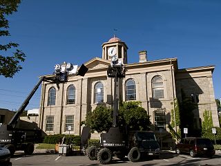
Hamilton, Ontario, Canada, has become a popular destination for the television and film industry, attracting dozens of film and television productions each year.

<span class="mw-page-title-main">Geography of Hamilton, Ontario</span>

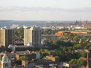
Hamilton is located on the western end of the Niagara Peninsula and wraps around the westernmost part of the Lake Ontario. Most of the city including the downtown section lies along the south shore. Situated in the geographic centre of the Golden Horseshoe, it lies roughly midway between Toronto and Buffalo. The two major physical features are Hamilton Harbour marking the northern limit of the city and the Niagara Escarpment running through the middle of the city across its entire breadth, bisecting the city into 'upper' and 'lower' parts.

<span class="mw-page-title-main">Culture of Hamilton, Ontario</span> Overview of the culture of Hamilton, Ontario (Canada)

Hamilton, Ontario's culture has built on its historical and social background. Some attractions include a museum of aircraft, HMCS Haida National Historic Site, historic naval ship; Canada's most famous warship and the last remaining Tribal Class in the world, a stately residence of a Prime Minister of Upper Canada, a functioning nuclear reactor at McMaster University, a horticultural haven, the Canadian Football Hall of Fame, African Lion Safari and Christ the King Cathedral.

<span class="mw-page-title-main">Queen Street, Hamilton, Ontario</span>

Queen Street is a Lower City arterial road in Hamilton, Ontario, Canada. It starts off at Beckett Drive, a mountain-access road in the city and is a two-way street up to King Street West and a one-way street (southbound) the rest of the way north up to the Canadian National Railway Yard, where the road turns right, merging with Stuart Street which travels in a west–east direction.

<span class="mw-page-title-main">York Boulevard</span>

York Boulevard is a Lower City arterial road in Hamilton, Ontario, Canada. Formerly known as Highway 2 and Highway 6, it starts in Burlington, Ontario, at Plains Road West as a two-way arterial road that wraps around and over Hamilton Harbour, enters the city of Hamilton in the west end at Dundurn Park, and ends at James Street North. It has a one-way section from Queen Street to Bay Street North, and continues east of James Street North as Wilson Street.)

<span class="mw-page-title-main">Burlington Heights (Ontario)</span> Promontory and peninsula between Hamilton and Burlington, Ontario, Canada

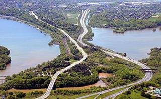
Burlington Heights refers to a promontory or area of flat land sitting elevated above the west end of Hamilton Harbour in the city of Hamilton, Ontario which continues as a peninsula to the north toward the city of Burlington, Ontario. It separates Cootes Paradise Marsh on the west from the harbor on the east. Geologically the Burlington Heights is a sand and gravel bar formed across the eastern end of the Dundas Valley by Glacial Lake Iroquois. It is the northern continuation of the longer Iroquois Bar which extends south into Hamilton.

<span class="mw-page-title-main">Runnymede, Toronto</span> Neighbourhood in Toronto, Ontario, Canada

Runnymede is a neighbourhood in Toronto, Ontario, Canada located north of Bloor Street West between Jane Street and Runnymede Road north to Dundas Street West. It is located directly north of the former village of Swansea and west of the High Park North neighbourhood. The immediate area around Bloor Street is commonly known as Bloor West Village after the shopping area along Bloor Street, whereas the area to the north is considered the Runnymede neighbourhood.

<span class="mw-page-title-main">Dundas Street</span> Major arterial road in Ontario, Canada

Dundas Street is a major historic arterial road in Ontario, Canada. The road connects the city of Toronto with its western suburbs and several cities in southwestern Ontario. Three provincial highways—2, 5, and 99—followed long sections of its course, although these highway segments have since been downloaded to the municipalities they passed through. Originally intended as a military route to connect the shipping port of York to the envisioned future capital of London, Ontario, the street today connects Toronto landmarks such as Yonge–Dundas Square and the city's principal Chinatown to rural villages and the regional centres of Hamilton and London.

References

  1. Manson, Bill (2003). Footsteps In Time: Exploring Hamilton's heritage neighbourhoods. North Shore Publishing Inc. ISBN   1-896899-22-6.
  2. "Ontario Architecture: Dundas". Ontarioarchitecture.com. Retrieved 2008-09-28.
  3. "Downtown Dundas: The Carnegie Gallery". Downtowndundas.ca. Archived from the original on 2009-03-03. Retrieved 2008-09-28.
  4. "Dundas Cactus Festival, (official site)". Archived from the original on 2008-08-17. Retrieved 2008-09-28.
  5. "Historical Dundas". Myhamilton.ca). Archived from the original on November 12, 2007. Retrieved 2008-09-28.
  6. "The Hamilton Spectator: City slaps long-closed DeLuxe Restaurant with notice". Thespec.com. Retrieved 2008-09-28.
  7. "Hollywood North Report: The West Wing Shooting in Dundas, Ontario". Hollywoodnorthreport.com. Retrieved 2008-09-28.
  8. "Internet Movie Database: Man of the Year". Imdb.com. Retrieved 2008-09-28.
  9. "Internet Movie Database: Molly, An American Girl on the Home Front". Imdb.com. Retrieved 2008-09-28.
  10. "Internet Movie Database: Closing the Ring". Imdb.com. Retrieved 2008-09-28.
  11. "Hamilton Neighbourhood Boundaries, (map.hamilton.ca)" (PDF). Archived from the original (PDF) on 2008-06-25. Retrieved 2008-09-28.