
Nedumangad is a municipal town in the Thiruvananthapuram district in the Indian state of Kerala. It is the headquarters of Nedumangad Tehsil and Nedumangad Revenue Division. It is a suburb of the extended metropolitan region of Thiruvananthapuram. It is located around 16 km (9.9 mi) to the north-east of Thiruvananthapuram on the State Highway 2. It is an important commercial center in the district. It is a growing commercial and educational hub and all important government institutions are situated in the town. The Nedumangadu market has significance in southern Kerala.

Kollam, also known by its former name Quilon, is an ancient seaport and city on the Malabar Coast of India bordering the Laccadive Sea, which is a part of the Arabian Sea. It is 71 km (44 mi) north of the state capital Thiruvananthapuram. The city is on the banks of Ashtamudi Lake and the Kallada river. Kollam is the fourth largest city in Kerala and is known for cashew processing and coir manufacturing. It is the southern gateway to the Backwaters of Kerala and is a prominent tourist destination. Kollam is one of the most historic cities with continuous settlements in India. Geographically, Quilon formation seen around coastal cliffs of Ashtamudi Lake, represent sediments laid down in the Kerala basin that existed during Mio-Pliocene times.
Paravur is a municipality in the Kollam district of Kerala, India. Paravur is located 11.6 km (7.2 mi) southeast of the Kollam city centre, and is a part of the Kollam metropolitan area. Paravur railway station is the last station in Kollam district which is on the route to Trivandrum while travelling towards South India.
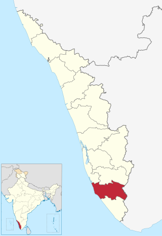
Kollam district, is one of 14 districts of the state of Kerala, India. The district has a cross-section of Kerala's natural attributes; it is endowed with a long coastline, a major Laccadive Sea seaport and an inland lake. The district has many water bodies. Kallada River is one among them, and land on the east bank of the river is East Kallada and that on the west bank is West Kallada.

Anchalumoodu is a town and neighbourhood of the city of Kollam, India. It is a historic town near the place, where the Peruman railway accident happened in 1988. Anchalumoodu is 8 km away from Kollam city, 26 km from Paravur and 8 km from Kundara town. College of Engineering, Perumon is very close to this place. Anchalumoodu was a part of Thrikkadavoor till 2015. In May 2015, Government of Kerala have decided to expand City Corporation of Kollam by merging Thrikkadavoor panchayath. Now Anchalumoodu along with Thrikkadavoor is a part of Kollam city.

Mayyanad is a village in Kollam district in the state of Kerala, India.

Eravipuram is a Neighbourhood of the city of Kollam in Kerala, India. It is one among the 6 zones of the Kollam City Corporation. Other zones of the city of Kollam are Central Zone-I, Central Zone-II, Sakthikulangara, Kilikollur and Vadakkevila.
Chandanathope is a town located in Kollam district, Kerala. It lies 23 kilometres (14 mi) from Paravur town and 8 kilometres (5.0 mi) from Kollam city centre on the Kollam–Thirumangalam National Highway 744. In Malayalam, the name denotes a place with sandalwood plantations. It is also known for cashew processing and its exports two major cashew exporters of Kollam namely VLC Cashews and MARK has their facilities in the town.
Hinduism, Islam and Christianity are the prominent religions in Kollam district. As per the Census 2011, out of the total population of 2,635,375 persons, 64.42% follow Hinduism, 19.30% follow Islam and 16.00% follow Christianity. Other religions comprise 0.04%, while 0.25% did not state any religion.

Punthalathazham is a landlocked neighbourhood of the city of Kollam in the Indian state of Kerala. It is located around six kilometres east of the core Kollam (Quilon) city towards Kannanalloor . This place has a little geographical importance and serves as the tail boundary of Kollam Municipal Corporation. Inhabitants belong to working and middle classes.
Sakthikulangara is a zone and neighbourhood situated at the coastal area of the city of Kollam in Kerala India. It is one among the 6 zonal headquarters of Kollam Municipal Corporation.

Paravur railway station(Code:PVU) is a railway station in the Indian municipal town of Paravur in Kollam district, Kerala. Paravur railway station falls under the Thiruvananthapuram railway division of the Southern Railway zone of Indian Railways. It is a 'NSG 5' class railway station coming under the Southern Railway zone.
Nedungolam or Nedumgolam is the Northern border town of Paravur municipality in the Kollam district of Kerala state, India. Nedungolam is very near to the world-famous-wetland in Kollam district, Polachira, which is a favorite destination for migratory birds. A census conducted on 2003 reveals that over 26,000 birds belonging to 37 species are visiting or living in the Polachira wetlands.

Kollam Metropolitan Area is the 4th largest Metropolis in Kerala and 14th largest urban agglomeration in South India. It is one of the 10 fastest growing cities in the world covering an area of 364.51 km2 (2015) with a 31.1% urban growth between 2015 and 2020 as per the survey conducted by Economist Intelligence Unit (EIU) based on urban area growth during January 2020.

Mayyanad railway station(Code: MYY) is an Indian railway station situated at Kollam, Kerala.

Transport in Kollam includes various modes of road, rail and water transportation in the city and its suburbs. State-owned Kerala State Road Transport Corporation buses, private buses, Indian Railways, state-owned Kerala State Water Transport Department boats & ferry, taxis and auto rickshaws are serving the city of Kollam. The city had a strong commercial reputation since the days of the Phoenicians and Romans. Ibn Battuta mentioned Kollam Port as one of the five Indian ports he had seen during the course of his twenty-four year travels.
Mulamkadakam or Mulangadakam/Mulamkadakom is a neighbourhood of Kollam (Quilon) city, India. It is situated at the northern region of the city. Mulamkadakam is the 7th ward of Kollam Municipal Corporation which is in Sakthikulangara zone of the city. Devi temple at Mulamkadakam is famous in the state. Kerala University's University Institute of Technology centre is situated at Mulamkadakam.
Valathungal or Valathumgal is a neighbourhood and suburb of Kollam city in the Indian state of Kerala. It is the 30th ward in Kollam Municipal Corporation. Valathungal is a fairly densely populated area of the city. Eravipuram railway station is very close to Valathungal.

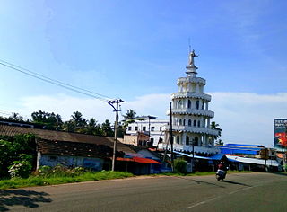
The Paravur Estuaries are a group of estuaries in Paravur, India, near the South-Western coast of Kollam district, Kerala. Paravur is one among the 4 municipal towns in Kollam district, Kerala state. The place is known for its natural beauties, backwater locations, white-sand beaches and concentration of temples.

Paravur Municipal Bus Stand or Paravur Private Bus Stand is the one and only bus stand in Paravur municipal town of Kollam district, Kerala. The bus stand construction project was implemented by the Municipal council of Paravur before some years.


