Mevaram | |
|---|---|
Neighbourhood | |
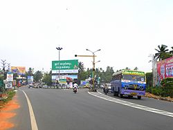 Kollam Bypass at Mevaram | |
 Mevaram Location in Kollam, India  Mevaram Mevaram (Kerala)  Mevaram Mevaram (India) | |
| Coordinates: 8°52′08″N76°38′37″E / 8.868936°N 76.643635°E | |
| Country | |
| City | Kollam |
| City Zone | Eravipuram |
| Government | |
| • Type | Council |
| • Body | Kollam Municipal Corporation, Mayyanad Panchayat |
| • MP | N.K Premachandran |
| • MLA | M.Noushad |
| Languages | |
| • Official | Malayalam, English |
| Time zone | UTC+5:30 (IST) |
| PIN | 691020 |
| Vehicle registration | KL-02 |
| Avg. summer temperature | 33 °C (91 °F) |
| Avg. winter temperature | 21 °C (70 °F) |
| Website | http://www.kollam.nic.in |
Mevaram, is a neighbourhood and a junction in the city of Kollam in the Indian state of Kerala. The Kollam Bypass, which forms part of National Highway-66, begins from Mevaram junction. [1] [2] Mevaram is located at the borders of Kollam Municipal Corporation. It is the southern tip of Kollam City.
