Kutleš Кутлеш | |
---|---|
Village | |
Coordinates: 43°08′N21°51′E / 43.133°N 21.850°E | |
Country | |
District | Jablanica District |
Municipality | Leskovac |
Population (2002) | |
• Total | 651 |
Time zone | CET (UTC+1) |
• Summer (DST) | CEST (UTC+2) |
Kutleš is a village in the municipality of Leskovac, Serbia. According to the 2002 census, the village has a population of 651 people. [1]
A village is a clustered human settlement or community, larger than a hamlet but smaller than a town, with a population ranging from a few hundred to a few thousand. Though villages are often located in rural areas, the term urban village is also applied to certain urban neighborhoods. Villages are normally permanent, with fixed dwellings; however, transient villages can occur. Further, the dwellings of a village are fairly close to one another, not scattered broadly over the landscape, as a dispersed settlement.
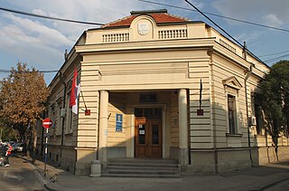
Leskovac is a city and the administrative center of the Jablanica District in southern Serbia. According to the 2011 census, the city urban area has 60,288 inhabitants, while the city administrative area has 144,206.
Serbia, officially the Republic of Serbia, is a country situated at the crossroads of Central and Southeast Europe in the southern Pannonian Plain and the central Balkans. The sovereign state borders Hungary to the north, Romania to the northeast, Bulgaria to the southeast, North Macedonia to the south, Croatia and Bosnia and Herzegovina to the west, and Montenegro to the southwest. The country claims a border with Albania through the disputed territory of Kosovo. Serbia's population is about seven million. Its capital, Belgrade, ranks among the oldest and largest citiеs in southeastern Europe.
Coțușca is a commune in Botoșani County, Romania. It is composed of nine villages: Avram Iancu, Cotu Miculinți, Coțușca, Crasnaleuca, Ghireni, Mihail Kogălniceanu, Nichiteni, Nicolae Bălcescu and Puțureni.
Schitu is a commune located in Giurgiu County, Romania. It is composed of four villages: Bila, Cămineasca, Schitu and Vlașin.
Karakoyun is an abandoned village in the Gegharkunik Province of Armenia.
Gighera is a commune in Dolj County, Romania with a population of 3,405 people. It is composed of three villages: Gighera, Nedeia and Zăval.
Vădăstrița is a commune in Olt County, Romania. It is composed of a single village, Vădăstrița.
Xuluf is a village in the municipality of Keçili in the Shamkir Rayon of Azerbaijan.
Imielno is a village in the administrative district of Gmina Zagórów, within Słupca County, Greater Poland Voivodeship, in west-central Poland. It lies approximately 5 kilometres (3 mi) south-west of Zagórów, 19 km (12 mi) south of Słupca, and 71 km (44 mi) south-east of the regional capital Poznań.
The village of Újcsanálos is located in the county of Borsod-Abaúj-Zemplén, in the Miskolc district, in the valley of the Hernád river, the same distance from Miskolc and Szerencs, which is part of the historic Zemplén county, including the Harangod region.
Zaovine is a village near the Zaovine Lake in the municipality of Bajina Bašta, Serbia. According to the 2002 census, the village has a population of 442 people.
Crkovnica is a village in the municipality of Leskovac, Serbia. According to the 2002 census, the village has a population of 133 people.
Draškovac is a village in the municipality of Leskovac, Serbia. According to the 2002 census, the village has a population of 791 people.
Jablanica is a village in the municipality of Boljevac, Serbia. According to the 2002 census, the village has a population of 435 people.
Dupci is a village in the municipality of Brus, Serbia. According to the 2002 census, the village has a population of 456 people.
Kovioci is a village in the municipality of Brus, Serbia. According to the 2002 census, the village has a population of 156 people.
Vapa is a village in the municipality of Čačak, Serbia. According to the 2011 census, the village has a population of 695 people.
Crasnencoe is a commune in the Rîbnița District of Transnistria, Moldova. It is composed of three villages: Crasnencoe, Dimitrova and Ivanovca. It is currently under the administration of the breakaway government of the Transnistrian Moldovan Republic.
Trešnjevica is a village in the municipality of Sjenica, Serbia. According to the 2002 census, the village has a population of 97 people.
Golemo Selo is a village in the municipality of Vranje, Serbia. According to the 2002 census, the village has a population of 1051 people.
Bunar is a village in the municipality of Jagodina, Serbia. According to the 2002 census, the village has a population of 495 people.
Tekija is a village in the municipality of Paraćin, Serbia. According to the 2002 census, the village has a population of 1251 people.
Coordinates: 43°08′N21°51′E / 43.133°N 21.850°E
A geographic coordinate system is a coordinate system that enables every location on Earth to be specified by a set of numbers, letters or symbols. The coordinates are often chosen such that one of the numbers represents a vertical position and two or three of the numbers represent a horizontal position; alternatively, a geographic position may be expressed in a combined three-dimensional Cartesian vector. A common choice of coordinates is latitude, longitude and elevation. To specify a location on a plane requires a map projection.
This Jablanica District, Serbia location article is a stub. You can help Wikipedia by expanding it. |