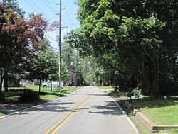
New Monmouth is an unincorporated community located within Middletown Township in Monmouth County, New Jersey, United States. The area is served as United States Postal Service ZIP code 07748.

New Lisbon is an unincorporated community located within Pemberton Township in Burlington County, New Jersey, United States. It is a settlement along Four Mile Road where it intersects Mount Misery Road. The community is located along the Philadelphia and Long Branch Railway, later a part of the Pennsylvania Railroad, and featured a train station.

Polhemustown is an unincorporated community located within Upper Freehold Township in Monmouth County, New Jersey, United States. The community is mostly made up of farmland with a few homes and businesses scattered around the area. Polhemustown is centered about the intersection of County Route 539, Polhemustown Road, and Holmes Mill Road.

Hedding is an unincorporated community located within Mansfield Township, in Burlington County, New Jersey, United States. From 1793–1813, the area was known as Bryant's Tavern after William Byrant of Brian the proprietor. In 1817, the name was changed to Three Tuns as a sign before the hostelry depicted three casks or tuns. In 1847, a church was built which was named Hedding Methodist Episcopal Church in honor of Elijah Hedding, a Bishop of this denomination. Three Tuns remained as the name of the area until 1920 when it was changed to Hedding, named after the church. The community itself is made up of single-family houses clustered around the main intersection in the settlement, Old York Road and Kinkora Road / Columbus Hedding Road ; the remainder of the area consists of farmland. Interstate 295 runs southeast of the community but no interchanges provide direct access to it.

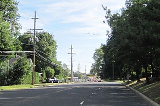
Pleasant Valley Crossroads is an unincorporated community located within Holmdel Township in Monmouth County, New Jersey, United States. Route 34 and County Route 520 are major roads in this area.

Prospertown is an unincorporated community located within the New Jersey townships of Jackson and Plumsted in Ocean County and Upper Freehold in Monmouth County. The community is home to Prospertown Lake and is adjacent to Six Flags Great Adventure, both located on County Route 537. The center of the community is located at the intersection of CR 537, Hawkin Road, and Emleys Hill Road. Most of the area consists of pine forests but there are some homes along the roads in the area.

Burrs Mill is an unincorporated community located within Southampton Township in Burlington County, New Jersey, United States. Found in a rural portion of the township near Route 70, it is located along its eponymous brook in a forested area within the Pine Barrens. A low density of houses surround nearby roads including Burrs Mill Road and Route 70's fire roads.

Harts Corner is an unincorporated community located within Hopewell Township in Mercer County, New Jersey, United States. The center of the settlement is located about the intersection of Washington Crossing-Pennington Road and Scotch Road. Three of the four quadrants of the intersection contain farmland and Hopewell Township Municipal Offices, township public works, and recreational facilities occupy the remaining quadrant.

Emleys Hill is an unincorporated community located within Upper Freehold Township in Monmouth County, New Jersey, United States. The settlement is located at the intersection of Emleys Hill Road and Burlington Path Road.

Cranbury Station is an unincorporated community located within Cranbury Township in Middlesex County, New Jersey, United States. The area immediately around the site of the former railroad station along the Camden and Amboy Railroad contains agricultural businesses and small homes. Hightstown-Cranbury Station Road is the main road through the settlement paralleling the railroad and Station Road, County Route 615 as a major road heading east and west through the area. Modern warehouses line Station Road and the nearby New Jersey Turnpike west of the station while large housing developments are located east of here in Monroe Township.

Snydertown is an unincorporated community located within East Amwell Township in Hunterdon County, New Jersey, United States. The settlement is located on the southern face of Sourland Mountain at the intersection of Linvale Road and Snydertown Road. In the past, a mill operated in Snydertown.
Half Acre is an unincorporated community located within Monroe Township in Middlesex County, New Jersey, United States. The settlement is located roughly at the intersection of Prospect Plains Road and Half Acre Road in the center of the township. Some single-family homes and small businesses are located along those two roads and Cranbury-Half Acre Road but most of the area is made up of age-restricted housing developments including Concordia, Clearbrook Park, Greenbriar at Whittingham, and Encore at Monroe.

Cooleys Corner is an unincorporated community located within Upper Freehold Township in Monmouth County, New Jersey, United States. The site of the settlement is within the Assunpink Wildlife Management Area, a New Jersey Department of Environmental Protection Division of Fish and Wildlife-operated preserved area in Monmouth and Mercer counties along the Assunpink Creek. Before the creation of the Assunpink Lake in the 1970s, the area consisted of farmland located at the intersection of Clarksburg Road and Imlaystown-Hightstown Road. Some farmland is still present in the area but is now mostly used by hunters. The main boat ramp to Assunpink Lake is located along the former Imlaystown-Hightstown Road.

Ely is an unincorporated community located within Millstone Township in Monmouth County, New Jersey, United States. The settlement is named for the Ely family that owned property in the area and operated the Charleston Springs hotel. Today, the settlement is located along Stage Coach Road, County Route 524, in the eastern portion of the township. Most of the area consists of large single-family homes though some farmland and the township-owned Brandywine Soccer Complex are located in the near the settlement.

Matthews is an unincorporated community located within Howell Township in Monmouth County, New Jersey, United States. The settlement is located on the western border of the township near Jackson Township, Ocean County and Interstate 195. It is located about the intersection of Hulses Corner Road and Fort Plains Road. The Howell side of the North Branch Metedeconk River is mainly rural with only a few houses located along the main surface roads while the Jackson side of the river is more suburbanized.

Mount Pleasant is an unincorporated community located within Marlboro Township in Monmouth County, New Jersey, United States. It is named for a hill of the same name, one of the highest points in Marlboro Township. The settlement is located at the intersection of Reids Hill Road and Beacon Hill Road.

Pullentown is an unincorporated community located within Upper Freehold Township in Monmouth County, New Jersey, United States. The settlement is located along County Route 526 east of Allentown and just west of its intersection with Sharon Station Road. The area contains mostly farmland with some homes and small businesses located along the road.

Red Valley is an unincorporated community located within Upper Freehold Township in Monmouth County, New Jersey, United States. The settlement is located at the intersection of County Route 526 and Red Valley Road (south) and Yellow Meetinghouse Road (north) near the township's eastern border with Millstone Township. Except for some single-family houses located along the roads in the area, the area is primarily made up of farmland.

Buttonwood Corners is an unincorporated community located within East Amwell Township in Hunterdon County, New Jersey, United States. Located along the ridge line of the Sourland Mountains, it consists of forested lands with homes dotted along the narrow roads that pass through the area.

Scotts Corner or Scotts Corners is an unincorporated community located within Plainsboro Township in Middlesex County, New Jersey, United States. The corner itself is located at the intersection of Scotts Corner Road and Dey Road in the eastern portion of the township. The area contains residential neighborhoods on all four quadrants of the intersection; an apartment complex comprises the southwestern corner of it while single-family housing developments are located in the other three corners.