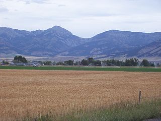
Yellowstone National Park, located primarily in the U.S. state of Wyoming, though the park also extends into Montana and Idaho and its Mountains and Mountain Ranges are part of the Rocky Mountains. There are at least 70 named mountain peaks over 8,000 feet (2,400 m) in Yellowstone in four mountain ranges. Two of the ranges—The Washburn Range and the Red Mountains—are minor and completely enclosed within park boundaries. The other two ranges are major, multi-state ranges that extend far beyond the boundaries of the park. The Gallatin Range begins approximately 75 miles (121 km) north of Yellowstone near Bozeman, Montana, and dominates the northwest corner of the park. The Absaroka Range, the largest range in the park, begins approximately 80 miles (130 km) north of the park near Livingston, Montana, along the Yellowstone River and runs southeast into, then south through the entire eastern side of the park to the Gros Ventre Range in Wyoming. The highest peak in the park, Eagle Peak is in the Absaroka Range. Yellowstone also has several isolated peaks over 8,000 feet (2,400 m) on the plateaus that dominate the central, western and southwestern sections of the park. [1]

