Miroševce | |
---|---|
Village | |
Coordinates: 42°51′56″N21°50′21″E / 42.86556°N 21.83917°E | |
Country | |
District | Jablanica District |
Municipality | Leskovac |
Population (2002) | |
• Total | 1,053 |
Time zone | CET (UTC+1) |
• Summer (DST) | CEST (UTC+2) |
Miroševce is a village in the municipality of Leskovac, Serbia. According to the 2002 census, the village has a population of 1053 people. [1]
A village is a clustered human settlement or community, larger than a hamlet but smaller than a town, with a population ranging from a few hundred to a few thousand. Though villages are often located in rural areas, the term urban village is also applied to certain urban neighborhoods. Villages are normally permanent, with fixed dwellings; however, transient villages can occur. Further, the dwellings of a village are fairly close to one another, not scattered broadly over the landscape, as a dispersed settlement.
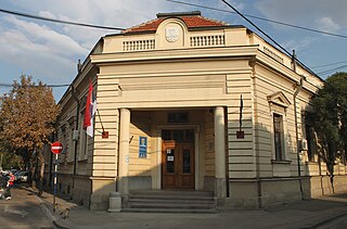
Leskovac is a city and the administrative center of the Jablanica District in southern Serbia. According to the 2011 census, the city urban area has 60,288 inhabitants, while the city administrative area has 144,206.
Serbia, officially the Republic of Serbia, is a country situated at the crossroads of Central and Southeast Europe in the southern Pannonian Plain and the central Balkans. The sovereign state borders Hungary to the north, Romania to the northeast, Bulgaria to the southeast, North Macedonia to the south, Croatia and Bosnia and Herzegovina to the west, and Montenegro to the southwest. The country claims a border with Albania through the disputed territory of Kosovo. Serbia's population is about seven million. Its capital, Belgrade, ranks among the oldest and largest citiеs in southeastern Europe.
Vrba may refer to:
Podgaj is a village in the administrative district of Gmina Aleksandrów Kujawski, within Aleksandrów County, Kuyavian-Pomeranian Voivodeship, in north-central Poland. It lies 6 kilometres (4 mi) south-west of Aleksandrów Kujawski and 22 km (14 mi) south of Toruń.
Kutakan, is a village in the Gegharkunik Province of Armenia. It has been known as Sultan Ali Kishlak and Gyunashli, and until 1968 as Janahmed. The Kutakan community also includes the nearby village of Zariver.
Rzędziany is a village in the administrative district of Gmina Tykocin, within Białystok County, Podlaskie Voivodeship, in north-eastern Poland. It lies approximately 9 kilometres (6 mi) south-east of Tykocin and 21 km (13 mi) west of the regional capital Białystok.
Siemianówka is a village in the administrative district of Gmina Narewka, within Hajnówka County, Podlaskie Voivodeship, in north-eastern Poland, close to the border with Belarus.
Qumlu is a village in the Gadabay Rayon of Azerbaijan.
Ximran is a village in the Ismailli Rayon of Azerbaijan. The village forms part of the municipality of Əhən.
Wyrębów is a village in the administrative district of Gmina Zadzim, within Poddębice County, Łódź Voivodeship, in central Poland. It lies approximately 8 kilometres (5 mi) north of Zadzim, 10 km (6 mi) south-west of Poddębice, and 42 km (26 mi) west of the regional capital Łódź.
Sulbiny Górne is a village in the administrative district of Gmina Garwolin, within Garwolin County, Masovian Voivodeship, in east-central Poland. It lies approximately 4 kilometres (2 mi) south of Garwolin and 59 km (37 mi) south-east of Warsaw.
Grzybowo is a village in the administrative district of Gmina Raciąż, within Płońsk County, Masovian Voivodeship, in east-central Poland.
Mierzyn is a village in the administrative district of Gmina Międzychód, within Międzychód County, Greater Poland Voivodeship, in west-central Poland. It lies approximately 5 kilometres (3 mi) north-west of Międzychód and 78 km (48 mi) west of the regional capital Poznań.
Mokre is a village in the administrative district of Gmina Czersk, within Chojnice County, Pomeranian Voivodeship, in northern Poland. It lies approximately 6 kilometres (4 mi) north of Czersk, 31 km (19 mi) north-east of Chojnice, and 74 km (46 mi) south-west of the regional capital Gdańsk.
Rychowo is a village in the administrative district of Gmina Białogard, within Białogard County, West Pomeranian Voivodeship, in north-western Poland. It lies approximately 12 kilometres (7 mi) south-west of Białogard and 102 km (63 mi) north-east of the regional capital Szczecin.
Fortuna Stadium is a multi-use stadium in Covaci, Timiş County. It is the home ground of Fortuna Covaci. It holds 1,500 people all on seats.
Perks Corner is an unincorporated community in El Dorado County, California. It is located 2.5 miles (4.0 km) west-southwest of Placerville, at an elevation of 1762 feet.
Choratice is a municipality and village in Benešov District in the Central Bohemian Region of the Czech Republic.
Kirderanna is a village in Saaremaa Parish, Saare County in western Estonia.
Lipova is a village in the municipality of Vrnjačka Banja, Serbia. According to the 2011 census, the village has a population of 985 people.
Do Palangu is a village in Bord Khun Rural District, Bord Khun District, Deyr County, Bushehr Province, Iran. At the 2006 census, its population was 55, in 13 families.
Coordinates: 42°51′56″N21°50′21″E / 42.86556°N 21.83917°E
A geographic coordinate system is a coordinate system that enables every location on Earth to be specified by a set of numbers, letters or symbols. The coordinates are often chosen such that one of the numbers represents a vertical position and two or three of the numbers represent a horizontal position; alternatively, a geographic position may be expressed in a combined three-dimensional Cartesian vector. A common choice of coordinates is latitude, longitude and elevation. To specify a location on a plane requires a map projection.
This Jablanica District, Serbia location article is a stub. You can help Wikipedia by expanding it. |