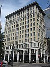
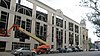
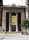
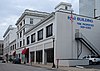
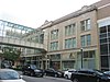
[3] Name on the Register Image Date listed [4] Location Description 1 Adath Jeshurun Temple and School Adath Jeshurun Temple and School January 28, 1982 (# 82002703 757 S. Brook St. 38°14′35″N 85°45′07″W / 38.243056°N 85.751944°W / 38.243056; -85.751944 (Adath Jeshurun Temple and School ) 2 Almsted Brothers Building Almsted Brothers Building March 1, 1982 (# 82002704 425 W. Market St. 38°15′20″N 85°45′29″W / 38.255556°N 85.757917°W / 38.255556; -85.757917 (Almsted Brothers Building ) 3 Ancient and Accepted Scottish Rite Temple Ancient and Accepted Scottish Rite Temple April 29, 1982 (# 82002705 200 E. Gray St. 38°14′48″N 85°45′04″W / 38.246667°N 85.751111°W / 38.246667; -85.751111 (Ancient and Accepted Scottish Rite Temple ) 4 Belle of Louisville (steamer) Belle of Louisville (steamer) April 10, 1972 (# 72000535 401 W. River Rd. 38°15′34″N 85°45′20″W / 38.259306°N 85.755556°W / 38.259306; -85.755556 (Belle of Louisville (steamer) 5 Bosler Fireproof Garage Bosler Fireproof Garage August 18, 1983 (# 83002639 423 S. 3rd St. 38°15′08″N 85°45′19″W / 38.252222°N 85.755278°W / 38.252222; -85.755278 (Bosler Fireproof Garage ) Later called the Morrissey Garage, the city of Louisville began demolition of the building April 11–12, 2015 [5] 6 Brandeis House Brandeis House March 1, 1984 (# 84001553 310 E. Broadway 38°14′42″N 85°44′57″W / 38.245000°N 85.749167°W / 38.245000; -85.749167 (Brandeis House ) 7 Breslin Building Breslin Building June 20, 2013 (# 83004589 305 W. Broadway 38°14′47″N 85°45′25″W / 38.246389°N 85.756944°W / 38.246389; -85.756944 (Breslin Building ) Originally nominated in 1983, but was initially denied due to owner objection. Objections were lifted in 2013. 8 Brown Hotel Building and Theater Brown Hotel Building and Theater February 17, 1978 (# 78001346 335 W. Broadway 38°14′47″N 85°45′29″W / 38.246389°N 85.758056°W / 38.246389; -85.758056 (Brown Hotel Building and Theater ) 9 J.T.S. Brown and Son's Complex J.T.S. Brown and Son's Complex December 10, 1998 (# 98001489 105, 107-109 W. Main St. 38°15′23″N 85°45′07″W / 38.256389°N 85.751944°W / 38.256389; -85.751944 (J.T.S. Brown and Son's Complex ) 10 The Business Women's Club The Business Women's Club February 7, 2008 (# 08000006 425 Muhammad Ali Boulevard 38°15′05″N 85°45′31″W / 38.251389°N 85.758611°W / 38.251389; -85.758611 (The Business Women's Club ) 11 Caperton Block Caperton Block July 12, 1984 (# 84001554 564-574 4th St. 38°14′57″N 85°45′29″W / 38.249167°N 85.758056°W / 38.249167; -85.758056 (Caperton Block ) 12 Cathedral of the Assumption Cathedral of the Assumption September 21, 1977 (# 77000623 443 S. 5th St. 38°15′07″N 85°45′31″W / 38.251944°N 85.758611°W / 38.251944; -85.758611 (Cathedral of the Assumption ) 13 Chestnut Street Methodist Church Chestnut Street Methodist Church July 16, 1979 (# 79001000 809 W. Chestnut St. 38°15′00″N 85°45′55″W / 38.250000°N 85.765278°W / 38.250000; -85.765278 (Chestnut Street Methodist Church ) 14 Christ Church Cathedral Christ Church Cathedral August 14, 1973 (# 73000807 421 S. 2nd St. 38°15′07″N 85°45′13″W / 38.251944°N 85.753611°W / 38.251944; -85.753611 (Christ Church Cathedral ) 15 The Cumberland The Cumberland March 14, 1996 (# 96000278 201 York St. 38°14′38″N 85°45′20″W / 38.243889°N 85.755556°W / 38.243889; -85.755556 (The Cumberland ) 16 J. Dolfinger and Company Building J. Dolfinger and Company Building December 21, 1990 (# 90001836 642 S. 4th St. 38°14′50″N 85°45′30″W / 38.247361°N 85.758333°W / 38.247361; -85.758333 (J. Dolfinger and Company Building ) 17 Electric Building Electric Building March 14, 1985 (# 85000558 619 S. 4th St. 38°14′54″N 85°45′28″W / 38.248250°N 85.757778°W / 38.248250; -85.757778 (Electric Building ) 18 Elks Athletic Club Elks Athletic Club July 16, 1979 (# 79001003 604 S. 3rd St. 38°14′55″N 85°45′23″W / 38.248611°N 85.756389°W / 38.248611; -85.756389 (Elks Athletic Club ) 19 Fifth Ward School Fifth Ward School March 31, 1978 (# 78001353 743 S. 5th St. 38°14′40″N 85°45′36″W / 38.244444°N 85.760000°W / 38.244444; -85.760000 (Fifth Ward School ) 20 First Lutheran Church First Lutheran Church October 29, 1982 (# 82001558 417 E. Broadway 38°14′44″N 85°44′48″W / 38.245556°N 85.746667°W / 38.245556; -85.746667 (First Lutheran Church ) 21 First National Bank-Kentucky Title Company Building First National Bank-Kentucky Title Company Building May 19, 1983 (# 83002664 214 S. 5th St. 38°15′18″N 85°45′32″W / 38.255000°N 85.758889°W / 38.255000; -85.758889 (First National Bank-Kentucky Title Company Building ) 22 German Bank Building German Bank Building October 11, 1984 (# 84000029 150 S. 5th St. 38°15′20″N 85°45′31″W / 38.255556°N 85.758611°W / 38.255556; -85.758611 (German Bank Building ) 23 German Insurance Bank German Insurance Bank March 14, 1985 (# 85000559 207 W. Market St. 38°15′19″N 85°45′14″W / 38.255278°N 85.753889°W / 38.255278; -85.753889 (German Insurance Bank ) 24 Hamilton Brothers Warehouse Hamilton Brothers Warehouse February 7, 2008 (# 08000007 125-127 W. Main St. 38°15′23″N 85°45′09″W / 38.256389°N 85.752500°W / 38.256389; -85.752500 (Hamilton Brothers Warehouse ) 25 Heyburn Building Heyburn Building July 16, 1979 (# 79001007 332 W. Broadway 38°14′45″N 85°45′29″W / 38.245833°N 85.758056°W / 38.245833; -85.758056 (Heyburn Building ) 26 House of Weller House of Weller September 26, 1979 (# 79001008 121 W. Main St. 38°15′23″N 85°45′09″W / 38.256389°N 85.752583°W / 38.256389; -85.752583 (House of Weller ) 27 Howard-Hardy House Howard-Hardy House November 9, 2004 (# 03000709 429 S. 2nd St. 38°15′06″N 85°45′14″W / 38.251667°N 85.753889°W / 38.251667; -85.753889 (Howard-Hardy House ) 28 E.L. Hughes Company Building Upload image August 4, 2016 (# 16000498 209 E. Main St. 38°15′21″N 85°44′58″W / 38.255857°N 85.749391°W / 38.255857; -85.749391 (E.L. Hughes Company Building ) 29 Inter-Southern Insurance Building Inter-Southern Insurance Building March 19, 1980 (# 80001605 239-247 S. 5th St. 38°15′15″N 85°45′30″W / 38.254167°N 85.758333°W / 38.254167; -85.758333 (Inter-Southern Insurance Building ) 30 Jefferson County Armory Jefferson County Armory March 24, 1980 (# 80001606 525 W. Muhammad Ali Boulevard 38°15′06″N 85°45′37″W / 38.251667°N 85.760278°W / 38.251667; -85.760278 (Jefferson County Armory ) 31 Jefferson County Courthouse Jefferson County Courthouse April 10, 1972 (# 72000537 527 W. Jefferson St. 38°15′16″N 85°45′34″W / 38.254444°N 85.759444°W / 38.254444; -85.759444 (Jefferson County Courthouse ) Now the Louisville Metro Hall, seat of government for all of Louisville and Jefferson County, Kentucky. 32 Jefferson County Courthouse Annex Jefferson County Courthouse Annex April 21, 1980 (# 80001607 517 Court Pl. 38°15′18″N 85°45′34″W / 38.255000°N 85.759444°W / 38.255000; -85.759444 (Jefferson County Courthouse Annex ) 33 Jefferson County Fiscal Court Building Upload image April 16, 2024 (# 100010228 531 Court Place 38°15′18″N 85°45′36″W / 38.2549°N 85.7599°W / 38.2549; -85.7599 (Jefferson County Fiscal Court Building ) 34 Jefferson County Jail Jefferson County Jail July 16, 1973 (# 73000808 514 W. Liberty St. 38°15′11″N 85°45′36″W / 38.253056°N 85.760000°W / 38.253056; -85.760000 (Jefferson County Jail ) 35 Haury Motor Company Showroom and Garage Upload image March 13, 2017 (# 100000739 741 S. 3rd St. 38°14′40″N 85°45′25″W / 38.244431°N 85.756931°W / 38.244431; -85.756931 (Haury Motor Company Showroom and Garage ) 36 Kaufman-Straus Building Kaufman-Straus Building February 14, 1978 (# 78001357 427-437 S. 4th St. 38°15′07″N 85°45′25″W / 38.251944°N 85.756944°W / 38.251944; -85.756944 (Kaufman-Straus Building ) 37 Keneseth Israel Synagogue Keneseth Israel Synagogue October 29, 1982 (# 82001559 232-236 E. Jacob St. 38°14′38″N 85°45′01″W / 38.243889°N 85.750278°W / 38.243889; -85.750278 (Keneseth Israel Synagogue ) 38 Kentucky National Bank Kentucky National Bank July 16, 1979 (# 79001010 300 W. Main St. 38°15′22″N 85°45′18″W / 38.256111°N 85.755000°W / 38.256111; -85.755000 (Kentucky National Bank ) 39 Kurfees Paint Company Kurfees Paint Company July 30, 2013 (# 13000560 201 E. Market St. 38°15′17″N 85°44′59″W / 38.254722°N 85.749722°W / 38.254722; -85.749722 (Kurfees Paint Company ) 40 Levy Brothers Building Levy Brothers Building March 24, 1978 (# 78001359 235 W. Market St. 38°15′19″N 85°45′18″W / 38.255278°N 85.755000°W / 38.255278; -85.755000 (Levy Brothers Building ) 41 Loew's and United Artists State Theatre Loew's and United Artists State Theatre March 28, 1978 (# 78001361 625 S. 4th St. 38°14′53″N 85°45′28″W / 38.248056°N 85.757778°W / 38.248056; -85.757778 (Loew's and United Artists State Theatre ) 42 Louisville City Hall Complex Louisville City Hall Complex September 1, 1976 (# 76000905 601, 603, 617 W. Jefferson St. 38°15′16″N 85°45′38″W / 38.254444°N 85.760556°W / 38.254444; -85.760556 (Louisville City Hall Complex ) 43 Louisville College of Dentistry Upload image July 28, 2022 (# 100007975 129 East Broadway 38°14′45″N 85°45′07″W / 38.2457°N 85.7519°W / 38.2457; -85.7519 (Louisville College of Dentistry ) 44 Louisville Free Public Library Louisville Free Public Library March 27, 1980 (# 80001608 301 W. York St. 38°14′40″N 85°45′28″W / 38.244444°N 85.757778°W / 38.244444; -85.757778 (Louisville Free Public Library ) 45 Louisville Grocery Company Building Louisville Grocery Company Building April 18, 2003 (# 03000258 231 E. Main St. 38°15′22″N 85°44′54″W / 38.256111°N 85.748333°W / 38.256111; -85.748333 (Louisville Grocery Company Building ) 46 Louisville Municipal Bridge, Pylons and Administration Building Louisville Municipal Bridge, Pylons and Administration Building March 8, 1984 (# 84001578 Spans the Ohio River between Louisville and Jeffersonville, IN 38°15′36″N 85°45′09″W / 38.260000°N 85.752500°W / 38.260000; -85.752500 (Louisville Municipal Bridge, Pylons and Administration Building ) Extends into Clark County, Indiana 47 Louisville Trust Building Louisville Trust Building April 18, 1977 (# 77000624 208 S. 5th St. 38°15′19″N 85°45′31″W / 38.255278°N 85.758611°W / 38.255278; -85.758611 (Louisville Trust Building ) 48 Madrid Building Madrid Building July 11, 1985 (# 85001509 545 S. 3rd St. 38°14′58″N 85°45′21″W / 38.249444°N 85.755833°W / 38.249444; -85.755833 (Madrid Building ) 49 Main Street District, Expanded Main Street District, Expanded April 1, 1980 (# 80001609 316, 320, 324 and 328 W. Main St. 38°15′23″N 85°45′22″W / 38.256389°N 85.756111°W / 38.256389; -85.756111 (Main Street District, Expanded ) 50 Marmaduke Building Marmaduke Building July 26, 1991 (# 91000921 520 S. 4th St. 38°15′02″N 85°45′28″W / 38.250417°N 85.757776°W / 38.250417; -85.757776 (Marmaduke Building ) 51 Mayor Andrew Broaddus Mayor Andrew Broaddus June 30, 1989 (# 89001446 401 W. River Rd. 38°15′34″N 85°45′18″W / 38.259306°N 85.755000°W / 38.259306; -85.755000 (Mayor Andrew Broaddus 52 Miller Paper Company Buildings Miller Paper Company Buildings February 11, 2011 (# 11000007 118-122 E. Main St. 38°15′21″N 85°45′02″W / 38.255833°N 85.750556°W / 38.255833; -85.750556 (Miller Paper Company Buildings ) 53 New Enterprise Tobacco Warehouse New Enterprise Tobacco Warehouse December 4, 1980 (# 80001611 925 W. Main St. 38°15′23″N 85°45′40″W / 38.256389°N 85.761111°W / 38.256389; -85.761111 (New Enterprise Tobacco Warehouse ) 54 Old Presbyterian Theological Seminary Old Presbyterian Theological Seminary March 24, 1978 (# 78001362 109 E. Broadway 38°14′46″N 85°45′10″W / 38.246111°N 85.752778°W / 38.246111; -85.752778 (Old Presbyterian Theological Seminary ) 55 Old U.S. Customshouse and Post Office and Fireproof Storage Company Warehouse Old U.S. Customshouse and Post Office and Fireproof Storage Company Warehouse November 23, 1977 (# 77000626 300-314 W. Liberty St. 38°15′10″N 85°45′21″W / 38.252833°N 85.755833°W / 38.252833; -85.755833 (Old U.S. Customshouse and Post Office and Fireproof Storage Company Warehouse ) Originally listed as the "Old U.S. Customshouse and Post Office"; warehouse added in a boundary increase of May 31, 1980 56 Pendennis Club Pendennis Club December 4, 2003 (# 03001225 218 W. Muhammad Ali Boulevard 38°15′02″N 85°45′18″W / 38.250556°N 85.755000°W / 38.250556; -85.755000 (Pendennis Club ) 57 Republic Building Republic Building August 12, 1982 (# 82002718 429 W. Muhammad Ali Boulevard 38°15′05″N 85°45′32″W / 38.251389°N 85.758889°W / 38.251389; -85.758889 (Republic Building ) 58 Ronald-Brennan House Ronald-Brennan House August 11, 1975 (# 75000774 631 S. 5th St. 38°14′53″N 85°45′34″W / 38.248056°N 85.759444°W / 38.248056; -85.759444 (Ronald-Brennan House ) 59 Rossmore Apartment House Rossmore Apartment House November 14, 1978 (# 78001365 22 Theater Sq. 38°14′50″N 85°45′31″W / 38.247222°N 85.758611°W / 38.247222; -85.758611 (Rossmore Apartment House ) 60 St. Paul's German Evangelical Church and Parish House St. Paul's German Evangelical Church and Parish House February 25, 1982 (# 82002724 213 E. Broadway 38°14′45″N 85°45′03″W / 38.245833°N 85.750833°W / 38.245833; -85.750833 (St. Paul's German Evangelical Church and Parish House ) 61 Savoy Historic District Savoy Historic District June 1, 1988 (# 88000188 209-221 W. Jefferson St. 38°15′14″N 85°45′16″W / 38.253889°N 85.754444°W / 38.253889; -85.754444 (Savoy Historic District ) 62 Sears, Roebuck and Company Store Sears, Roebuck and Company Store February 18, 1983 (# 83002729 800 W. Broadway 38°14′47″N 85°45′56″W / 38.246389°N 85.765556°W / 38.246389; -85.765556 (Sears, Roebuck and Company Store ) 63 Second and Market Streets Historic District Second and Market Streets Historic District March 17, 1988 (# 88000186 Second and Market Sts. [6] 38°15′19″N 85°45′15″W / 38.255278°N 85.754167°W / 38.255278; -85.754167 (Second and Market Streets Historic District ) 64 Seelbach Hotel Seelbach Hotel August 12, 1975 (# 75000775 500 S. 4th St. 38°15′03″N 85°45′28″W / 38.250833°N 85.757778°W / 38.250833; -85.757778 (Seelbach Hotel ) 65 Snead Manufacturing Building Snead Manufacturing Building August 1, 1978 (# 78001367 817 W. Market St. 38°15′23″N 85°45′52″W / 38.256389°N 85.764444°W / 38.256389; -85.764444 (Snead Manufacturing Building ) 66 South Central Bell Company Office Building South Central Bell Company Office Building December 3, 1980 (# 80001620 521 W. Chestnut St. 38°14′58″N 85°45′38″W / 38.249444°N 85.760556°W / 38.249444; -85.760556 (South Central Bell Company Office Building ) 67 Southern National Bank Southern National Bank August 12, 1971 (# 71000349 320 W. Main St. 38°15′23″N 85°45′21″W / 38.256389°N 85.755833°W / 38.256389; -85.755833 (Southern National Bank ) Also known as the Old Bank of Louisville; designated a National Historic Landmark on November 11, 1971 68 Speed Building Speed Building May 18, 1983 (# 83002737 319 Guthrie St. 38°15′00″N 85°45′24″W / 38.250000°N 85.756667°W / 38.250000; -85.756667 (Speed Building ) 69 Starks Building Starks Building July 11, 1985 (# 85001508 455 S. 4th St. 38°15′05″N 85°45′26″W / 38.251389°N 85.757222°W / 38.251389; -85.757222 (Starks Building ) 70 Steam Engine Company No. 2 Steam Engine Company No. 2 November 7, 1980 (# 80001625 617-621 W. Jefferson St. 38°15′16″N 85°45′41″W / 38.254444°N 85.761389°W / 38.254444; -85.761389 (Steam Engine Company No. 2 ) 71 Stewart's Dry Goods Company Building Stewart's Dry Goods Company Building August 12, 1982 (# 82002725 501 S. 4th St. 38°15′03″N 85°45′26″W / 38.250833°N 85.757222°W / 38.250833; -85.757222 (Stewart's Dry Goods Company Building ) 72 W.K. Stewart Bookstore W.K. Stewart Bookstore March 24, 2003 (# 02001469 550 S. 4th St. 38°14′59″N 85°45′29″W / 38.249639°N 85.758056°W / 38.249639; -85.758056 (W.K. Stewart Bookstore ) 73 Theater Building Theater Building August 12, 1982 (# 82002726 625-633 S. 4th St. 38°14′52″N 85°45′28″W / 38.247778°N 85.757778°W / 38.247778; -85.757778 (Theater Building ) 74 Third and Jefferson Streets Historic District Third and Jefferson Streets Historic District March 17, 1988 (# 88000190 301-317 S. 3rd St. and 232-244 Jefferson St. 38°15′12″N 85°45′18″W / 38.253333°N 85.755000°W / 38.253333; -85.755000 (Third and Jefferson Streets Historic District ) 75 Third and Market Streets Historic District Third and Market Streets Historic District March 17, 1988 (# 88000187 201-219 S. 3rd St. and 224-240 W. Market St. 38°15′17″N 85°45′18″W / 38.254722°N 85.755000°W / 38.254722; -85.755000 (Third and Market Streets Historic District ) 76 Trade Mart Building Trade Mart Building May 25, 1973 (# 73000811 131 W. Main St. 38°15′23″N 85°45′11″W / 38.256389°N 85.753056°W / 38.256389; -85.753056 (Trade Mart Building ) 77 Tyler Hotel Tyler Hotel March 17, 1988 (# 88000189 229-245 W. Jefferson St. 38°15′14″N 85°45′18″W / 38.253889°N 85.755000°W / 38.253889; -85.755000 (Tyler Hotel ) 78 Tyler-Muldoon House Tyler-Muldoon House July 20, 1977 (# 77000629 132 E. Gray St. 38°14′48″N 85°45′06″W / 38.246667°N 85.751667°W / 38.246667; -85.751667 (Tyler-Muldoon House ) 79 United States Post Office, Court House and Custom House United States Post Office, Court House and Custom House March 18, 1999 (# 99000334 601 W. Broadway 38°14′48″N 85°45′45″W / 38.246667°N 85.762500°W / 38.246667; -85.762500 (United States Post Office, Court House and Custom House ) 80 University of Louisville School of Medicine University of Louisville School of Medicine July 30, 1975 (# 75000778 101 W. Chestnut St. 38°14′55″N 85°45′12″W / 38.248611°N 85.753333°W / 38.248611; -85.753333 (University of Louisville School of Medicine ) 81 Walnut Street Theater Walnut Street Theater September 1, 1978 (# 78001370 416 W. Muhammad Ali Boulevard 38°15′04″N 85°45′31″W / 38.251111°N 85.758611°W / 38.251111; -85.758611 (Walnut Street Theater ) 82 Weissinger-Gaulbert Apartments Weissinger-Gaulbert Apartments December 12, 1977 (# 77000630 709 S. 3rd St. 38°14′44″N 85°45′24″W / 38.245556°N 85.756667°W / 38.245556; -85.756667 (Weissinger-Gaulbert Apartments ) 83 West Main Street Historic District West Main Street Historic District March 22, 1974 (# 74000884 W. Main St.; specifically the 600-800 blocks of W. Main St. and the south side of the 500 block 38°15′26″N 85°45′44″W / 38.257222°N 85.762222°W / 38.257222; -85.762222 (West Main Street Historic District ) Specific addresses represent a boundary increase of March 27, 1980 84 Whiskey Row Historic District Whiskey Row Historic District June 4, 2010 (# 89000385 101-133 W. Main St. 38°15′23″N 85°45′09″W / 38.256389°N 85.752500°W / 38.256389; -85.752500 (Whiskey Row Historic District ) 85 Wright and Taylor Building Wright and Taylor Building November 15, 1984 (# 84000383 611-617 S. 4th St. 38°14′54″N 85°45′28″W / 38.248472°N 85.757778°W / 38.248472; -85.757778 (Wright and Taylor Building ) 86 Y.M.C.A. Building Y.M.C.A. Building December 16, 1977 (# 77000631 227-229 W. Broadway 38°14′46″N 85°45′23″W / 38.246111°N 85.756389°W / 38.246111; -85.756389 (Y.M.C.A. Building )