O'Connell River

Last updated

O'Connell
Australia Queensland relief location map.jpg
Red pog.svg
Location of O'Connell river mouth in Queensland
Location
Country Australia
State Queensland
Region North Queensland
Physical characteristics
Source 
  locationClarke Range (Yalboroo)
  coordinates 20°56′31″S148°39′00″E / 20.94181°S 148.65003°E / -20.94181; 148.65003
  elevation410 m (1,350 ft)
Mouth Coral Sea
  location
Lethebrook, Whitsunday Region / Bloomsbury, Mackay Region
  coordinates
20°34′06″S148°40′00″E / 20.56833°S 148.66667°E / -20.56833; 148.66667
  elevation
0 m (0 ft)
Length34.2 km (21.3 mi) [1]
Basin size886.5 km2 (342.3 sq mi) [2]
Discharge 
  locationNear mouth
  average15.75 m3/s (497 GL/a) [2]
Basin features
Tributaries 
  leftCeadar Creek, Boundary Creek, Dingo Creek, Andromache
  rightHorse Creek, Plantain Creek, Gibson Creek, Dinner Creek
[3]

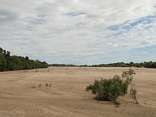
The O'Connell River is a river in North Queensland, Australia. [4] [5]

The headwaters of the river rise in the Clarke Range, just north of the Eungella National Park. It flows north parallel with the Bruce Highway, then discharges into the Repulse Fish Habitat area near Covering Beach and onto the Coral Sea. [5]

The river has a catchment area of 2,388 square kilometres (922 sq mi), of which 128 km2 (49 sq mi) is composed of estuarine wetlands. [6]

See also

Related Research Articles

<span class="mw-page-title-main">Coomera River</span> River in Queensland, Australia

The Coomera River is a perennial river in the South East region of Queensland, Australia. Its catchment lies within the Gold Coast and Scenic Rim Region local government areas and covers an area of 489 square kilometres (189 sq mi).

<span class="mw-page-title-main">Gilbert River (Queensland)</span> River in Queensland, Australia

The Gilbert River is located in Far North Queensland, Australia. When combined with the Einasleigh River, the river system is the largest river system in northern Australia.

The Edward River is a river in Far North Queensland, Australia.

<span class="mw-page-title-main">Boyne River (Central Queensland)</span> River in Queensland, Australia

The Boyne River is a river in Central Queensland, Australia.

<span class="mw-page-title-main">Bohle River</span> River in Queensland, Australia

The Bohle River is a river in North Queensland, Australia.

The Black River is a river in North Queensland, Australia.

The Haughton River is a river in North Queensland, Australia.

The Burrum River is a river in the Wide Bay-Burnett region of Queensland, Australia.

The Waterpark Creek is a creek in Central Queensland, Australia.

The Barratta Creek is a creek in North Queensland, Australia.

<span class="mw-page-title-main">Bowen River (Queensland)</span> River in Queensland, Australia

The Bowen River is a river in North Queensland, Australia.

The Hann River is a river in Far North Queensland, Australia.

The Isaac River is a river and anabranch in Central Queensland, Australia.

The Jeannie River is a river in Far North Queensland, Australia.

The Kendall River is a river in Far North Queensland, Australia.

<span class="mw-page-title-main">Lockhart River (Queensland)</span> River in Queensland, Australia

The Lockhart River is a river in Queensland, Australia.

The Mcdonald River, also known as the Macdonald River and locally as the Collett River, is a river in Far North Queensland, Australia.

<span class="mw-page-title-main">Mossman River</span> River in Far North Queensland, Australia

The Mossman River is a river in lower Cape York Peninsula, Queensland, Australia.

The Olive River is a river in the Cape York Peninsula of Far North Queensland, Australia.

The Stewart River is a river in the Cape York Peninsula of Far North Queensland, Australia.

References

  1. "Map of O'Connell River, QLD".
  2. 1 2 "East Coastal Watersheds".
  3. "Map of O'Connell River". Bonzle Digital Atlas of Australia. Retrieved 31 July 2015.
  4. "O'Connell River – watercourse in the Whitsunday Region (entry 24954)". Queensland Place Names. Queensland Government . Retrieved 26 December 2024.
  5. 1 2 "Layers: Locality; Mountains and ranges; Contours; Watercourses; Road and rail". Queensland Globe. Queensland Government . Retrieved 26 December 2024.
  6. "O'Connell River drainage basin". WetlandInfo. Queensland Government . Retrieved 31 July 2015.