


The following outline is provided as an overview of and topical guide to Myanmar:
Contents
- General reference
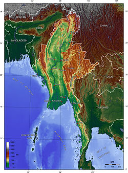
- Geography of Myanmar
- Environment of Myanmar
- Regions of Myanmar
- Demography of Myanmar
- Government and politics of Myanmar
- Branches of government
- Foreign relations of Myanmar
- Law and order in Myanmar
- Military of Myanmar
- Local government in Myanmar
- History of Myanmar
- Culture of Myanmar
- Art in Myanmar
- Sports in Myanmar
- Economy and infrastructure of Myanmar
- Education in Myanmar
- Health in Myanmar
- See also
- References
- External links
Myanmar , also known as Burma, is the most extensive country in mainland Southeast Asia. [1] The country is bordered by the People's Republic of China on the northeast, Laos on the east, Thailand on the southeast, Bangladesh on the west, and India on the northwest, with the Bay of Bengal to the southwest. One-third of Burma's total perimeter, 1,930 kilometers (1,199 mi), forms an uninterrupted coastline. The country's culture, heavily influenced by neighbours, is based on Theravada Buddhism intertwined with local elements.