Bunbury is a coastal city in the Australian state of Western Australia, approximately 175 kilometres (109 mi) south of the state capital, Perth. It is the state's third most populous city after Perth and Mandurah, with a population of approximately 75,000.

Yokine is a suburb of Perth, Western Australia. Its local government area is the City of Stirling.

Roleystone is a suburb of Perth, Western Australia in the south eastern corridor.

Harvey is a town located in the South West of Western Australia along the South Western Highway, 140 kilometres (87 mi) south of Perth, between Pinjarra and Bunbury. It has a population of 2,750. Harvey Town is known for its dairy industry and oranges.

Burswood is an inner southeastern suburb of Perth, Western Australia, located immediately across the Swan River from Perth's central business district (CBD). Its local government area is the Town of Victoria Park. Burswood is the location of the State Tennis Centre, Perth Stadium, Belmont Park Racecourse, and the Crown Perth casino and hotel complex.

South Western Highway is a highway in the South West region of Western Australia connecting Perth's southeast with Walpole. It is a part of the Highway 1 network for most of its length. It is about 406 kilometres (252 mi) long.

Australind is a town in Western Australia, located 12 km north-east of Bunbury's central business district. Its local government area is the Shire of Harvey. At the 2016 census, Australind had a population of 14,539.
Mitchell was an electoral district of the Legislative Assembly in the Australian state of Western Australia. It existed from 1983 to 2005 and, under the name Leschenault, continued until 2008.

Leschenault is an outer suburb of Bunbury, Western Australia 16 km to the north-east. Its local government area is the Shire of Harvey. Leschenault is generally considered to be a higher socioeconomic area, with higher than average real estate prices.
Millbridge is a northeastern suburb of Bunbury, Western Australia, adjoining Eaton 9 km from the centre of Bunbury. At the 2021 census, it had a population of 2,736. Its local government area is the Shire of Dardanup.

East Bunbury is an inner southeastern suburb of Bunbury, Western Australia 4 kilometres (2.5 mi) from the centre of Bunbury. It is located within the local government area of the City of Bunbury.

The City of Bunbury is a local government area in the South West region of Western Australia, covering an area of 65.7 square kilometres (25.4 sq mi) along the coast about 180 kilometres (112 mi) south of Perth, the capital of Western Australia. The City of Bunbury is one of four local governments comprising the Greater Bunbury sub-region. As at the 2016 Census, the City of Bunbury had an estimated population of almost 32,000.

Sanctuary Cove is a gated community and town in the suburb of Hope Island in the City of Gold Coast, Queensland, Australia. It is completely self-contained residential environment with its own shopping centre and entertainment facilities, with the addition of many of the facilities of a holiday resort, such as boating marinas and golf courses. It was the second of such developments in Australia and is notable for its impact in planning legislation in Queensland to allow it to proceed.

The Old Bunbury railway station was the main railway station for Bunbury from 1894 until 1996. It was the terminus for the Australind passenger railway service from Perth. It was replaced in May 1985 by the current Bunbury Terminal in East Bunbury.
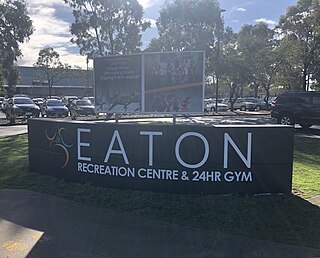
Eaton is a northeastern suburb of Bunbury, Western Australia, 7 km from the centre of Bunbury on the south shore of the Collie River. Its local government area is the Shire of Dardanup, and the offices for the Shire are located within the suburb. Eaton contains a state high school, Eaton Community College, and two state primary schools, Eaton and Glen Huon. The suburb also contains a shopping centre called Eaton Fair, as well as a sporting complex led by Eaton Recreation Centre.

Dalyellup,, is an outer northern suburb of the Shire of Capel local government area. The suburb was established in 1999 when the Department of Housing and Works entered into a joint venture with Satterley Property Group to develop Dalyellup Beach Estate, a master-planned community which was expected to yield 3,000 lots by its completion in 2012.

Cockburn Central is a suburb of Perth, the capital city of Western Australia, and is 24 kilometres (15 mi) south of Perth's central business district (CBD) along the Kwinana Freeway. Its local government area is the City of Cockburn, and it is intended by the Government to serve as a regional centre for the area. It was approved as a name by the Geographic Names Committee in 2007.

Forrest Highway is a 95-kilometre-long (59 mi) highway in Western Australia's Peel and South West regions, extending Perth's Kwinana Freeway from east of Mandurah down to Bunbury. Old Coast Road was the original Mandurah–Bunbury route, dating back to the 1840s. Part of that road, and the Australind Bypass around Australind and Eaton, were subsumed by Forrest Highway. The highway begins at Kwinana Freeway's southern terminus in Ravenswood, continues around the Peel Inlet to Lake Clifton, and heads south to finish at Bunbury's Eelup Roundabout. There are a number of at-grade intersections with minor roads in the shires of Murray, Waroona, and Harvey including Greenlands Road and Old Bunbury Road, both of which connect to South Western Highway near Pinjarra.
Kings Cross Centre is a shopping centre in Kings Cross, a locality in the inner-city suburb of Potts Point. It is located underneath the Coca-Cola billboard and Zenith residential apartments.


