
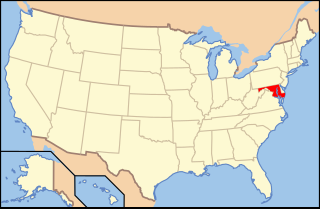
The Chesapeake Bay is an estuary in the U.S. states of Maryland and Virginia. The Bay is located in the Mid-Atlantic region and is primarily separated from the Atlantic Ocean by the Delmarva Peninsula with its mouth located between Cape Henry and Cape Charles. With its northern portion in Maryland and the southern part in Virginia, the Chesapeake Bay is a very important feature for the ecology and economy of those two states, as well as others. More than 150 major rivers and streams flow into the Bay's 64,299-square-mile (166,534 km2) drainage basin, which covers parts of six states and all of Washington, D.C.

The Delmarva Peninsula, or simply Delmarva, is a large peninsula on the East Coast of the United States, occupied by Delaware and parts of the Eastern Shores of Maryland and Virginia. The peninsula is 170 miles (274 km) long. In width, it ranges from 70 miles (113 km) near its center, to 12 miles (19 km) at the isthmus on its northern edge, to less near its southern tip of Cape Charles. It is bordered by the Chesapeake Bay on the west, the Delaware River, Delaware Bay, and the Atlantic Ocean on the east, and the Elk River and its isthmus on the north.

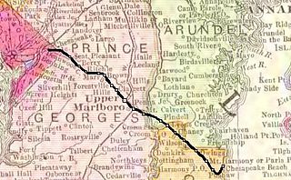
Somerset County is the southernmost county in the U.S. state of Maryland. As of the 2010 census, the population was 26,470. making it the second-least populous county in Maryland. The county seat is Princess Anne.

Cecil Calvert, 2nd Baron Baltimore, was an English nobleman who was the first Proprietor of the Province of Maryland, ninth Proprietary Governor of the Colony of Newfoundland and second of the colony of Province of Avalon to its southeast. His title was "First Lord Proprietary, Earl Palatine of the Provinces of Maryland and Avalon in America". He received the proprietorship after the death of his father, George Calvert, 1st Baron Baltimore,, for whom it had been intended. Cecil Calvert established and managed the Province of Maryland from his home, Kiplin Hall, in North Yorkshire, England. As an English Roman Catholic, he continued the legacy of his father by promoting religious tolerance in the colony.

The Patuxent River is a tributary of the Chesapeake Bay in the state of Maryland. There are three main river drainages for central Maryland: the Potomac River to the west passing through Washington, D.C., the Patapsco River to the northeast passing through Baltimore, and the Patuxent River between the two. The 908-square-mile (2,352 km2) Patuxent watershed had a rapidly growing population of 590,769 in 2000. It is the largest and longest river entirely within Maryland, and its watershed is the largest completely within the state.

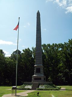
The Province of Maryland was an English and later British colony in North America that existed from 1632 until 1776, when it joined the other twelve of the Thirteen Colonies in rebellion against Great Britain and became the U.S. state of Maryland. Its first settlement and capital was St. Mary's City, in the southern end of St. Mary's County, which is a peninsula in the Chesapeake Bay and is also bordered by four tidal rivers.

The Eastern Shore of Maryland is a part of the U.S. state of Maryland that lies predominantly on the east side of the Chesapeake Bay and consists of nine counties. As of the 2010 census, its population was 449,226, with just under 8 percent of Marylanders living in the region. The term "Eastern Shore" distinguishes a territorial part of the State of Maryland from the Western Shore of Maryland, land west of the Chesapeake Bay.

Southern Maryland in popular usage is composed of the state's southernmost counties on the "Western Shore" of the Chesapeake Bay in the state of Maryland. This region includes all of Calvert, Charles, and St. Mary's counties and sometimes the southern portions of Anne Arundel and Prince George's counties.

Kent Island is the largest island in the Chesapeake Bay and an historic place in Maryland. To the east, a narrow channel known as the Kent Narrows barely separates the island from the Delmarva Peninsula, and on the other side, the island is separated from Sandy Point, an area near Annapolis, by roughly four miles (6.4 km) of water. At only four miles wide, the main waterway of the bay is at its narrowest at this point and is spanned here by the Chesapeake Bay Bridge. The Chester River runs to the north of the island and empties into the Chesapeake Bay at Kent Island's Love Point. To the south of the island lies Eastern Bay. The United States Census Bureau reports that the island has 31.62 square miles (81.90 km2) of land area.

The recorded history of Maryland dates back to the beginning of European exploration, starting with the Venetian John Cabot, who explored the coast of North America for the Kingdom of England in 1498. After European settlements had been made to the south and north, the colonial Province of Maryland was granted by King Charles I to Sir George Calvert (1579–1632), his former Secretary of State in 1632, for settlement beginning in March 1634. It was notable for having been established with religious freedom for Roman Catholics, since Calvert had publicly converted to that faith. Like other colonies and settlements of the Chesapeake Bay region, its economy was soon based on tobacco as a commodity crop, highly prized among the English, cultivated primarily by African slave labor, although many young people came from Britain sent as indentured servants or criminal prisoners in the early years.
Point Lookout State Park is a Maryland state park occupying Point Lookout, the southernmost tip of a peninsula formed by the confluence of Chesapeake Bay and the Potomac River in St. Mary's County, Maryland. The state park preserves the site of an American Civil War prisoner of war camp and the Point Lookout Light, which was built in 1830. It is the southernmost spot on Maryland's western shore, the coastal region on the western side of the Chesapeake Bay.
Maryland's Western Shore is an area of Maryland west of the Chesapeake Bay. Originally, it included all areas not on the Eastern Shore and some colonial and later state government functions were administered separately for each region. The term no longer identifies an official region of Maryland and is used in contrast to the "Eastern Shore", also known as the "Delmarva" peninsula separated from the Maryland northeast corner of mainland with northern Delaware in the north by the Chesapeake and Delaware Canal, heavily used by transiting cargo ships along the major East Coast port cities.

Andrew White was an English Jesuit missionary who was involved in the founding of the Maryland colony. He was a chronicler of the early colony, and his writings are a primary source on the land, the Native Americans of the area, and the Jesuit mission in North America. For his efforts in converting and educating the native population, he is frequently referred to as the "Apostle of Maryland." He is considered a forefather of Georgetown University, and is memorialized in the name of its White-Gravenor building, a central location of offices and classrooms on the university's campus.
Maryland wine is wine made in the U.S. state of Maryland. The industry has grown rapidly since the first winery in Maryland, Boordy Vineyards, opened in 1945. It is estimated that the industry contributes $50 million annually to the Maryland economy.
The demographics of Virginia are the various elements used to describe the population of the Commonwealth of Virginia and are studied by various government and non-government organizations. Virginia is the 12th-most populous state in the United States with over 8 million residents and is the 35th largest in area.
The Chesapeake Beach Railway (CBR), now defunct, was an American railroad of southern Maryland and Washington, DC built in the 19th century. The CBR ran 27.629 miles from Washington, D.C. on tracks formerly owned by the Southern Maryland Railroad and then on its own single track through Maryland farm country to a resort at Chesapeake Beach. It was built by Otto Mears, a Colorado railroad builder, who planned a shoreline resort with railroad service from Washington and Baltimore. It served Washington and Chesapeake Beach for almost 35 years, but the Great Depression and the rise of the automobile marked the end of the CBR. The last train left the station on April 15, 1935. Parts of the right-of-way are now used for roads and a future rail trail.

Maryland Route 261 is a state highway in the U.S. state of Maryland. The highway runs 12.86 miles (20.70 km) from MD 263 near Parran north to MD 778 at Friendship. MD 261 connects Prince Frederick with and serves as the main street through the Chesapeake Bay beach communities of Chesapeake Beach and North Beach in northeastern Calvert County and Rose Haven in southeastern Anne Arundel County. The highway was constructed from north of its present terminus through Chesapeake Beach in the early 1930s. The road was built as MD 613 east from Friendship in the mid-1930s and extended east to Rose Haven in the late 1940s. MD 261 was extended south to its present terminus near Parran and north through North Beach to Rose Haven in the mid-1950s. MD 261 took over MD 613 west to Friendship in the early 1960s.
The history of the Native Americans in Baltimore and what is now Baltimore dates back at least 12,000 years. As of 2014, Baltimore is home to a small Native American population centered in East Baltimore. The majority of the Native Americans now living in Baltimore belong to the Lumbee, Piscataway, and Cherokee tribes. The Piscataway tribe is indigenous to Southern Maryland, living in the area for centuries prior to European colonization. The Lumbee and Cherokee are indigenous to North Carolina and neighboring states of the Southeastern United States. Many of the Lumbee and Cherokee migrated to Baltimore during the mid-1900s along with other migrants from the South, such as African-Americans and white Appalachians.

The Baltimore Chesapeake and Atlantic railroad, nicknamed Black Cinders & Ashes, ran from Baltimore, Maryland to Ocean City, Maryland consisting of 87 miles (140.0 km) of center-line track and 15.6 miles (25.11 km) of sidings. Chartered in 1886, the railroad started construction in 1889 and cost $2.356 million ($2019=65,697,000).


