
Bannock Peak is a 10,329-foot (3,148-metre) mountain summit in the southern section of the Gallatin Range in Yellowstone National Park, in the U.S. state of Wyoming. The peak ranks as the sixth-highest peak in the Gallatin Range. Precipitation runoff from the mountain drains west into headwaters of the Gallatin River and east into Panther Creek which is a tributary of the Gardner River. Topographic relief is significant as the summit rises nearly 2,000 feet above Panther Creek in one mile (1.6 km). This mountain's toponym was officially adopted in 1897 by the United States Board on Geographic Names.

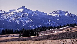
Pilot Peak, elevation 11,699 feet (3,566 m), is a prominent mountain peak in the Absaroka Range in Park County, Wyoming. The peak is visible from US Route 212, the Beartooth Highway just east of the Northeast Entrance Station to Yellowstone National Park. Index Peak rises just north of Pilot Peak.

Amphitheater Mountain is a prominent 11,042-foot-elevation (3,366-meter) mountain summit located in Park County, Wyoming, United States.

Cutoff Mountain is a 10,695-foot (3,260-metre) mountain summit located in Park County, Montana.
Pollux Peak is an 11,063-foot-elevation (3,372-meter) mountain summit located in Yellowstone National Park, in Park County, Wyoming, United States.

Saddle Mountain is a 10,670-foot-elevation (3,250-meter) mountain summit located in Yellowstone National Park, in Park County, Wyoming, United States.

Top Notch Peak is a 10,245-foot-elevation (3,123 meter) mountain summit located in Yellowstone National Park, in Park County, Wyoming, United States.
Silvertip Peak is a 10,645-foot-elevation (3,245-meter) mountain summit located in Park County, Wyoming, United States.

Wolf Mountain is an 11,808-foot (3,599-metre) mountain summit located in Park County, Montana.

Hoodoo Peak is a 10,571-foot-elevation (3,222-meter) mountain summit located in Park County, Wyoming, United States.

Black Mountain is a 10,941-foot (3,335-metre) summit located in Park County, Montana, United States.

Pinnacle Buttes is an 11,516-foot-elevation (3,510-meter) mountain summit located in Fremont County, Wyoming, United States.
Jim Mountain is a 10,430-foot-elevation (3,179-meter) summit in Park County, Wyoming, United States.

Sheep Mountain is a 10,608-foot (3,233-metre) summit in Park County, Montana, United States.

Indian Peak is a 10,929-foot-elevation (3,331-meter) mountain summit in Park County, Wyoming, United States.

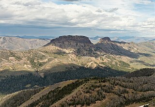
Hurricane Mesa is an 11,069-foot-elevation (3,374-meter) mountain summit in Park County, Wyoming, United States.
Mount Abundance is a 10,116-foot (3,083-metre) summit in Park County, Montana, United States.

Sunset Peak is a 10,201-foot (3,109-metre) summit in Park County, Montana, United States.

Mount Humphreys is an 11,019-foot-elevation (3,359-meter) mountain summit in Park County, Wyoming, United States.

Table Mountain is an 11,069-foot-elevation (3,374-meter) mountain summit in Park County, Wyoming, United States.


