
Alexandria Township is a township in Hunterdon County, New Jersey, United States. As of the 2010 United States Census, the township's population was 4,938, reflecting an increase of 240 (+5.1%) from the 4,698 counted in the 2000 Census, which had in turn increased by 1,104 (+30.7%) from the 3,594 counted in the 1990 Census.

Holland Township is a township in Hunterdon County, New Jersey, United States. As of the 2010 United States Census, the township's population was 5,291, reflecting an increase of 167 (+3.3%) from the 5,124 counted in the 2000 Census, which had in turn increased by 232 (+4.7%) from the 4,892 counted in the 1990 Census.
Kingwood Township is a township in Hunterdon County, New Jersey, United States, located on the Hunterdon Plateau. As of the 2010 United States Census, the township's population was 3,845, reflecting an increase of 63 (+1.7%) from the 3,782 counted in the 2000 Census, which had in turn increased by 457 (+13.7%) from the 3,325 counted in the 1990 Census.
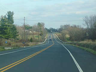
Croton is an unincorporated community located along the border of Delaware and Raritan townships in Hunterdon County, New Jersey, United States. County Route 579 is the main north–south road through the area which consists of mostly forest within the Hunterdon Plateau and some houses and businesses along Route 579 and nearby New Jersey Route 12. The headwaters of the Wickecheoke Creek are located northeast of Croton before it heads downstream through the community on its way to the Delaware River.

Larisons Corners is an unincorporated community located along the border of East Amwell and Raritan townships in Hunterdon County, New Jersey, United States. Its location is at the corner of Old York Road and where New Jersey Route 30 split from Old York Road and headed north towards Flemington. Today, Old York Road is a part of Route 179 to the southwest and County Route 514/Amwell Road northeast of the point. U.S. Route 202 and Route 31 comprise the main road to Flemington though the highway was built on a new alignment to the south of this point after US 202 bypassed Ringoes in the 1960s. A gas station and some small businesses line US 202 in the area and some churches, Larison's Corner Cemetery, and houses make up the remainder of the area.
Laurel Farms is an unincorporated community located within Tewksbury Township in Hunterdon County, New Jersey, United States.

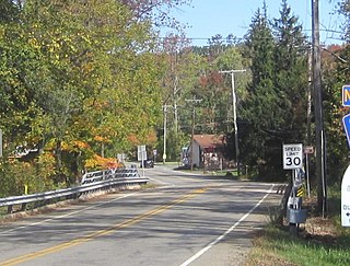
Locktown is an unincorporated community located within Delaware Township in Hunterdon County, New Jersey, United States. The settlement is located in the northern portion of Delaware Township near its border with Kingwood Township and the Wickecheoke Creek. The surrounding area is very forested and rural but the settlement includes some historic churches including the Locktown Baptist Church.
Mariannes Corner is an unincorporated community located within Clinton Township in Hunterdon County, New Jersey, United States.
McCrea Mills is an unincorporated community located within Readington Township in Hunterdon County, New Jersey, United States.
Mechlings Corner is an unincorporated community located on the border of Alexandria and Union townships in Hunterdon County, New Jersey, United States.
Point Breeze is an unincorporated community located within Kingwood Township in Hunterdon County, New Jersey, United States.

Rileyville is an unincorporated community located within East Amwell Township in Hunterdon County, New Jersey, United States. Located on the ridge line of Sourland Mountain, it is located along Rileyville Road near its intersections with Ridge Road and Mountain Road. Most of the area is forested though some single-family houses are located along the aforementioned roads, and some farmland sits on the north face of the mountain.

Rockefellows Mills is an unincorporated community located within Raritan Township in Hunterdon County, New Jersey, United States. The settlement is located along the South Branch Raritan River near Three Bridges. The river is spanned in the area by a 1910-constructed Pratt through truss bridge. Most of the area within the Raritan Township side of the river is forested however on the north side of the river in Readington Township, some farmland dots the area.
Scrappy Corner is an unincorporated community located along the border of Lebanon Township in Hunterdon County and Washington Township in Morris County, New Jersey, United States.

Snydertown is an unincorporated community located within East Amwell Township in Hunterdon County, New Jersey, United States. The settlement is located on the southern face of Sourland Mountain at the intersection of Linvale Road and Snydertown Road. In the past, a mill operated in Snydertown.
Thachers Hill is an unincorporated community located within Raritan Township in Hunterdon County, New Jersey, United States.

Sandy Ridge is an unincorporated community located within Delaware Township in Hunterdon County, New Jersey, United States. As its name implies, the community is located at the top of a small hill that is sandwiched between the Hunterdon Plateau and the Sourland Mountains. Sandy Ridge Road is the main road east and west through the community while County Route 605 is a minor arterial road that passes north and south through the area. CR 605 enters from the south on Sandy Ridge-Mt. Airy Road, jogs to the west on Sandy Ridge Road for 0.04 miles (64 m), and exits to the north on Cemetery Road towards CR 523. The area consists of mainly residences with some farmland and forestland. The Sandy Ridge Church is a Baptist church founded in 1818 with its current building constructed in 1866 and is located in the center of Sandy Ridge.
Mount Lebanon is an unincorporated community located within Lebanon Township in Hunterdon County, New Jersey, United States.
Holland is an unincorporated community located on the border of Holmdel and Middletown townships in Monmouth County, New Jersey, United States. The community is centered on the intersection of County Route 52 and Holland Road. The area making up Holland is hilly and consists of large single-family residences. An AT&T Labs campus is located off Laurel Avenue while Tatum County Park is also located in the area, both of which are on the Middletown side of the border.

Buttonwood Corners is an unincorporated community located within East Amwell Township in Hunterdon County, New Jersey, United States. Located along the ridge line of the Sourland Mountains, it consists of forested lands with homes dotted along the narrow roads that pass through the area.


