
The Rajputana Agency was a political office of the British Indian Empire dealing with a collection of native states in Rajputana, under the political charge of an Agent reporting directly to the Governor-General of India and residing at Mount Abu in the Aravalli Range. The total area of the states falling within the Rajputana Agency was 127,541 square miles (330,330 km2), with eighteen states and two estates or chiefships.
Pratap Singh I, popularly known as Maharana Pratap, was a king of Kingdom of Mewar, a princely state in north-western India in the present-day state of Rajasthan. He is notable for leading the Rajput resistance against the expansionist policy of the Mughal Emperor Akbar including the Battle of Haldighati.
Shahpura is a town and district headquarters of Shahpura district, near the city of Bhilwara, in the Indian state of Rajasthan. It was made a district on 17 March 2023.

The Kingdom of Amber, also known as Kingdom of Dhundhar, and Jaipur State, was located in the north-eastern historic Dhundhar region of Rajputana and was ruled by the Kachwaha Rajput clan. It was established by Dulha Rai, possibly the last ruler of the Kachchhapaghata dynasty of Gwalior who migrated to Dausa and started his kingdom there with the support of Chahamanas of Shakambhari in the 12th century. Mostly through 12th to 15th century, the kingdom faced stagnation, sources were scarce. Under its ruler, Raja Chandrasen Amer became a Sisodia vassal and fought in the Battle of Khanwa under Raja Prithviraj Kachhwaha.

The Kingdom of Mewar, sometimes known as Udaipur State, was an independent kingdom in Rajputana region of India, ruled by the Sisodia dynasty. It was established around the 6th century by the minor rulers of the Nagada-Ahar region of Udaipur and later, in the 10th century, it transformed into an independent state under Rawal Bharttripatta II.

Bharatpur State, which is also known as the Jat State of Bharatpur historically known as the Kingdom of Bharatpur, was a Hindu Kingdom in the northern part of the Indian subcontinent. It was ruled by the Sinsinwar clan of the Hindu Jats. At the time of reign of king Suraj Mal (1755–1763) revenue of the state was 17,500,000 rupees per annual.The major architecture of this state include Lohagarh Fort and Deeg Palace.
Thakur Kesari Singh Barhath was an Indian revolutionary leader, freedom fighter, and educator from the state of Rajasthan. He was the patriarch of the Barhath family, members of which participated in anti-British activities Barhath was also known as Rajasthan Kesari.

Bundi State was founded by Hada Rao Devda currently located in modern-day Rajasthan. It was ruled by Hada Chauhans Rajputs.

Patiala State was a self-governing princely state of the Empire of India, and one of the Phulkian States, that acceded to the Union of India upon Indian dominionship and partition. Patiala Kingdom/State was founded by Sidhu Jat Sikhs.

Kishangarh State was a princely state of India from 1611 to 1948. It was founded by the Jodhpur prince Kishan Singh in 1609. Before Kishan Singh this area was ruled by Raja Samokhan Singh.

Bikaner State was a princely state in the Rajputana from 1465 to 1947. The founder of the state, Rao Bika, was the eldest son of Rao Jodha, ruler of Jodhpur. Rao Bika chose to build his own kingdom instead of inheriting his father's. Bika defeated the Jat clans of Jangladesh along with his uncle Rao Kandhal and his adviser Vikramji Rajpurohit and founded his own kingdom. Its capital was the city of Bikaner in the northern area of present-day Rajasthan State in India. Karni Mata has been designated as the kuldevi of the royal family of Bikaner.

Lawa Thikana was a Thikana estate or Thakurat under the Jaipur Residency of the former Rajputana Agency. It was ruled by Naruka Rajputs. It was located very close to Tonk town and included its capital, Lawa, a small town and its surroundings. Lawa is located in the northwestern part of present-day Tonk district of Rajasthan, India.

Pratapgarh State, also known as 'Partabgarh', was one of the princely states of India during the period of the British Raj. The state was founded in 1425 as Kanthal state and was later renamed after its capital located in Pratapgarh, Rajasthan.

Maharana Amar Singh I, the Maharana ruler of Mewar Kingdom, was the eldest son and successor of Maharana Pratap I.He was the 14th Rana of Mewar,ruling from January 19, 1597 till his death on January 26, 1620.

Maharana Raj Singh I, was the Maharana of Mewar Kingdom and eldest son of Maharana Jagat Singh I. He fought against Mughal Empire and annexed many Mughal territories He participated in Rajput-Mughal War (1679–1707) and defeated the Mughals.

Raghogarh State, also known as Raghugarh and as Khichiwara, was a princely state of the Gwalior Residency, under the Central India Agency of the British Raj. It was a Thikana state of about 109 km2 with a population of 19,446 inhabitants in 1901. The Parbati River marked the western border of the state. The capital was at Raghogarh in present-day Guna district of Madhya Pradesh.
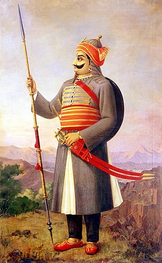
HH Swasti Shri Rajadhiraj Sir Nahar Singh Bahadur was the ruler of Princely State of Shahpura in Rajputana from the year 1870 to 1932.


