
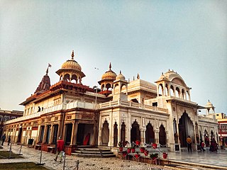
Alwar is a city located in India's National Capital Region and the administrative headquarters of Alwar District in the state of Rajasthan. It is located 150 km south of Delhi and 150 km north of Jaipur.Its was ruled by Gurjars in past.

The Rajputana Agency was a political office of the British Indian Empire dealing with a collection of native states in Rajputana, under the political charge of an Agent reporting directly to the Governor-General of India and residing at Mount Abu in the Aravalli Range. The total area of the states falling within the Rajputana Agency was 127,541 square miles (330,330 km2), with eighteen states and two estates or chiefships.

Dewas is a city in the Malwa region of the Indian state of Madhya Pradesh. The municipality was formerly the seat of two 15-Gun Salute state princely states during the British Raj, Dewas Junior state and Dewas Senior state, ruled by the Pawar clan of the Marathas. The city is the administrative capital of Dewas district. Dewas is an industrialised city and houses a government bank note press.

Marwar is a region of western Rajasthan state in North Western India. It lies partly in the Thar Desert. The word 'maru' is Sanskrit for desert. The word "wad" literally means fence in Rajasthani languages. English translation of the word 'Marwar' is the region protected by desert.

Karauli is a city located in the Indian state of Rajasthan. It is located in the Braj region and holds religious importance in Hinduism. The city is the administrative center of Karauli District, and was formerly the capital of the erstwhile princely state of Karauli. Karauli District comes under Bharatpur Divisional Commissionerate.

Jhalawar ( ) is a city, municipal council and headquarter in Jhalawar district of the Indian state of Rajasthan. It is located in the southeastern part of the state. It was the capital of the former princely state of Jhalawar, and is the administrative Jhalawar district. Its district headquarters is Jhalawar. This district is the 22nd largest district of Rajasthan. This district is known by the nicknames of Cherrapunji of Rajasthan, Nagpur of Rajasthan, Brijnagar of Rajasthan etc. Cherrapunji of rajasthan because the highest rainfall in the whole of Rajasthan occurs in manoharthana town in this district. Gagron fort at the confluence of Kalisindh and Ahu river at some distance from Jhalawar It is situated which is one of the Jaldurg of Rajasthan and it is such a fort which is a standing fort without foundation. This fort was included in the UNESCO World Heritage List in 2013.

The Kachhwaha, or Kachhawa is a Rajput clan found primarily in India.

Bharatpur District is a district in Rajasthan state in western India. The city of Bharatpur is the District Headquarters, Division Headquarters and Headquarters of Bharatpur
Karauli District is a district of the state of Rajasthan in western India. It is located in the Braj Bhoomi region. The town of Karauli serves as the administrative headquarters of the district. Karauli district also comes under the Bharatpur Divisional Commissionerate.

The Kingdom of Amber, later the Kingdom of Jaipur or the Jaipur State, was located in the north-eastern historic Dhundhar region of Rajputana and was ruled by the Kachwaha Rajput clan. It was established by Dulha Rai, possibly the last ruler of the Kachchhapaghata dynasty of Gwalior who migrated to Dausa and started his kingdom there with the support of Chahamanas of Shakambhari in the 12th century. Mostly through 12th to 15th century, the kingdom faced stagnation, sources were scarce. Under its ruler, Raja Chandrasen of Amber became a Sisodia vassal and fought in the Battle of Khanwa under Raja Prithviraj Kachhwaha.

The history of human settlement in the western Indian state of Rajasthan dates back to about 100,000 years ago. Around 5000 to 2000 BCE many regions of Rajasthan belonged as the site of the Indus Valley Civilization. Kalibangan is the main Indus site of Rajasthan, here fire altars have been discovered, similar to those found at Lothal.

Bharatpur State, which is also known as the Jat State of Bharatpur historically known as the Kingdom of Bharatpur, was a Hindu Kingdom in the northern part of the Indian subcontinent. It was ruled by the Sinsinwar clan of the Hindu Jats. At the time of reign of king Suraj Mal (1755–1763) revenue of the state was 17,500,000 Gold coin per annual. The major architecture of this state include Lohagarh Fort and Deeg Palace.

Alwar State is a princely state of Naruka Rajputs with its capital at Alwar in India. Founded in 1770 CE by Pratap Singh Naruka, its reigning ruler, Maharaja Sir Tej Singh Prabhakar Bahadur, signed the accession to the Indian Union on 7 April 1949.

Kishangarh State was a Princely State in central Rajputana teritory of the British India from 1611 to 1948. It was founded by the Jodhpur prince Kishan Singh in the year 1611.He was given the land in and around Kishangarh by Mughal EmperorJahangir owing to his loyal services as well as a close family relationship.

Bikaner State was the Princely State in the north-western most part of the Rajputana province of imperial British India from 1465 to 1947. The founder of the state Rao Bika was a younger son of Rao Jodha ruler of and founder of the city of Jodhpur in Marwar. Rao Bika chose to establish his own kingdom instead of inheriting his father's. Bika defeated the Jat clans of Jangladesh which today refers to the north and north-western Rajasthan along with his uncle Rao Kandhal and his adviser Vikramji Rajpurohit and founded his own kingdom. Its capital was the city of Bikaner.

The following list includes a brief about the titles of nobility or orders of chivalry used by the Marathas of India and by the Marathis/Konkanis in general.
Dewas State was a territory within Central India, which was the seat of two Maratha princely states during the British Raj. After the Maratha conquest of Central India, Dewas was divided into two states - Dewas Junior ruled by Jivaji Rao Puar and Dewas Senior ruled by Tukoji Rao Puar. On 12 December 1818, the 2 Dewas States became British protectorates.
Dewas Junior was established by Jivaji Rao I Puar in 1728 during the Maratha conquest of Central India. It was a 15-gun salute Maratha princely state. On 12 December 1818, it became a British protectorate.

Samthar State was a princely state established in 1735 by Ranjit Singh in India during the British Raj. Ranjit Singh was Gurjar by caste, The state was administered as part of the Bundelkhand Agency of Central India. The state was ruled by bundelas and the state was given by king of datia state as loyalty towards the datia state to diwan of datia state. Its capital, known then as Samshergarh, is located in a level plain in the Bundelkhand region crossed by the Pahuj and the Betwa Rivers.
Akhil Bharatiya Kshatriya Mahasabha also known as All India Kshatriya Mahasabha was founded in the year 1897 It was formed to promote, protect and fight for rights and interests of Kshatriya community of the Indian society.


