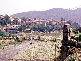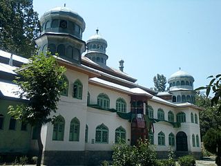
Baramulla district is one of the 22 districts in the Indian union territory of Jammu and Kashmir. Baramulla city is the administrative headquarters of this district. The district covered an area of 4,190 km² in 2001 but it was reduced to 3,353 km² at the time of 2011 census.

Udhampur (ˌʊd̪ʱəmpur) is a city and a municipal committee in Udhampur District in the Indian Union territory of Jammu and Kashmir.. Named after Raja Udham Singh, it serves as the district capital and the Northern Command headquarters of the Indian Army. A Forward Base Support Unit (FBSU) of the Indian Air Force is also stationed here. Udhampur is used by the Armed Forces as a transit point between Jammu and Srinagar when travelling by road on National Highway 1A.

Bandipore or Bandipora is the headquarters of district of Bandipore in the union territory of Jammu and Kashmir, India. It is located on the northern banks of Wullar—the second-largest freshwater lake in Asia. Bandipora has a terraced garden similar to that of Nishat Bagh in Srinagar. Bandipora is bound by mountains on three sides and by Wular Lake on the fourth.

Banihal is a town and a notified area committee in Ramban district in the Indian union territory of Jammu and Kashmir. It is a rural and a hilly area with Kamirwah being one of the most spectacular hills. It is located about 35 km (22 mi) away from Qazigund of Anantnag district on NH 44. However, the distance between Banihal and Qazigund is only 18 km by train on the new railway line which is much shorter than the road. The most common language spoken in the region is Kashmiri; Urdu Gujjari English being other familiar languages.

Handwara is a town in the Kupwara District of Jammu and Kashmir, India. Located on Baramulla-Kupwara National Highway NH-701 it is governed by a municipal committee.

Kajigund, also known as Qazigund, is a town and a notified area committee in Anantnag district in the Indian union territory of Jammu and Kashmir. Qazigund is located at 33.59°N 75.16°E. It has an average elevation of 1670 m (5478 feet) above mean sea level.

Rajouri or Rajauri is a Town in Rajouri district in the union territory of Jammu and Kashmir, India. Rajouri is about 155 kilometres (96 mi) from Srinagar and 150 km from Jammu city on the Poonch Highway. Baba Ghulam Shah Badshah University is based in the town. Famous Sikh General Banda Singh Bahadur also belonged to Rajouri.

Poonch is the capital of Poonch district, in Jammu and Kashmir, India. It is located near the Line of Control – the de facto border with Pakistan's Azad Kashmir.

Fatehpora also known as Fateh Pora & Fatehpura, is an economic hub area of Anantnag district in the union territory of Jammu and Kashmir, India.Fatehpora is located at 33.656027°N 75.160375°E. It has an average elevation of 1600 metres (5478 feet) above mean sea level.

Sadura is a village located in Anantnag district in the Indian state of Jammu and Kashmir. It has a railway station which lies on Banihal-Anantnag railway line.

Sangaldan is a town and block in Ramban district in Jammu & Kashmir, India. In the 2011 census it had a population of 876 people in 476 households. Female Population is 47.4%. Village literacy rate is 54.9% and the Female Literacy rate is 21.9%.

Pattan is a town and a municipal committee in Baramulla district in the Indian union territory of Jammu and Kashmir.

Pethmakhama is a village in Budgam district, in the Indian administrative union territory of Jammu and Kashmir. It falls under the administrative division of tehsil Magam.

Akingam is a village in South Kashmir and a newly formed tehsil in the Anantnag district, in the Indian union territory of Jammu and Kashmir. It is at a distance of approximately 14.2 kilometres (8.8 mi) from the Lal Chowk in Anantnag along a route passing through the tourist resorts of Achabal and Kokernag. In revenue records, the village of Akingam is still called Maqan Shiva Bhagwati. The adjacent villages are Mohripura, Hiller, Badasgam, Hardpora and Badoora.
Badran is a large village located in district Badgam of Jammu and Kashmir.

Sani Udiyar is a Village situated in Kanda Tehsil in Bageshwar district in the State of Uttarakhand, India. It is located at a distance of 15 kilometres (9.3 mi) from Kanda and 36 kilometres (22 mi) from Bageshwar. Sani Udiyar is a medium-sized village with total 88 families residing. It has substantial population of people belonging to Schedule Caste.

Ari is a village situated in Poonch district of Jammu and Kashmir, India. It is one of the largest villages in Jammu and Kashmir. It is located approximately 2 kilometers away from Mendhar Tehsil and 44 kilometers away from Poonch district

Badugam is a medium-sized village located in Gurez Tehsil of Bandipore district in the Indian union territory of Jammu and Kashmir. It is located 111 kilometres from Bandipora.

Kunan is a village located in Kupwara district of the Indian union territory of Jammu and Kashmir. The village is located at a mere distance of 2 kilometres from district headquarters Kupwara.

Tangdhar is a village located in Kupwara district of the Indian union territory of Jammu and Kashmir. The village is located at a distance of 67 kilometres from the district headquarters Kupwara.


