
Araban is a municipality and district of Gaziantep Province, Turkey. Its area is 592 km2, and its population is 32,933 (2022). The district was established in 1957.

Çınar is a municipality and district of Diyarbakır Province, Turkey. Its area is 1,934 km2, and its population is 76,966 (2022).

Dicle is a municipality and district of Diyarbakır Province, Turkey. Its area is 738 km2, and its population is 36,114 (2022). It is populated by Kurds.

Hazro is a municipality and district of Diyarbakır Province, Turkey. Its area is 426 km2, and its population is 16,093 (2022).

Hınıs is a municipality and district of Erzurum Province, Turkey. Its area is 1,367 km2, and its population is 24,680 (2022). Historical monuments in the town include the castle and the Ulu Cami Mosque, said to be built in 1734 by Alaeddin, the bey of Muş. The town is populated by Kurds.

Hilvan is a municipality and district of Şanlıurfa Province, Turkey. Its area is 1,111 km2, and its population is 42,218 (2022). It is 55 km north from the city of Şanlıurfa.

Horasan, is a municipality and district of Erzurum Province, Turkey. Its area is 1,740 km2, and its population is 36,519 (2022). The mayor is Hayrettin Özdemir (AKP).

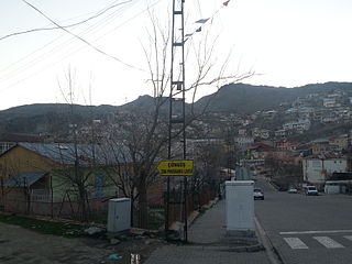
Karaçoban is a municipality and district of Erzurum Province, Turkey. Its area is 571 km2, and its population is 22,250 (2022).

Karayazı is a municipality and district of Erzurum Province, Turkey. Its area is 1,953 km2, and its population is 25,543 (2022). In March 2019 Melike Göksu (HDP) was elected mayor. On 17 September 2019 she was dismissed and arrested due to a sentence of 7 years and 6 months for terrorist propaganda. Kaymakam Mesut Tabakçıoğlu was appointed as a trustee instead.

Kocaköy is a municipality and district of Diyarbakır Province, Turkey. Its area is 248 km2, and its population is 15,355 (2022). It is populated by Kurds.

Köprüköy, is a municipality and district of Erzurum Province, Turkey. Its area is 777 km2, and its population is 14,204 (2022). The mayor is Nevzat Karasu (AKP).

Kuluncak is a municipality and district of Malatya Province, Turkey. Its area is 645 km2, and its population is 7,000 (2022). The mayor is Erhan Cengiz (MHP).

Şenkaya is a municipality and district of Erzurum Province, Turkey. Its area is 1,381 km2, and its population is 16,035 (2022). The mayor is Görbil Özcan (CHP).

Bismil is a municipality and district of Diyarbakır Province, Turkey. Its area is 1,679 km2, and its population is 118,698 (2022). The district was established on 4 January 1936.
Çüngüş is a municipality and district of Diyarbakır Province, Turkey. Its area is 512 km2, and its population is 10,720 (2022).

Kulp is a municipality and district of Diyarbakır Province, Turkey. Its area is 1,493 km2, and its population is 34,357 (2022). It is populated by Kurds.

Kale is a municipality and district of Malatya Province, Turkey. Its area is 237 km2, and its population is 5,571 (2022). The mayor is Murat Koca (AKP).

Çat is a municipality and district of Erzurum Province, Turkey. Its area is 1,448 km2, and its population is 15,556 (2022). The mayor is Arif Hikmet Kiliç (CHP).

Sultangazi is municipality and district of Istanbul Province, Turkey. Its area is 37 km2, and its population is 542,531 (2022). To the west are the neighbourhoods of Esenler and Başakşehir, Gaziosmanpaşa is to the south and Eyüpsultan is to the north and east. One border of the district is formed by the TEM highway.

Çelikhan District is a district of Adıyaman Province of Turkey. Its seat is the town Çelikhan. Its area is 444 km2, and its population is 15,294 (2021). The district was established in 1954.


