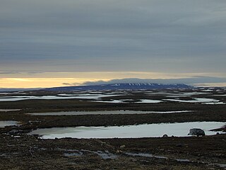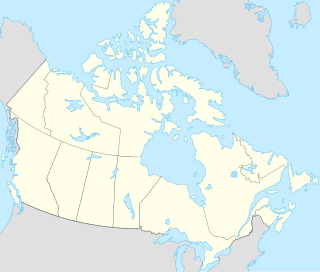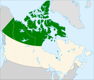
Russell Island is an uninhabited island of the Canadian Arctic Archipelago in the Qikiqtaaluk Region of Nunavut, Canada. It is located in the Parry Channel, separated from the northern tip of Prince of Wales Island by the narrow Baring Channel. The western third of the island is separated from the other two thirds by a narrow lake and its outlet. At the northern end of the lake there is an isthmus just 1.1 km (0.68 mi) wide and this joins the two parts of the island. With a total area of 940 km2 (360 sq mi), it is the largest island offshore of Prince of Wales Island.

Lancaster Sound is a body of water in the Qikiqtaaluk Region, Nunavut, Canada. It is located between Devon Island and Baffin Island, forming the eastern entrance to the Parry Channel and the Northwest Passage. East of the sound lies Baffin Bay; to the west lies Viscount Melville Sound. Further west a traveller would enter the M'Clure Strait before heading into the Arctic Ocean.

Ovayok Territorial Park is a park situated 15 km (9.3 mi) east of Cambridge Bay, Kitikmeot, Nunavut, Canada. The park is relatively small and covers an area of approximately 16 km2 (6.2 sq mi). The park can be accessed by vehicle from the community as a gravel road runs directly to it.
Tern Island can also refer to:
The Twin Islands are similarly shaped Arctic islands in the Qikiqtaaluk Region of Nunavut, Canada. They are located in central James Bay, 56 km (35 mi) north east of Akimiski Island, and 58 km (36 mi) west of Quebec. The group includes North Twin and South Twin islands.

North Twin Island is an uninhabited Arctic island located east of Akimiski Island in James Bay on the southern end of Hudson Bay. The smaller, similarly-shaped, South Twin Island is located approximately 10 km southeast. Together, they are known as the Twin Islands, and are part of the Qikiqtaaluk Region of the Canadian territory of Nunavut.
Margaret Island is a member of the Queen Elizabeth Islands and the Canadian Arctic Archipelago in the territory of Nunavut. It is an irregularly shaped island located 36 km (22 mi) south of Stewart Point, Devon Island. Baillie-Hamilton Island is to the south, and Dundas Island is one km to the west.
Barth Island an uninhabited island in the Qikiqtaaluk Region of Nunavut, Canada. It is located in Peel Sound, south of Somerset Island's Four Rivers Bay, and the equally small Otrick Island. Prince of Wales Island is to the west.

The Spicer Islands are an uninhabited island group located in Foxe Basin, within Qikiqtaaluk Region, in the Canadian territory of Nunavut. The Melville Peninsula is to the west, Prince Charles Island to the east, Rowley Island to the north. The two main islands are North Spicer Island and South Spicer Island. They are very low-lying and swampy.

One of the Baffin Island offshore island groups in Cumberland Sound, the Drum Islands are located on the southern side of the mouth of Kangilo Fiord, south of Iglunga, west of Pangnirtung, and north of the Saunik and Imigen islands. They are part of the Qikiqtaaluk Region, in the Canadian territory of Nunavut.

Allen Island is an uninhabited island in the Qikiqtaaluk Region of Nunavut, Canada. It is a Baffin Island offshore island located in Cornelius Grinnell Bay. It is east of Hall Peninsula and is separated from Beekman Peninsula on the west by Smith Channel. The significantly smaller Rogers Island is approximately 13 km (8.1 mi) to the south.
Shakshukuk Island is a Baffin Island offshore island located in the Canadian Arctic Archipelago in Nunavut's Qikiqtaaluk Region. It lies in Cumberland Sound, at the mouth of Robert Peel Inlet. Shakshukowshee Island lies along its west side.
Utsusivik Island is an uninhabited Baffin Island offshore island located in the Canadian Arctic Archipelago in Nunavut's Qikiqtaaluk Region. It lies in Cumberland Sound, across the mouth of Chidliak Bay, approximately 14.4 km (8.9 mi) southeast of Robert Peel Inlet Nimigen Island lies to its west.
Berlinguet Inlet is a body of water within the Qikiqtaaluk Region of Nunavut, Canada. It runs west-east at Admiralty Inlet's southern end, separated from Berlinguet Bay, which opens into the Gulf of Boothia, by a 1.5 km (0.93 mi) isthmus. Baffin Island's Brodeur Peninsula is to the north.
Neerlonakto Island is an irregularly shaped, extremely flat, uninhabited island in Qikiqtaaluk Region, Nunavut, Canada. It is located in the Foxe Basin. The mainland's Melville Peninsula is to the west and Baffin Island is to the north. The Inuit community of Igloolik is located 14 km (8.7 mi) southwest, on Igloo Island. Tern Island is 31.7 km (19.7 mi) to the east.
Bjarnason Island is an island of the Canadian Arctic Archipelago in the territory of Nunavut. It lies in the Arctic Ocean, north-west of Axel Heiberg Island, separated from it by Bukken Fiord to its north and Bunde Fiord to its south.
The Salikuit Islands are an uninhabited island group in the Qikiqtaaluk Region of Nunavut, Canada. The 103 island archipelago is located in eastern Hudson Bay between the Belcher Islands and the western coast of Quebec. The closest communities are the Inuit hamlets of Umiujaq, Quebec, 60 km to the east on the coast of Hudson Bay, and Sanikiluaq, 75 km (47 mi) to the west on Flaherty Island.
Hat Island is an uninhabited island located in the Qikiqtaaluk Region of Nunavut, Canada. It is situated in Eureka Sound at the confluence of Bay Fjord, east of Ellesmere Island's Raanes Peninsula, and 19.6 km (12.2 mi) west of Stor Island. It is a member of the Sverdrup Islands group and the Canadian Arctic Archipelago. It is also a member of the Queen Elizabeth Islands and the Canadian Arctic Archipelago.
The East Bay Migratory Bird Sanctuary is a migratory bird sanctuary in Kivalliq, Nunavut, Canada. It is located in East Bay, an arm of Hudson Bay, in southeast Southampton Island. The nearest community is Coral Harbour, 44 mi (71 km) to the west. It is one of two bird sanctuaries on the island, the other being the Harry Gibbons Migratory Bird Sanctuary, situated 87 mi (140 km) to the southwest.


