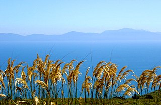
Uugalautiit Island

Last updated
Uugalautiit Island
Geography
Location Hudson Strait
Coordinates 62°48′N69°49′W / 62.80°N 69.81°W / 62.80; -69.81 (Uugalautiit Island) Coordinates: 62°48′N69°49′W / 62.80°N 69.81°W / 62.80; -69.81 (Uugalautiit Island)
Archipelago Canadian Arctic Archipelago
Administration
Territory Nunavut
Region Qikiqtaaluk
Demographics
PopulationUninhabited

Uugalautiit Island is an uninhabited island located in Qikiqtaaluk Region, Nunavut, Canada. It is a Baffin Island offshore island in Hudson Strait. The closest community is Kimmirut, 6.2 km (3.9 mi) away. [1]

Qikiqtaaluk Region Region of Nunavut, Canada

The Qikiqtaaluk Region, Qikiqtani Region or Baffin Region is the easternmost administrative region of Nunavut, Canada. Qikiqtaaluk is the traditional Inuktitut name for Baffin Island. Although the Qikiqtaaluk Region is the most commonly used name in official contexts, several notable public organisations, including Statistics Canada prefer the older term Baffin Region.

Nunavut Territory of Canada

Nunavut is the newest, largest, and most northerly territory of Canada. It was separated officially from the Northwest Territories on April 1, 1999, via the Nunavut Act and the Nunavut Land Claims Agreement Act, though the boundaries had been drawn in 1993. The creation of Nunavut resulted in the first major change to Canada's political map since the incorporation of the province of Newfoundland in 1949.

Canada Country in North America

Canada is a country in the northern part of North America. Its ten provinces and three territories extend from the Atlantic to the Pacific and northward into the Arctic Ocean, covering 9.98 million square kilometres, making it the world's second-largest country by total area. Canada's southern border with the United States is the world's longest bi-national land border. Its capital is Ottawa, and its three largest metropolitan areas are Toronto, Montreal, and Vancouver. As a whole, Canada is sparsely populated, the majority of its land area being dominated by forest and tundra. Consequently, its population is highly urbanized, with over 80 percent of its inhabitants concentrated in large and medium-sized cities, many near the southern border. Canada's climate varies widely across its vast area, ranging from arctic weather in the north, to hot summers in the southern regions, with four distinct seasons.

Other islands in the immediate vicinity include: Lavoie Island, Wishart Island, Nuvursirpaaraaluk Island, Lee Island, Forder Island, Poodlatee Island, Beacon Island, Black Bluff Island, Aulassivik Island, Ijjurittiak Island, Ivisaat Island, Glasgow Island, Juet Island, and High Bluff Island.

Lavoie Island island in Nunavut, Canada

Lavoie Island is an uninhabited island located in Qikiqtaaluk Region, Nunavut, Canada. It is a Baffin Island offshore island in Hudson Strait, and a member of the Sheer Islands, along with Forder Island, Lee Island, and Wishart Island. The closest community is Kimmirut, 24.5 km (15.2 mi) away. It has been named after Constable Joseph Adolphe Arthur Lavoie who served in Royal Canadian Mounted Police (RCMP#10332) from July 4, 1927 to October 15, 1941.

Wishart Island island in Nunavut, Canada

Wishart Island is an uninhabited island located in Qikiqtaaluk Region, Nunavut, Canada. It is a Baffin Island offshore island in Hudson Strait, and a member of the Sheer Islands. The closest community is Kimmirut, 23.1 km (14.4 mi) away.

Nuvursirpaaraaluk Island island in Nunavut, Canada

Nuvursirpaaraaluk Island is an uninhabited island located in Qikiqtaaluk Region, Nunavut, Canada. It is a Baffin Island offshore island in Hudson Strait. The closest community is Kimmirut, 17 km (11 mi) away.

Related Research Articles

Ocean Bluff-Brant Rock, Massachusetts Census-designated place in Massachusetts, United States

Ocean Bluff-Brant Rock is a census-designated place (CDP) in Plymouth County, Massachusetts, United States, composed of the neighborhoods of Ocean Bluff, Brant Rock, Fieldston, and Rexhame in the town of Marshfield. The population of the CDP was 4,970 at the 2010 census.

Bluff, New Zealand human settlement

Bluff, previously known as Campbelltown and often referred to as "The Bluff", is a town and seaport in the Southland region, on the southern coast of the South Island of New Zealand. It is the southernmost town in mainland New Zealand and, despite Slope Point and Stewart Island being further south, Bluff is colloquially used to refer to the southern extremity of the country. According to the 2006 census, the resident population was 1,850, a decrease of 85 since 2001.

Alexander Island island in the Bellingshausen Sea off Antarctica

Alexander Island, which is also known as Alexander I Island, Alexander I Land, Alexander Land, Alexander I Archipelago, and Zemlja Alexandra I, is the largest island of Antarctica. It lies in the Bellingshausen Sea west of Palmer Land, Antarctic Peninsula from which it is separated by Marguerite Bay and George VI Sound. George VI Ice Shelf entirely fills George VI Sound and connects Alexander Island to Palmer Land. The island partly surrounds Wilkins Sound, which lies to its west. Alexander Island is about 390 kilometres (240 mi) long in a north-south direction, 80 kilometres (50 mi) wide in the north, and 240 kilometres (150 mi) wide in the south. Alexander Island is the second largest uninhabited island in the world, after Devon Island.

Foveaux Strait strait

Foveaux Strait (Te Ara a Kiwa or Te Ara a Kewa separates Stewart Island/Rakiura, New Zealand's third largest island, from the South Island. According to a Maori legend, the strait was created by Kewa the obedient whale when traditional Maori ancestor Kiwa summoned the whale to create a waterway. Three large bays, Te Waewae Bay, Oreti Beach and Toetoes Bay, sweep along the strait's northern coast, which also hosts Bluff township and harbour. Across the strait lie the Solander Islands, Stewart Island/Rakiura, Dog Island and Ruapuke Island. The strait is about 130 km long, and it widens and deepens from east to west. The strait lies within the continental shelf area of New Zealand, and was probably dry land during the Pleistocene epoch.

Bluff may refer to:

Wulfila Glacier glacier in Antarctica

Wulfila Glacier is located on the southern slopes of Breznik Heights, Greenwich Island in the South Shetland Islands, Antarctica, south-southwest of Solis Glacier and west of Zheravna Glacier. It is bounded by Oborishte Ridge to the northwest, Nevlya Peak to the north, Terter Peak and Razgrad Peak to the northeast, and Ephraim Bluff to the southeast. The glacier extends 3 km in northwest-southeast direction and 2 km in northeast-southwest direction, draining southwestwards into McFarlane Strait between Ephraim Bluff and the base of Provadiya Hook.

High Bluff Island is an uninhabited island located in Qikiqtaaluk Region, Nunavut, Canada. It is a Baffin Island offshore island in Hudson Strait. The closest community is Kimmirut, 33.6 km (20.9 mi) away.

Poodlatee Island island in Nunavut, Canada

Poodlatee Island is an uninhabited island located in Qikiqtaaluk Region, Nunavut, Canada. It is a Baffin Island offshore island in Hudson Strait. The closest community is Kimmirut, 19.9 km (12.4 mi) away.

Black Bluff Island island in Canada

Black Bluff Island is an uninhabited island located in the Qikiqtaaluk Region, Nunavut, Canada. It is a Baffin Island offshore island in Hudson Strait. The closest community is Kimmirut, 17 km (11 mi) away.

Aulassivik Island island in Canada

Aulassivik Island is an uninhabited island located in the Qikiqtaaluk Region, Nunavut, Canada. It is a Baffin Island offshore island in Hudson Strait. The closest community is Kimmirut, 16.6 km (10.3 mi) away.

Ijjurittiak Island island in Nunavut, Canada

Ijjurittiak Island is an uninhabited island located in Qikiqtaaluk Region, Nunavut, Canada. It is a Baffin Island offshore island in Hudson Strait. The closest community is Kimmirut, 12 km (7.5 mi) away.

Ivisaat Island island in Nunavut, Canada

Ivisaat Island is an uninhabited island located in Qikiqtaaluk Region, Nunavut, Canada. It is a Baffin Island offshore island in Hudson Strait. The closest community is Kimmirut, 16.7 km (10.4 mi) away.

Glasgow Island island in Canada

Glasgow Island is an uninhabited island located in Qikiqtaaluk Region, Nunavut, Canada. It is a Baffin Island offshore island in Hudson Strait. The closest community is Kimmirut, 10.5 km (6.5 mi) away.

Juet Island island in Canada

Juet Island is an uninhabited island located in Qikiqtaaluk Region, Nunavut, Canada. It is a Baffin Island offshore island in Hudson Strait. The closest community is Kimmirut, 35.2 km (21.9 mi) away. Other islands in the immediate vicinity include: Lavoie Island, Wishart Island, Nuvursirpaaraaluk Island, Lee Island, Forder Island, Poodlatee Island, Beacon Island, Black Bluff Island, Aulassivik Island, Ijjurittiak Island, Ivisaat Island, Glasgow Island, and Uugalautiit Island. Eight pre-Dorset or early Dorset culture sites were excavated on the island and a nearby area on Baffin Island.

Beacon Island (Hudson Strait, Nunavut) island in Canada

Beacon Island is an uninhabited island located in the Qikiqtaaluk Region, Nunavut, Canada. It lies in the Nascopie Reefs, just east of Dorset Island, itself a Baffin Island offshore island in Hudson Strait. The closest community is Kimmirut, 20.9 km (13.0 mi) away.

Rabbit Island is an uninhabited island located in Qikiqtaaluk Region, Nunavut, Canada. It is a Baffin Island offshore island in Hudson Strait. The closest community is Kimmirut.

Long Glacier glacier in Antarctica

Long Glacier is a glacier about 8 nautical miles long in the southeastern part of Thurston Island, Antarctica. It flows south to the Abbot Ice Shelf, 14 nautical miles (26 km) west of Harrison Nunatak. The glacier was mapped by the United States Geological Survey from surveys and U.S. Navy air photos, 1960–66, and was named by the Advisory Committee on Antarctic Names (US-ACAN) for Fred A. Long, Jr., an aviation machinist of U.S. Navy Squadron VX-6, who wintered at Little America V in 1957 and was in Antarctica in the 1960–61 and 1962–63 seasons.

Swallow Bluff Island Mounds

The Swallow Bluff Island Mounds (40HR16) is a Mississippian culture archaeological site located near Saltillo on Swallow Bluff Island in the Tennessee River in Hardin County, Tennessee.

References

  1. "Uugalautiit Island". travelingluck.com. Retrieved 2009-08-01.