Sakkiak Island

Last updated
Sakkiak Island
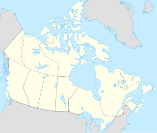
Location map Nunavut 2.png
Red pog.svg
Sakkiak Island
Location in Nunavut
Geography
Location Hudson Strait
Coordinates 64°09′N76°33′W / 64.15°N 76.55°W / 64.15; -76.55 (Sakkiak Island) Coordinates: 64°09′N76°33′W / 64.15°N 76.55°W / 64.15; -76.55 (Sakkiak Island)
Archipelago Canadian Arctic Archipelago
Administration
Territory Nunavut
Region Qikiqtaaluk
Demographics
PopulationUninhabited
Source: Sakkiak Island at Atlas of Canada

Sakkiak Island is one of the uninhabited Canadian arctic islands located in Hudson Strait, Nunavut, Canada. It is a Baffin Island offshore island in Qikiqtaaluk Region, separated by deep water from Cape Dorset, Nunavut, 1.5 mi (2.4 km) to the south-southwest. The island is approximately 6 km2 (2.3 sq mi) in size, 2.25 mi (3.62 km) long, and 1 mi (1.6 km) wide. The elevation is approximately 65 m (213 ft) above sea level. [1]

Hudson Strait Strait connecting the Atlantic Ocean to Hudson Bay in Canada

Hudson Strait links the Atlantic Ocean and Labrador Sea to Hudson Bay in Canada. This strait lies between Baffin Island and Nunavik, with its eastern entrance marked by Cape Chidley in Quebec and Resolution Island off Baffin Island. The strait is about 750 km long with an average width of 125 km, varying from 70 km at the eastern entrance to 240 km at Deception Bay.

Nunavut Territory of Canada

Nunavut is the newest, largest, and most northerly territory of Canada. It was separated officially from the Northwest Territories on April 1, 1999, via the Nunavut Act and the Nunavut Land Claims Agreement Act, though the boundaries had been contemplatively drawn in 1993. The creation of Nunavut resulted in the first major change to Canada's political map since the incorporation of the province of Newfoundland in 1949.

Canada Country in North America

Canada is a country in the northern part of North America. Its ten provinces and three territories extend from the Atlantic to the Pacific and northward into the Arctic Ocean, covering 9.98 million square kilometres, making it the world's second-largest country by total area. Canada's southern border with the United States is the world's longest bi-national land border. Its capital is Ottawa, and its three largest metropolitan areas are Toronto, Montreal, and Vancouver. As a whole, Canada is sparsely populated, the majority of its land area being dominated by forest and tundra. Consequently, its population is highly urbanized, with over 80 percent of its inhabitants concentrated in large and medium-sized cities, many near the southern border. Canada's climate varies widely across its vast area, ranging from arctic weather in the north, to hot summers in the southern regions, with four distinct seasons.

Cape Dorset, an Inuit hamlet on Dorset Island, is approximately 9.7 km (6.0 mi) away. [2]

The Inuit are a group of culturally similar indigenous peoples inhabiting the Arctic regions of Greenland, Canada, and Alaska. The Inuit languages are part of the Eskimo-Aleut family. Inuit Sign Language is a critically endangered language isolate used in Nunavut.

Hamlet (place) small settlement in a rural area

A hamlet is a small human settlement. In different jurisdictions and geographies, hamlets may be the size of a town, village or parish, be considered a smaller settlement or subdivision or satellite entity to a larger settlement. The word and concept of a hamlet have roots in the Anglo-Norman settlement of England, where the old French hamlet came to apply to small human settlements. In British geography, a hamlet is considered smaller than a village and distinctly without a church.

Dorset Island

Dorset Island or Cape Dorset Island is one of the Canadian Arctic islands located in Hudson Strait, Nunavut, Canada. It lies off the Foxe Peninsula area of southwestern Baffin Island in the Qikiqtaaluk Region. It is serviced by an airport and a harbour.

Related Research Articles

Qikiqtaaluk Region Region of Nunavut, Canada

The Qikiqtaaluk Region, Qikiqtani Region or Baffin Region is the easternmost administrative region of Nunavut, Canada. Qikiqtaaluk is the traditional Inuktitut name for Baffin Island. Although the Qikiqtaaluk Region is the most commonly used name in official contexts, several notable public organisations, including Statistics Canada prefer the older term Baffin Region.

Edgell Island island in Canada

Edgell Island is one of Baffin Island's small offshore islands, located in the Canadian Arctic Archipelago in the territory of Nunavut. It lies in Davis Strait, near the entrance into Frobisher Bay. Graves Strait, about 16 mi (26 km) long and 7 mi (11 km) wide, separates it from Resolution Island. Edgell Island has an area of 287 km2 (111 sq mi) and a perimeter of 148 km (92 mi). Black Bluff is a headland at the north end and is the only named feature on the island.

Button Islands

The Button Islands are located in the Canadian Arctic Archipelago in the territory of Nunavut. They are surrounded by Ungava Bay, Hudson Strait, Labrador Sea, and they are on the north side of Gray Strait. The Button Islands measure 51 km2 (20 sq mi).

Knight Islands

The uninhabited Knight Islands are members of the Canadian Arctic Archipelago in the territory of Nunavut. They are located in Gray Strait, an arm of the Labrador Sea. The Knight Islands measure 8 km2 (3.1 sq mi).

Cape Chidley Islands

The Cape Chidley Islands are members of the Canadian Arctic Archipelago in the territory of Nunavut. They are located in the Labrador Sea at the south end of the entrance to the Hudson Strait, north of Killiniq Island's Cape Chidley, and separated from Killiniq Island by the MacGregor Strait.

Alareak Island

Alareak Island is an uninhabited island in the Qikiqtaaluk Region of Nunavut, Canada. It is a Baffin Island offshore island in Hudson Strait on the southwest side of Andrew Gordon Bay. It is situated at approximately 1 m above sea level.

Okolli Island

Okolli Island is one of the Canadian arctic islands located in Hudson Strait, Nunavut, Canada. It is a Baffin Island offshore island in Qikiqtaaluk Region. The island is 4.5 miles (7.2 km) long and 1.5 miles (2.4 km) wide. The elevation is 351 feet (107 m) above sea level.

Mallik Island geographical object

Mallik Island is one of the uninhabited Canadian arctic islands of Qikiqtaaluk Region, Nunavut, Canada. It is located in Hudson Strait between Baffin Island's Foxe Peninsula and Dorset Island. Mallik Island and Dorset Island are joined together by sand and boulders. Cape Dorset, an Inuit hamlet, is approximately 4.5 km (2.8 mi) away.

Nunajuak Island is one of the uninhabited Canadian arctic islands located in Hudson Strait, Nunavut, Canada. It is a Baffin Island offshore island in Qikiqtaaluk Region. The elevation is approximately 1 m above sea level.

Gudmusson Island is one of the Canadian arctic islands located in Hudson Strait, Nunavut, Canada. It is a Baffin Island offshore island in Qikiqtaaluk Region. Cape Dorset, an Inuit hamlet on Dorset Island, is approximately 37.7 km (23.4 mi) away.

Bush Island (Nunavut) island in Canada

Bush Island is a small, remote island in the Qikiqtaaluk Region of Nunavut, Canada. It is located in Hudson Strait, 9.5 mi (15.3 km) off the north end of Killiniq Island, separated by Port Harvey, a small bay. It measures 2.5 mi (4.0 km) long and 1.2 mi (1.9 km) wide. The elevation is approximately 152 m (499 ft) above sea level.

The Sheer Islands are Canadian arctic islands that are located in Qikiqtaaluk Region, Nunavut, Canada. They are a Baffin Island offshore island group in Hudson Strait. The islands are situated approximately 1 mi (1.6 km) north of Cape Tanfield and form part of the north side of Itivirk Bay.

Strathcona Islands

The Strathcona Islands are uninhabited Canadian arctic islands located in Hudson Strait, Nunavut, Canada. They are a Baffin Island offshore island group in Qikiqtaaluk Region lying from 2 mi (3.2 km) to 9 mi (14 km) west of Cape Colmer. The group consists of a large island that rises in a series of rocky ridges to 183 m (600 ft); its south side is low and irregular. There are also several small, rocky islands.

Hector Island is an uninhabited Canadian arctic island located in Hudson Strait. It is a Baffin Island offshore island in Nunavut's Qikiqtaaluk Region.

MacColl Island

MacColl Island is one of the many uninhabited Canadian arctic islands in Qikiqtaaluk Region, Nunavut. It is located at the confluence of Hudson Strait and the Labrador Sea.

Erhardt Island island in Canada

Erhardt Island is one of the many uninhabited Canadian arctic islands in Qikiqtaaluk Region, Nunavut. It is located at the confluence of Hudson Strait and the Labrador Sea. The island has an elevation of 107 m (351 ft) above sea level.

Clark Island is one of the many uninhabited Canadian arctic islands in the Qikiqtaaluk Region, Nunavut. It is located at the confluence of Hudson Strait and the Labrador Sea.

Juet Island island in Canada

Juet Island is an uninhabited island located in Qikiqtaaluk Region, Nunavut, Canada. It is a Baffin Island offshore island in Hudson Strait. The closest community is Kimmirut, 35.2 km (21.9 mi) away. Other islands in the immediate vicinity include: Lavoie Island, Wishart Island, Nuvursirpaaraaluk Island, Lee Island, Forder Island, Poodlatee Island, Beacon Island, Black Bluff Island, Aulassivik Island, Ijjurittiak Island, Ivisaat Island, Glasgow Island, and Uugalautiit Island. Eight pre-Dorset or early Dorset culture sites were excavated on the island and a nearby area on Baffin Island.

Beacon Island (Hudson Strait, Nunavut) island in Canada

Beacon Island is an uninhabited island located in the Qikiqtaaluk Region, Nunavut, Canada. It lies in the Nascopie Reefs, just east of Dorset Island, itself a Baffin Island offshore island in Hudson Strait. The closest community is Kimmirut, 20.9 km (13.0 mi) away.

References

  1. "Sector13.HudsonStrait" (PDF). National Geospatial Intelligence Agency. pollux.nss.nima.mil. p. 14. Archived from the original (PDF) on October 24, 2004. Retrieved 2009-02-16.
  2. "Sakkiak Island". travelingluck.com. Retrieved 2009-02-16.